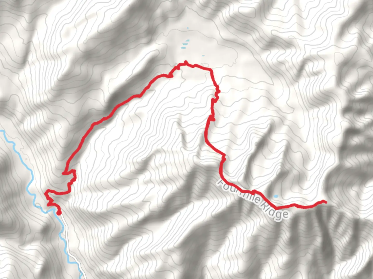
Angle Peak via Lake Creek Trail and Four Mile Ridge Trail
Download
Preview
Add to list
More
34.5 km
~2 day
1866 m
Out and Back
“Embark on a 35-km hike from lush forests to Angle Peak's summit, rich in views and history.”
Starting your journey near Chelan County, Washington, the trailhead for the Angle Peak via Lake Creek Trail and Four Mile Ridge Trail is accessible by car. If you're using public transport, the nearest significant landmark is the town of Chelan, from where you can arrange a taxi or rideshare to the trailhead.The trail spans approximately 35 kilometers (around 22 miles) with an elevation gain of about 1800 meters (5905 feet). This out-and-back trail is rated as medium difficulty, making it suitable for hikers with some experience and a good level of fitness.### Initial Ascent and Lake Creek TrailThe hike begins with a steady ascent through dense forest along the Lake Creek Trail. The first 5 kilometers (3.1 miles) will take you through a lush, green canopy, offering a cool and shaded environment. As you climb, you'll gain around 300 meters (984 feet) in elevation. Keep an eye out for local wildlife such as deer and various bird species. The trail is well-marked, but it's advisable to use HiiKER for navigation to ensure you stay on track.### Midway Point and Four Mile Ridge TrailAt approximately the 10-kilometer (6.2 miles) mark, you'll transition onto the Four Mile Ridge Trail. This section is more exposed, offering panoramic views of the surrounding valleys and peaks. The elevation gain becomes more pronounced here, with an additional 500 meters (1640 feet) over the next 5 kilometers (3.1 miles). The ridge is known for its wildflower meadows in the spring and summer, making it a picturesque segment of the hike.### Historical SignificanceAs you traverse the ridge, you'll be walking through an area rich in history. The region was historically inhabited by Native American tribes, and you may come across ancient petroglyphs and other artifacts. The trail also played a role during the early logging days of Washington State, and remnants of old logging equipment can sometimes be seen off the beaten path.### Final Ascent to Angle PeakThe final push to Angle Peak is the most challenging part of the hike. Over the last 5 kilometers (3.1 miles), you'll gain approximately 1000 meters (3281 feet) in elevation. The terrain becomes rocky and steep, requiring careful footing. The summit offers breathtaking 360-degree views of the North Cascades, making the strenuous climb well worth the effort. On a clear day, you can see as far as Glacier Peak and Mount Rainier.### Wildlife and FloraThroughout the hike, you'll encounter a variety of flora and fauna. The lower elevations are dominated by Douglas fir and western hemlock, while higher up, you'll find alpine meadows filled with lupine, Indian paintbrush, and other wildflowers. Wildlife sightings may include black bears, mountain goats, and marmots, so be sure to carry bear spray and know how to use it.### Return JourneyThe return journey follows the same path, allowing you to enjoy the views from a different perspective. Make sure to pace yourself and take breaks as needed, especially during the steep descent from Angle Peak.### Navigation and SafetyGiven the trail's length and elevation gain, it's crucial to be well-prepared. Use HiiKER for real-time navigation and updates on trail conditions. Carry sufficient water, high-energy snacks, and appropriate clothing for changing weather conditions. A first-aid kit and a map are also essential.This hike offers a rewarding challenge with stunning natural beauty and historical significance, making it a memorable adventure for those who undertake it.

What to expect?
Activity types
Comments and Reviews
User comments, reviews and discussions about the Angle Peak via Lake Creek Trail and Four Mile Ridge Trail, Washington.
4.0
average rating out of 5
2 rating(s)