Download
3D Flyover
Add to list
More
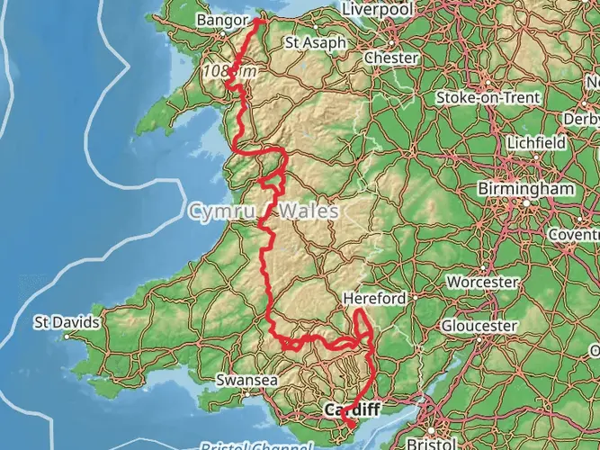
194.7 km
~9 days
8090 m
Multi-Day
“Embark on the Snowdonia Way, a scenic trek through Welsh history and mountain majesty.”
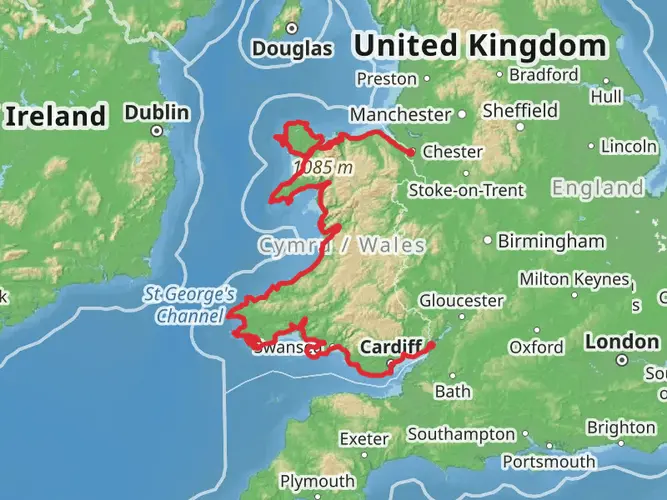
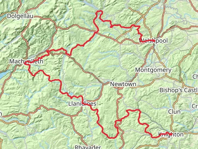
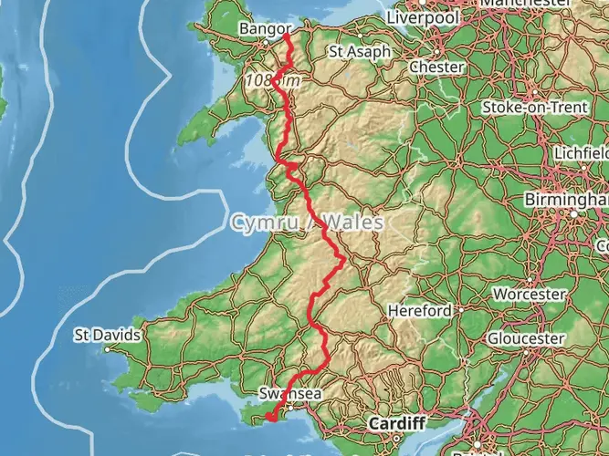
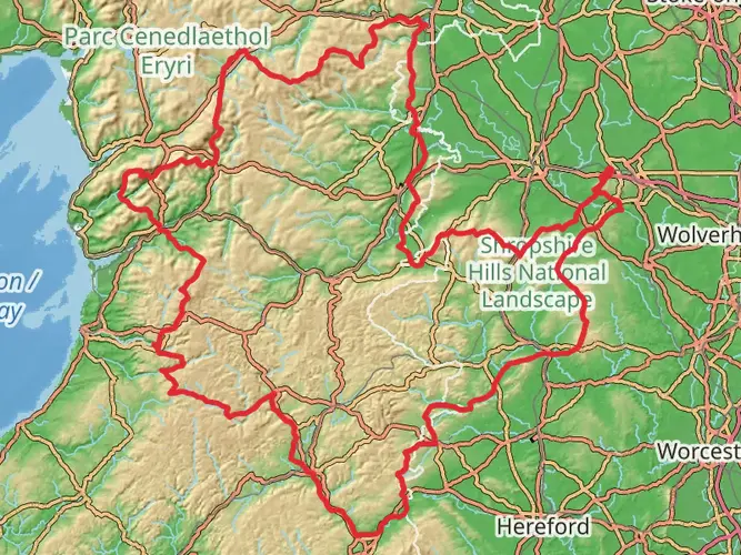
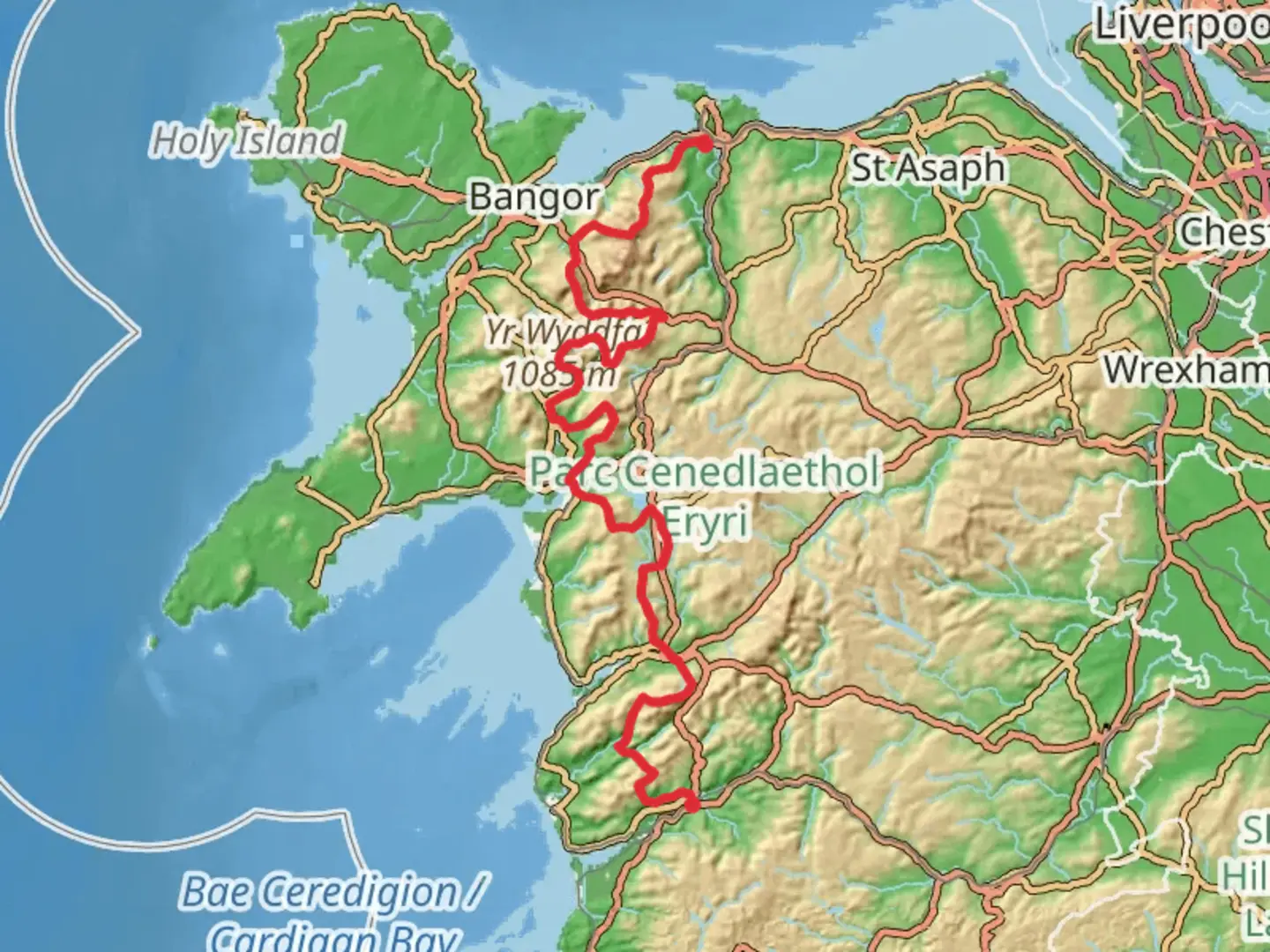
The Snowdonia Way - Mountain Trail is a captivating journey through the heart of the Welsh mountains, offering hikers a chance to immerse themselves in the rugged beauty of Snowdonia National Park. Spanning approximately 195 km (121 miles) with an elevation gain of around 8000 meters (26,247 feet), this point-to-point trail begins near the quaint village of Machynlleth in Powys, Wales, and concludes in the bustling town of Conwy on the northern coast.
Getting to the Trailhead To reach the starting point near Powys, travelers can take a train to Machynlleth station, which is well-connected to larger cities like Shrewsbury and Birmingham. From the station, the trailhead is just a short walk or taxi ride away. For those driving, Machynlleth is accessible via the A487 road, and parking is available in the town.
Navigating the Trail The Snowdonia Way - Mountain Trail is well-marked, but due to its length and varying terrain, it's advisable to use a reliable navigation tool like HiiKER to keep track of your progress and ensure you're on the right path.
Trail Highlights and Landmarks As you embark on this adventure, you'll traverse a diverse landscape, from serene valleys and dense woodlands to high mountain passes and exposed ridges. The trail takes you through the heart of Snowdonia, with the opportunity to summit some of Wales' highest peaks, including Cadair Idris and Snowdon itself, the highest mountain in Wales at 1,085 meters (3,560 feet).
Wildlife and Nature The region is rich in wildlife, with chances to spot rare birds such as the peregrine falcon and the iconic Welsh mountain goat. The flora is equally impressive, with wildflowers and ancient woodlands dotting the landscape. As you hike, you'll pass through areas of significant natural beauty, such as the Dyfi Biosphere Reserve and the picturesque Llyn Tegid (Bala Lake).
Cultural and Historical Significance Snowdonia is steeped in history and legend, with ancient castles and historical sites along the route. The trail passes near Harlech Castle, a UNESCO World Heritage Site, and Dolwyddelan Castle, a stronghold of Welsh princes. The region's rich slate mining heritage is also evident, with abandoned quarries and miners' tracks adding to the trail's historical tapestry.
Preparation and Planning Given the trail's length and varied terrain, hikers should be well-prepared with appropriate gear, including waterproof clothing and sturdy boots. The weather in Snowdonia can change rapidly, so be ready for all conditions. Accommodation options range from campsites and hostels to guesthouses and hotels, allowing for a range of experiences. It's recommended to book accommodations in advance, especially during peak seasons.
Safety and Considerations While the difficulty rating is estimated to be medium, the trail's length and elevation gain require a good level of fitness. Always carry a map and compass, and know how to use them in conjunction with your navigation app. Be mindful of the environment, practice Leave No Trace principles, and be prepared for remote sections where amenities are scarce.
By planning accordingly and respecting the natural and cultural heritage of the region, hikers can look forward to an unforgettable experience on the Snowdonia Way - Mountain Trail.

Comments and Reviews
User comments, reviews and discussions about the Snowdonia Way - Mountain Trail, Wales.
4.62
average rating out of 5
63 rating(s)