Sams Ridge, Hazel Mountain and Catlett Mountain Loop Trail
Download
Preview
Add to list
More
13.6 km
~3 hrs 59 min
763 m
Loop
“Embark on a scenic 14 km adventure through forests, mountains, and historic sites near Rappahannock County, Virginia.”
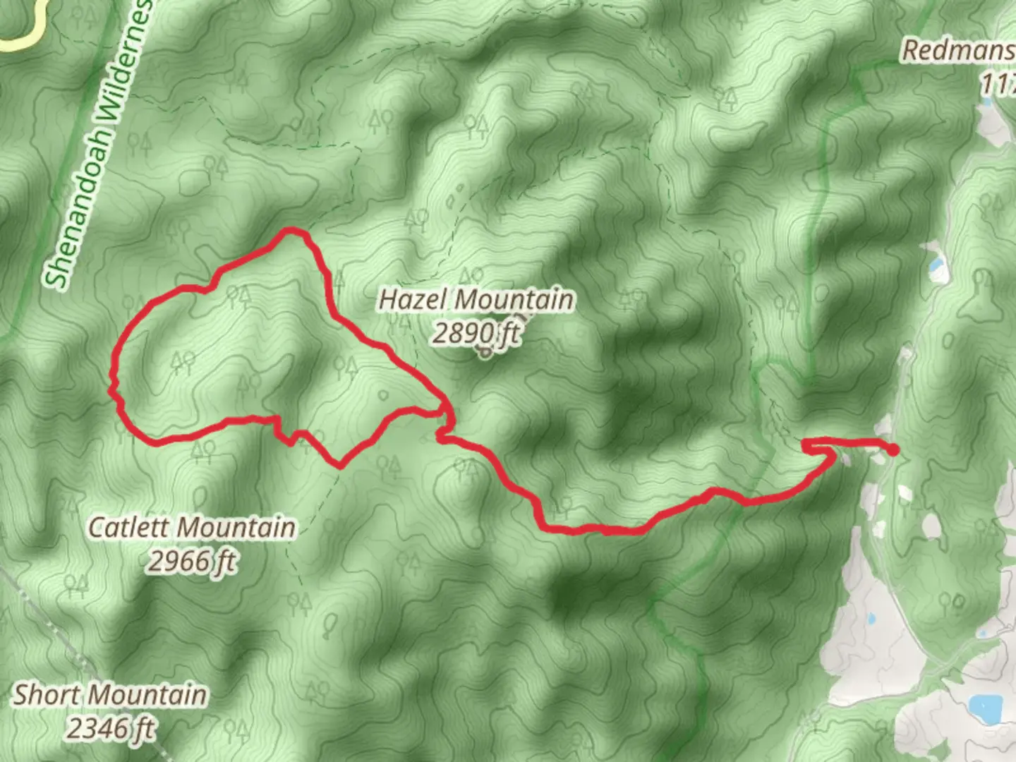
Starting your adventure near Rappahannock County, Virginia, the Sams Ridge, Hazel Mountain, and Catlett Mountain Loop Trail offers a rewarding 14 km (approximately 8.7 miles) journey with an elevation gain of around 700 meters (2,300 feet). This loop trail is rated as medium difficulty, making it suitable for moderately experienced hikers.### Getting There To reach the trailhead, you can drive to the nearest significant landmark, which is the town of Sperryville, Virginia. From Sperryville, head west on U.S. Route 211 until you reach the intersection with Route 522. Follow Route 522 south for a short distance until you see signs for the trailhead parking area. Public transport options are limited, so driving is the most convenient way to access the trail.### Trail Overview The loop begins with a steady ascent, taking you through dense forests rich with oak, hickory, and maple trees. The initial climb is about 3 km (1.9 miles) with an elevation gain of approximately 300 meters (984 feet). This section can be quite steep, so be prepared for a bit of a workout.### Sams Ridge As you continue, you'll reach Sams Ridge, a scenic area offering panoramic views of the surrounding valleys and mountains. This is a great spot to take a break and enjoy the vistas. The ridge is known for its diverse flora, including wildflowers in the spring and vibrant foliage in the fall.### Hazel Mountain The trail then descends slightly before climbing again towards Hazel Mountain. This section is about 4 km (2.5 miles) long with an elevation gain of around 200 meters (656 feet). Hazel Mountain is home to a variety of wildlife, including deer, black bears, and numerous bird species. Keep your eyes peeled and your camera ready.### Catlett Mountain The final major ascent takes you up Catlett Mountain, adding another 3 km (1.9 miles) and 200 meters (656 feet) of elevation gain. The summit offers another excellent viewpoint, perfect for capturing the beauty of the Blue Ridge Mountains. Historical remnants, such as old stone walls and foundations, can be found here, hinting at the area's past settlements.### Descending Back The descent back to the trailhead is gradual and covers the remaining 4 km (2.5 miles). This section is less strenuous, allowing you to enjoy the serene forest environment. Be cautious of loose rocks and roots, especially after rain, as the trail can become slippery.### Navigation and Safety For navigation, it's highly recommended to use the HiiKER app, which provides detailed maps and real-time GPS tracking. This will help you stay on course and avoid any potential detours. Always carry enough water, snacks, and a first-aid kit. Weather can change rapidly in the mountains, so pack layers and be prepared for sudden shifts in temperature.### Historical Significance The region around Rappahannock County has a rich history, dating back to the early European settlers and Native American tribes. The remnants of old homesteads and stone walls along the trail are a testament to the area's historical significance. These structures offer a glimpse into the lives of those who once called these mountains home.This trail offers a blend of natural beauty, challenging terrain, and historical intrigue, making it a must-visit for any hiking enthusiast.

What to expect?
Activity types
Comments and Reviews
User comments, reviews and discussions about the Sams Ridge, Hazel Mountain and Catlett Mountain Loop Trail, Virginia.
4.33
average rating out of 5
18 rating(s)