Download
Preview
Add to list
More
8.2 km
~2 hrs 13 min
351 m
Out and Back
“Embark on the Iron Ore Trail's scenic 5-mile hike through history-laden forests to a rewarding summit in Botetourt County.”
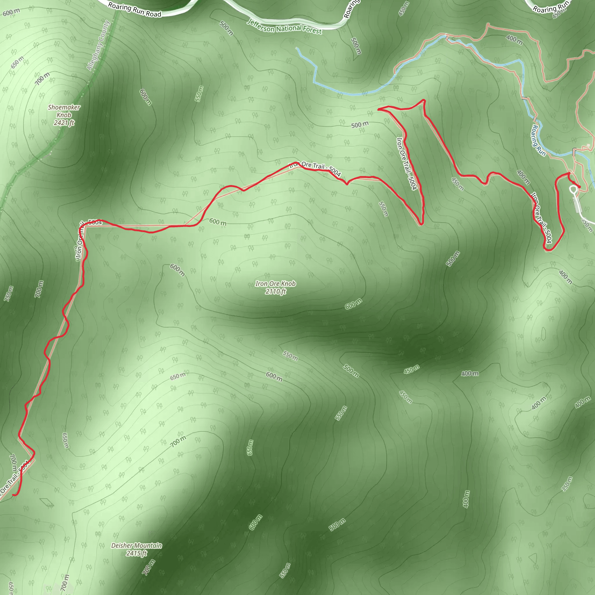
The Iron Ore Trail, nestled near Botetourt County in Virginia, offers an invigorating 8 km (approximately 5 miles) out-and-back journey through a landscape rich with historical significance and natural beauty. With an elevation gain of about 300 meters (roughly 980 feet), hikers can anticipate a moderately challenging trek that is as rewarding as it is demanding.
Getting to the Trailhead
To reach the starting point of the Iron Ore Trail, hikers can drive to the trailhead located near the community of Buchanan, Virginia. For those relying on public transportation, the closest bus stops may be in the town of Buchanan, from which you can take a taxi or arrange for a local shuttle service to the trailhead. Parking is available near the trailhead for those who arrive by car.
The Hike Itself
As you embark on the Iron Ore Trail, the path meanders through a mixed hardwood forest, where the canopy above provides a dappled shade that is particularly welcome during the warmer months. The first section of the trail is relatively flat, allowing hikers to warm up before the ascent begins.
Approximately 1.5 km (just under a mile) into the hike, the trail starts to climb steadily. The incline is gradual but persistent, offering a good workout for the legs. As you ascend, take a moment to appreciate the understory of ferns and wildflowers that change with the seasons.
Historical Significance
The Iron Ore Trail gets its name from the region's rich history of iron ore mining, which dates back to the 18th century. Around the 3 km (1.86 miles) mark, hikers will encounter remnants of this past, including old mine shafts and pits. These historical artifacts serve as a reminder of the area's industrial heritage and are safely observable from the trail. Please remember to respect these sites and not to enter or disturb them.
Flora and Fauna
Continuing on, the trail offers opportunities to spot local wildlife, such as white-tailed deer, squirrels, and a variety of bird species. The forest is also home to a diverse range of plant life, including Virginia pine, oak, and hickory trees. During the spring and summer, the blooming rhododendrons add a splash of color to the greenery.
The Summit and Return
Upon reaching the highest point of the trail, approximately 4 km (2.5 miles) from the start, hikers are rewarded with a serene spot to rest and enjoy a snack. The descent follows the same path, allowing for a different perspective on the landscape you've traversed.
Navigation
For those looking to navigate the trail with ease, HiiKER is an excellent tool to keep you on the right path. It's advisable to download the trail map on your device before setting out, as cell service can be spotty in the area.
Preparation
Before heading out, ensure you have adequate water, snacks, and weather-appropriate clothing. The trail can be rocky and root-filled in places, so sturdy hiking boots are recommended. Also, be prepared for changes in weather, as conditions can shift quickly in the mountains.
Leave No Trace
As with any natural space, it's crucial to follow Leave No Trace principles. Pack out all your trash, stay on the designated trail to protect the surrounding vegetation, and be considerate of wildlife and other hikers.
By respecting these guidelines and coming prepared, your hike on the Iron Ore Trail will be a memorable experience filled with the natural splendor and historical echoes of Botetourt County.
Comments and Reviews
User comments, reviews and discussions about the Iron Ore Trail, Virginia.
4.67
average rating out of 5
6 rating(s)

