Download
Preview
Add to list
More
8.2 km
~1 hrs 49 min
107 m
Point-to-Point
“Embark on the Wheeler Creek East Fork Trail for lush forests, scenic views, and historical intrigue.”
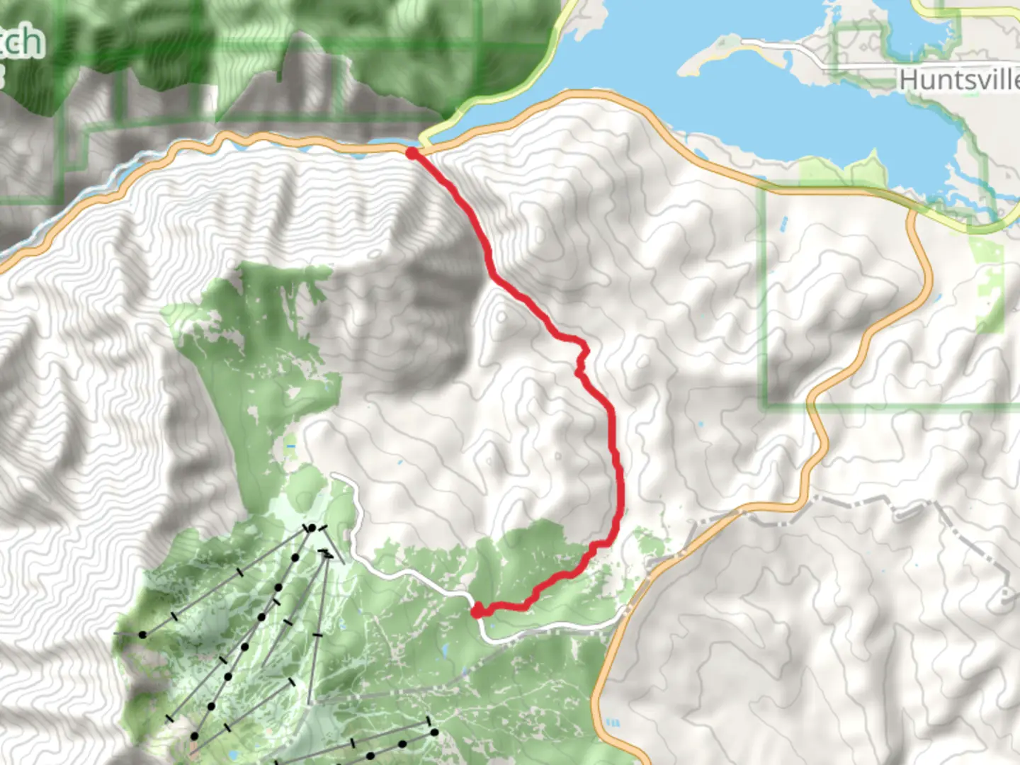
Starting near Weber County, Utah, the Wheeler Creek East Fork Trail stretches approximately 8 kilometers (around 5 miles) with an elevation gain of about 100 meters (328 feet). This point-to-point trail is estimated to be of medium difficulty, making it suitable for moderately experienced hikers.
Getting There To reach the trailhead, you can drive or use public transport. If driving, head towards the Wheeler Creek Trailhead, located near the Pineview Reservoir. For those using public transport, the nearest significant landmark is the Ogden Intermodal Transit Center. From there, you can take a local bus or a taxi to the trailhead.
Trail Overview The trail begins with a gentle ascent, winding through a lush forest of aspen and pine trees. Early on, you’ll cross a small wooden bridge over Wheeler Creek, a perfect spot for a quick photo or a moment of tranquility. The trail is well-marked, but it's always a good idea to have a reliable navigation tool like HiiKER to ensure you stay on track.
Flora and Fauna As you progress, the trail opens up to meadows filled with wildflowers during the spring and summer months. Keep an eye out for mule deer and wild turkeys, which are commonly seen in this area. Birdwatchers will also appreciate the variety of species, including hawks and woodpeckers.
Historical Significance The region around Wheeler Creek has a rich history. It was once a significant area for Native American tribes, and later, it became a route for early settlers and trappers. You might come across old remnants of cabins and mining equipment, offering a glimpse into the past.
Key Landmarks At approximately 3 kilometers (1.8 miles) in, you’ll encounter a scenic overlook that provides stunning views of the Ogden Canyon and the surrounding mountains. This is a great spot to take a break and enjoy the scenery.
Elevation and Terrain The trail continues with a moderate incline, gaining about 100 meters (328 feet) in elevation. The terrain varies from packed dirt to rocky sections, so sturdy hiking boots are recommended. The final stretch of the trail descends gently towards the end point, where you can either arrange for a pickup or hike back the way you came.
Safety and Preparation Given the moderate difficulty, it's essential to bring plenty of water, especially during the hotter months. Weather can change rapidly, so layers are advisable. Always check trail conditions before heading out, and consider downloading the trail map from HiiKER for offline use.
This trail offers a mix of natural beauty, wildlife, and historical intrigue, making it a rewarding hike for those prepared for a moderate challenge.
What to expect?
Activity types
Comments and Reviews
User comments, reviews and discussions about the Wheeler Creek East Fork Trail, Utah.
4.39
average rating out of 5
18 rating(s)
