Download
Preview
Add to list
More
9.3 km
~1 hrs 58 min
74 m
Out and Back
“The McGriff Canal Trail offers a scenic, flat 9 km hike ideal for all skill levels.”
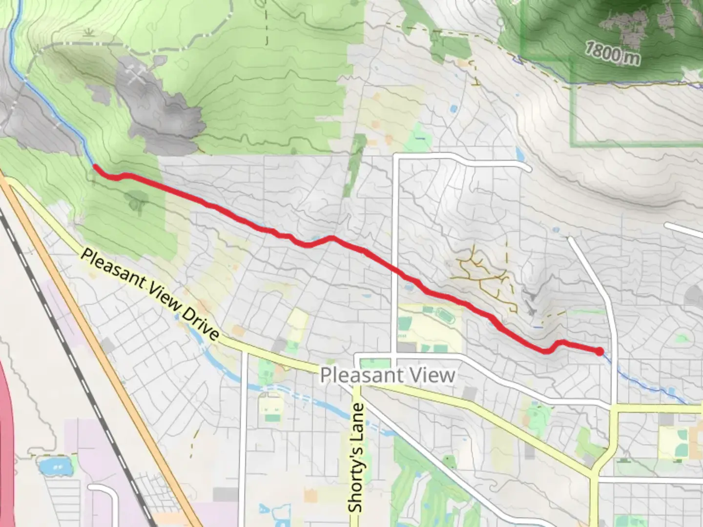
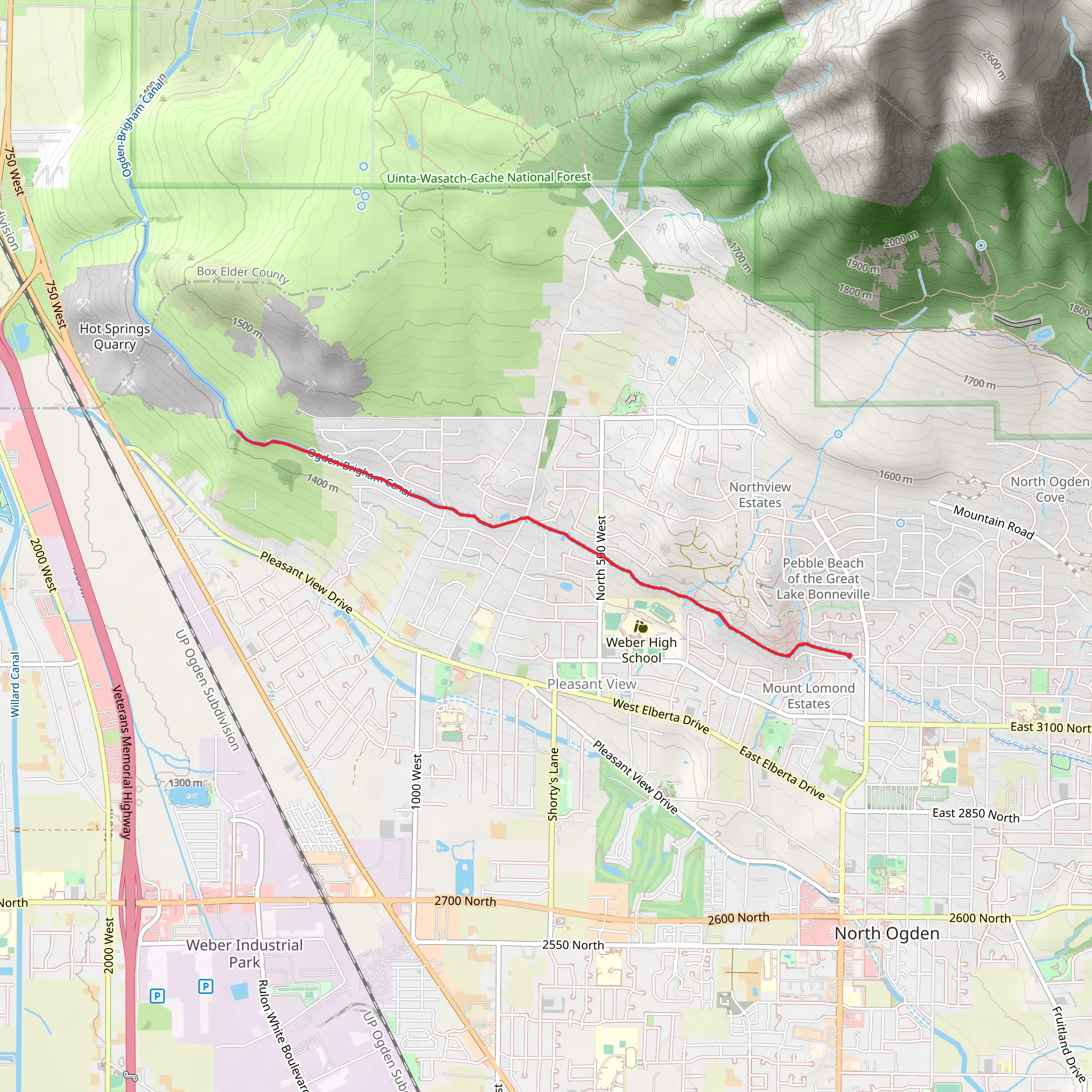
Starting near Weber County, Utah, the McGriff Canal Trail Out and Back is a delightful 9 km (approximately 5.6 miles) trail that offers a relatively flat and accessible hiking experience with an elevation gain of around 0 meters (0 feet). This makes it an ideal choice for hikers of varying skill levels, including families and those looking for a leisurely walk.### Getting There To reach the trailhead, you can drive or use public transportation. If driving, head towards the nearest significant landmark, the Weber County Fairgrounds, located at 1000 N 1200 W, Ogden, UT 84404. From there, it's a short drive to the trailhead. For those using public transport, the Ogden Transit Center is the closest major hub. From the transit center, you can take a local bus or a short taxi ride to the trailhead.### Trail Overview The McGriff Canal Trail is an out-and-back route, meaning you'll hike to the end point and then return along the same path. The trail is well-marked and maintained, making navigation straightforward. For those who prefer digital navigation tools, the HiiKER app provides detailed maps and real-time updates.### What to Expect The trail meanders alongside the McGriff Canal, offering picturesque views of the waterway and surrounding landscapes. As you hike, you'll pass through a variety of environments, including open fields, wooded areas, and sections that run parallel to residential neighborhoods. The flat terrain makes it easy to maintain a steady pace, and the well-trodden path ensures a comfortable walking surface.### Nature and Wildlife Keep an eye out for local wildlife, including various bird species such as ducks, herons, and occasionally, hawks. The canal itself is home to fish and other aquatic life, making it a lively and engaging environment for nature enthusiasts. During spring and summer, the trail is adorned with wildflowers, adding a splash of color to your hike.### Significant Landmarks Approximately 2 km (1.2 miles) into the hike, you'll come across a charming wooden footbridge that spans the canal. This is a popular spot for photos and a great place to take a short break. Further along, around the 4 km (2.5 miles) mark, you'll encounter a small park area with benches and picnic tables, perfect for a mid-hike snack or rest.### Historical Significance The McGriff Canal has historical roots dating back to the early 20th century when it was constructed to support local agriculture. The canal played a crucial role in the development of the surrounding communities by providing much-needed irrigation to farmlands. As you hike, you'll notice remnants of old irrigation equipment and signage that offer a glimpse into the area's agricultural past.### Preparation Tips Given the flat terrain and moderate difficulty rating, standard hiking gear should suffice. Comfortable walking shoes, a hat, sunscreen, and plenty of water are recommended. The trail is exposed in some sections, so be prepared for sun exposure, especially during the summer months. There are no significant elevation changes, making it accessible for hikers of all ages and fitness levels.### Navigation and Safety While the trail is well-marked, it's always a good idea to have a reliable navigation tool. The HiiKER app is highly recommended for its detailed maps and real-time updates. Additionally, be mindful of local weather conditions and trail advisories, which can be checked through the app or local resources.The McGriff Canal Trail Out and Back offers a serene and enjoyable hiking experience, rich with natural beauty and historical significance. Whether you're a seasoned hiker or a casual walker, this trail provides a perfect escape into nature without straying too far from the conveniences of Weber County.
What to expect?
Activity types
Comments and Reviews
User comments, reviews and discussions about the McGriff Canal Trail Out and Back, Utah.
4.44
average rating out of 5
9 rating(s)
