Download
Preview
Add to list
More
23.8 km
~1 day 2 hrs
1392 m
Out and Back
“Experience a challenging yet rewarding hike through Utah's Wasatch Range with stunning vistas and historical significance.”
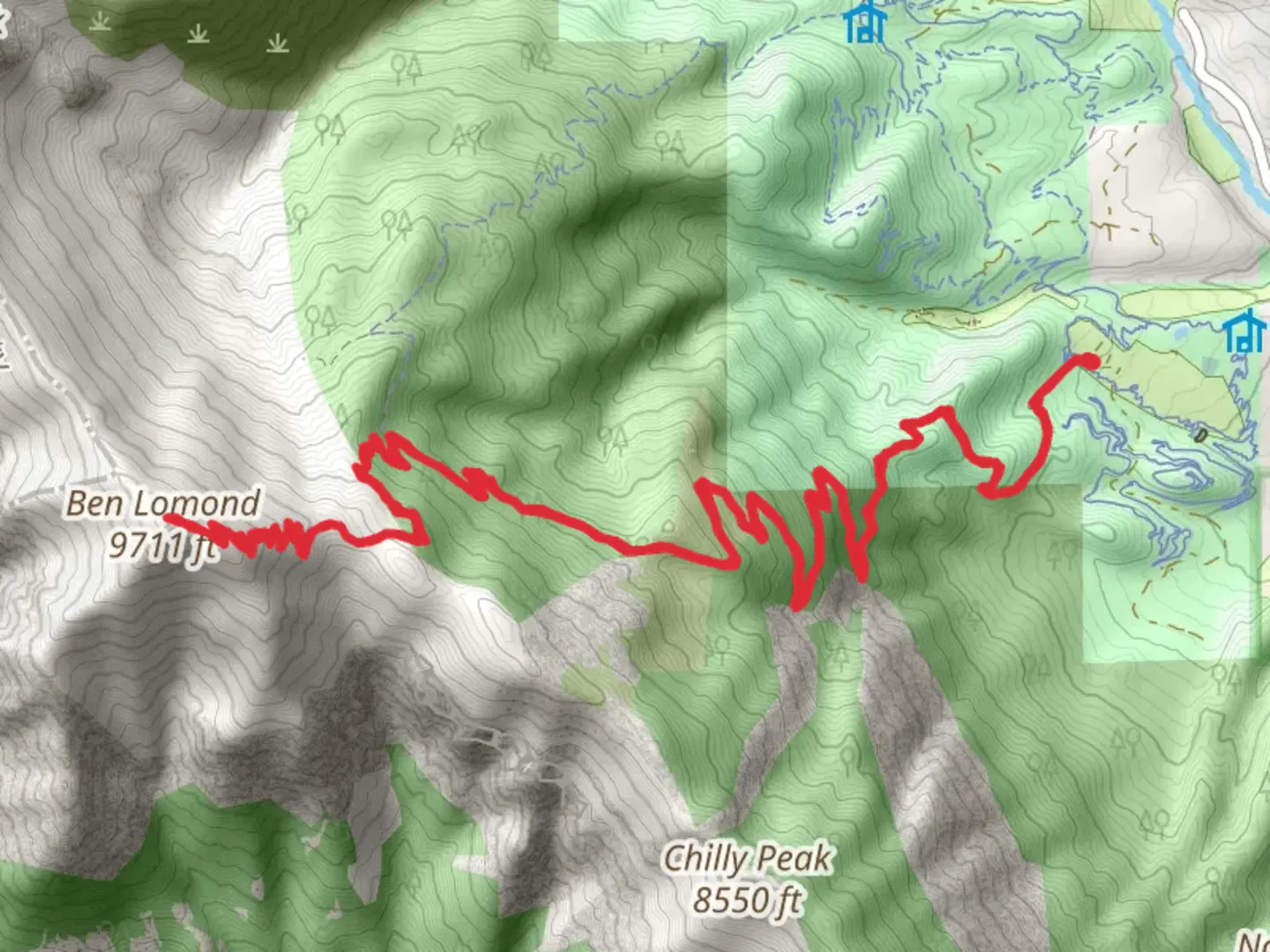
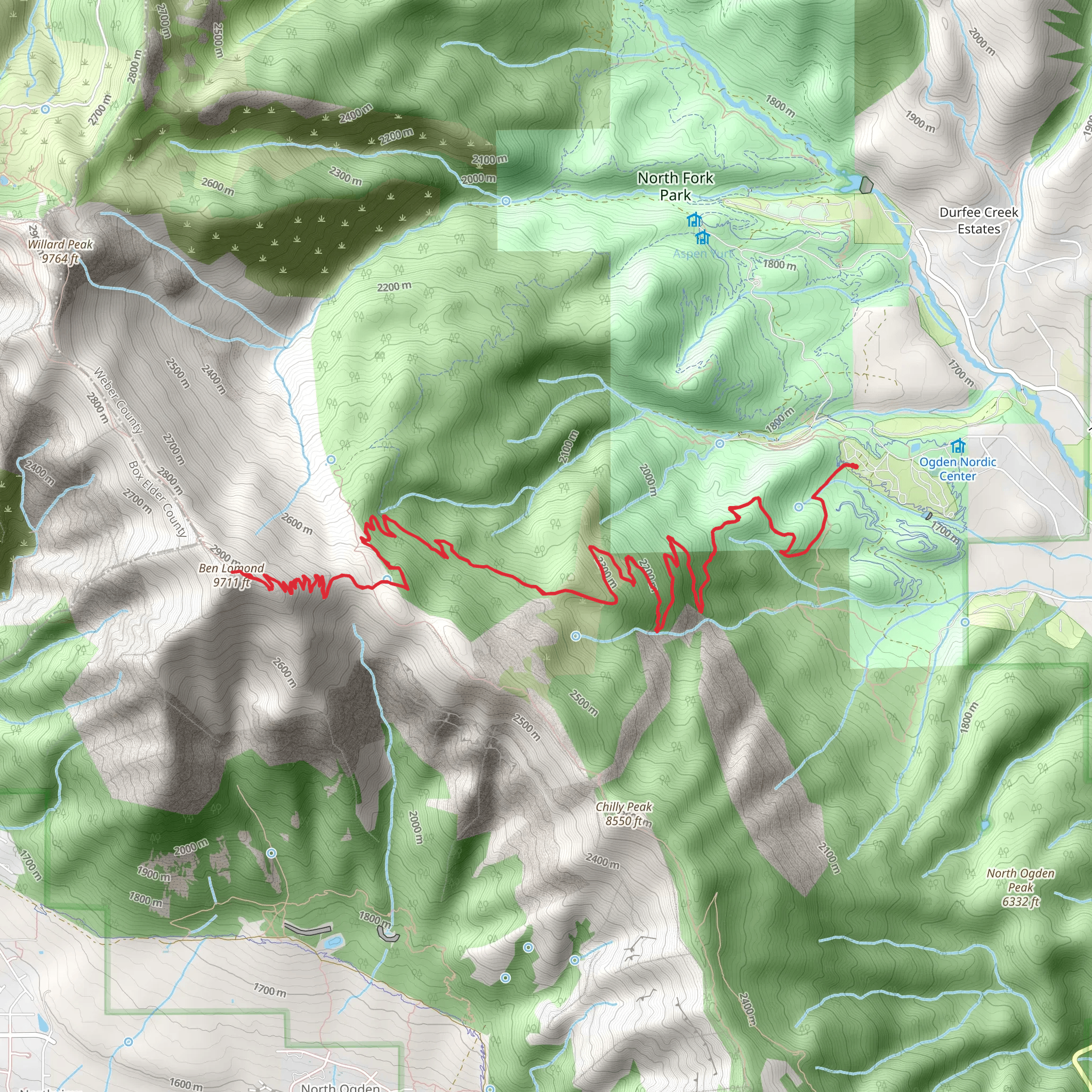
Starting your hike near Weber County, Utah, the Ben Lomond via Ben Lomond Trail and Skyline North Trail offers an invigorating journey through the Wasatch Range. This out-and-back trail spans approximately 24 kilometers (15 miles) with an elevation gain of around 1300 meters (4265 feet), making it a moderately challenging adventure suitable for hikers with some experience.### Getting There To reach the trailhead, you can drive or use public transportation. If driving, head towards North Ogden, Utah, and park near the North Ogden Divide Trailhead. For those using public transport, take a bus to North Ogden and then a short taxi ride to the trailhead.### Trail Overview The trail begins at the North Ogden Divide Trailhead, located near North Ogden Canyon Road. From here, you'll embark on a steady ascent through a mix of scrub oak and coniferous forest. The initial 3 kilometers (1.9 miles) offer a gentle climb, gaining about 300 meters (984 feet) in elevation, providing a good warm-up for the more strenuous sections ahead.### Significant Landmarks and Nature As you progress, you'll encounter several switchbacks that lead you to the ridge. Around the 5-kilometer (3.1-mile) mark, you'll reach a scenic overlook offering panoramic views of the Great Salt Lake and the Ogden Valley. This is a great spot to take a break and hydrate.Continuing along the ridge, the trail becomes steeper and rockier. At approximately 8 kilometers (5 miles) in, you'll come across the junction with the Skyline North Trail. From here, the path narrows and the vegetation becomes sparser, giving way to alpine meadows filled with wildflowers during the summer months.### Wildlife and Flora Keep an eye out for local wildlife, including mule deer, mountain goats, and a variety of bird species such as hawks and eagles. The flora is equally diverse, with wildflowers like Indian paintbrush and lupine adding splashes of color to the landscape.### Historical Significance Ben Lomond Peak holds historical significance as it is believed to have inspired the Paramount Pictures logo. The peak's distinctive shape is said to have been the model for the iconic mountain in the logo, making this hike not just a natural but also a cultural experience.### Final Ascent The final push to the summit is the most challenging part of the hike. Over the last 3 kilometers (1.9 miles), you'll gain approximately 500 meters (1640 feet) in elevation. The trail here is rugged and exposed, so be prepared for strong winds and cooler temperatures. Upon reaching the summit, at an elevation of 2,963 meters (9,721 feet), you'll be rewarded with 360-degree views of the surrounding peaks and valleys.### Navigation For navigation, it's highly recommended to use HiiKER, which provides detailed maps and real-time updates to ensure you stay on the correct path.### Return Journey The return journey follows the same route, offering a chance to revisit the stunning vistas and perhaps spot wildlife you missed on the way up. Make sure to pace yourself and take breaks as needed, especially on the steeper descents.This trail offers a blend of natural beauty, challenging terrain, and historical intrigue, making it a must-do for any avid hiker visiting the Weber County area.
What to expect?
Activity types
Comments and Reviews
User comments, reviews and discussions about the Ben Lomond via Ben Lomond Trail and Skyline North Trail, Utah.
4.48
average rating out of 5
21 rating(s)
