Download
Preview
Add to list
More
11.2 km
~3 hrs 6 min
525 m
Loop
“Experience the perfect blend of natural beauty, wildlife, and history on the 11 km Scott's Bypass and Shadow Lake Loop.”
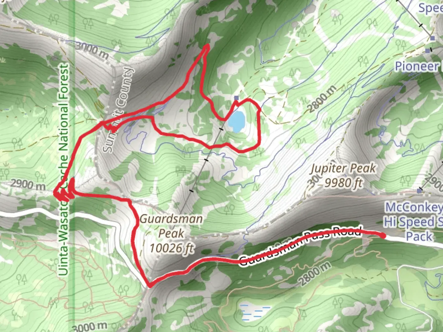
Starting near Wasatch County, Utah, the Scott's Bypass and Shadow Lake Loop is a captivating 11 km (approximately 6.8 miles) trail with an elevation gain of around 500 meters (1,640 feet). This loop trail is rated as medium difficulty, making it suitable for moderately experienced hikers.### Getting There To reach the trailhead, you can drive or use public transport. If driving, head towards the Mirror Lake Highway (UT-150) and look for the trailhead near the Crystal Lake Trailhead parking area. For those using public transport, the nearest significant landmark is the town of Kamas, Utah. From Kamas, you can take a local shuttle or taxi service to the trailhead.### Trail Overview The trail begins with a gentle ascent through a dense forest of pine and aspen trees. As you progress, the path becomes steeper, gaining elevation steadily. The first significant landmark you'll encounter is a small, serene meadow about 2 km (1.2 miles) in, offering a perfect spot for a short break.### Scott's Bypass Section Continuing on, you'll reach Scott's Bypass, a section known for its rocky terrain and panoramic views of the surrounding Wasatch Mountains. This part of the trail is approximately 3 km (1.9 miles) from the start and involves a moderate climb. Keep an eye out for mountain goats and mule deer, which are commonly seen in this area.### Shadow Lake Around the 5 km (3.1 miles) mark, you'll arrive at Shadow Lake, a pristine alpine lake surrounded by towering peaks. This is an ideal spot for a longer rest or even a picnic. The lake is also a great place for birdwatching, with species like the American dipper and Clark's nutcracker frequently spotted.### Historical Significance The region around Shadow Lake has historical significance, as it was once a summer hunting ground for the Ute Native American tribe. Artifacts and remnants of their presence can occasionally be found, adding a layer of historical intrigue to your hike.### Return Loop From Shadow Lake, the trail loops back, descending gradually through a series of switchbacks. This section offers stunning views of the valley below and is particularly beautiful in the late afternoon when the sun casts a golden hue over the landscape. The descent is about 4 km (2.5 miles) and brings you back to the initial forested area, completing the loop.### Navigation For navigation, it's highly recommended to use the HiiKER app, which provides detailed maps and real-time updates to ensure you stay on track.### Wildlife and Flora Throughout the hike, you'll encounter a diverse range of flora and fauna. The lower elevations are dominated by aspen and pine, while higher elevations feature alpine meadows filled with wildflowers during the summer months. Wildlife is abundant, so keep your camera ready for potential sightings of elk, black bears, and various bird species.### Final Stretch The final stretch of the trail is a gentle descent back to the trailhead, offering a relaxing end to a moderately challenging hike. Make sure to carry enough water, snacks, and a first-aid kit, as the trail can be quite remote in sections.This loop trail offers a perfect blend of natural beauty, wildlife, and historical significance, making it a must-visit for any hiking enthusiast.
What to expect?
Activity types
Comments and Reviews
User comments, reviews and discussions about the Scott's Bypass and Shadow Lake Loop, Utah.
4.57
average rating out of 5
14 rating(s)
