Download
Preview
Add to list
More
9.5 km
~2 hrs 15 min
213 m
Point-to-Point
“Embark on a picturesque 9 km hike around Jordanelle Reservoir, brimming with diverse terrains and rich history.”
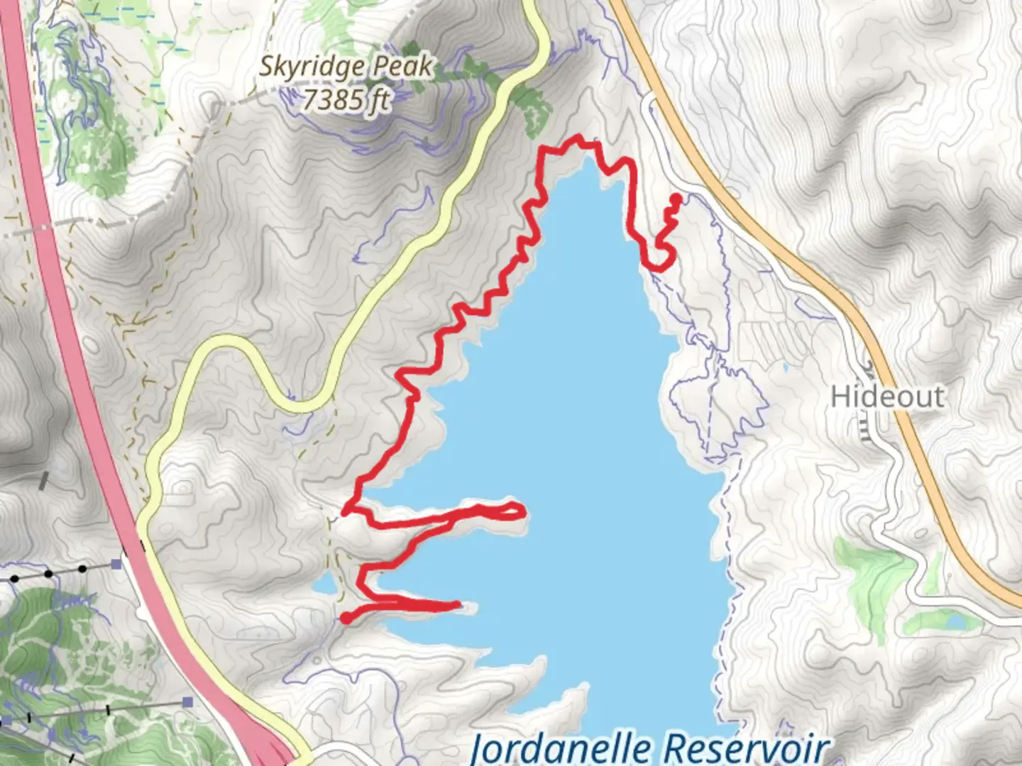
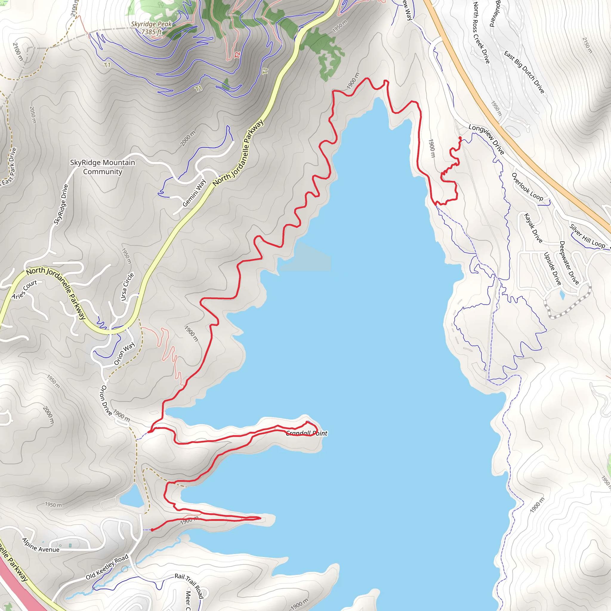
The Jordanelle Perimeter Trail offers a scenic 9 km (approximately 5.6 miles) journey around the Jordanelle Reservoir with an elevation gain of around 200 meters (656 feet). This point-to-point trail is nestled near Wasatch County, Utah, and provides hikers with a medium difficulty rating, making it a suitable adventure for those with some hiking experience.
Getting to the Trailhead
To reach the trailhead, if you're coming by car, navigate towards the Jordanelle State Park, which is the nearest significant landmark. The park is easily accessible from US Highway 40, and once you're in the vicinity, follow the signs directing you to the Hailstone Recreation Area, which serves as the main entrance to the park. Parking is available here, and you'll find the trailhead nearby.
For those opting for public transport, check the local schedules for buses that stop at or near the Jordanelle State Park. From the bus stop, you may need to walk a short distance to the trailhead, so plan accordingly.
Navigating the Trail
As you embark on the Jordanelle Perimeter Trail, you'll be greeted with a mix of terrains, including packed dirt, gravel, and some paved sections. The trail is well-marked, but carrying a navigation tool like HiiKER can be helpful for staying on track and monitoring your progress.
Natural Beauty and Wildlife
The trail wraps around the Jordanelle Reservoir, offering panoramic views of the water and surrounding mountains. You'll traverse through a variety of landscapes, including open meadows, aspen groves, and coniferous forests. Keep an eye out for local wildlife such as deer, elk, and a variety of bird species. The trail also provides an excellent opportunity for wildflower viewing during the spring and summer months.
Historical Significance
The region around Jordanelle Reservoir is rich in history. Before the reservoir's creation, the area was inhabited by Native American tribes, and later by pioneers and settlers. The reservoir itself, completed in 1995, is a testament to modern engineering and provides water storage, flood control, and recreational opportunities for the region.
Landmarks and Points of Interest
Approximately halfway through the hike, you'll come across a viewpoint that offers a stunning vista of the Heber Valley and the Uinta Mountains. This is a great spot to take a break and enjoy the natural beauty of the area.
As you near the end of the trail, you'll find yourself back at the Hailstone Recreation Area, where you can explore other amenities offered by Jordanelle State Park, such as picnic areas, boat rentals, and fishing spots.
Preparation and Planning
Before setting out, ensure you have adequate water, sun protection, and snacks. The trail can be exposed in places, so sunscreen and a hat are recommended. Also, be prepared for changing weather conditions, as mountain weather can be unpredictable. It's advisable to check the forecast and dress in layers.
Remember to leave no trace and pack out all your trash to preserve the beauty of the trail for future hikers. With its moderate difficulty and diverse landscapes, the Jordanelle Perimeter Trail is a rewarding experience for those looking to explore the natural splendor of Wasatch County, Utah.
What to expect?
Activity types
Comments and Reviews
User comments, reviews and discussions about the Jordanelle Perimeter Trail, Utah.
4.73
average rating out of 5
11 rating(s)
