Download
Preview
Add to list
More
8.7 km
~3 hrs 53 min
1291 m
Out and Back
“Experience breathtaking views, rich history, and challenging terrain on Utah's Mahogany Northwest Ridge trail.”
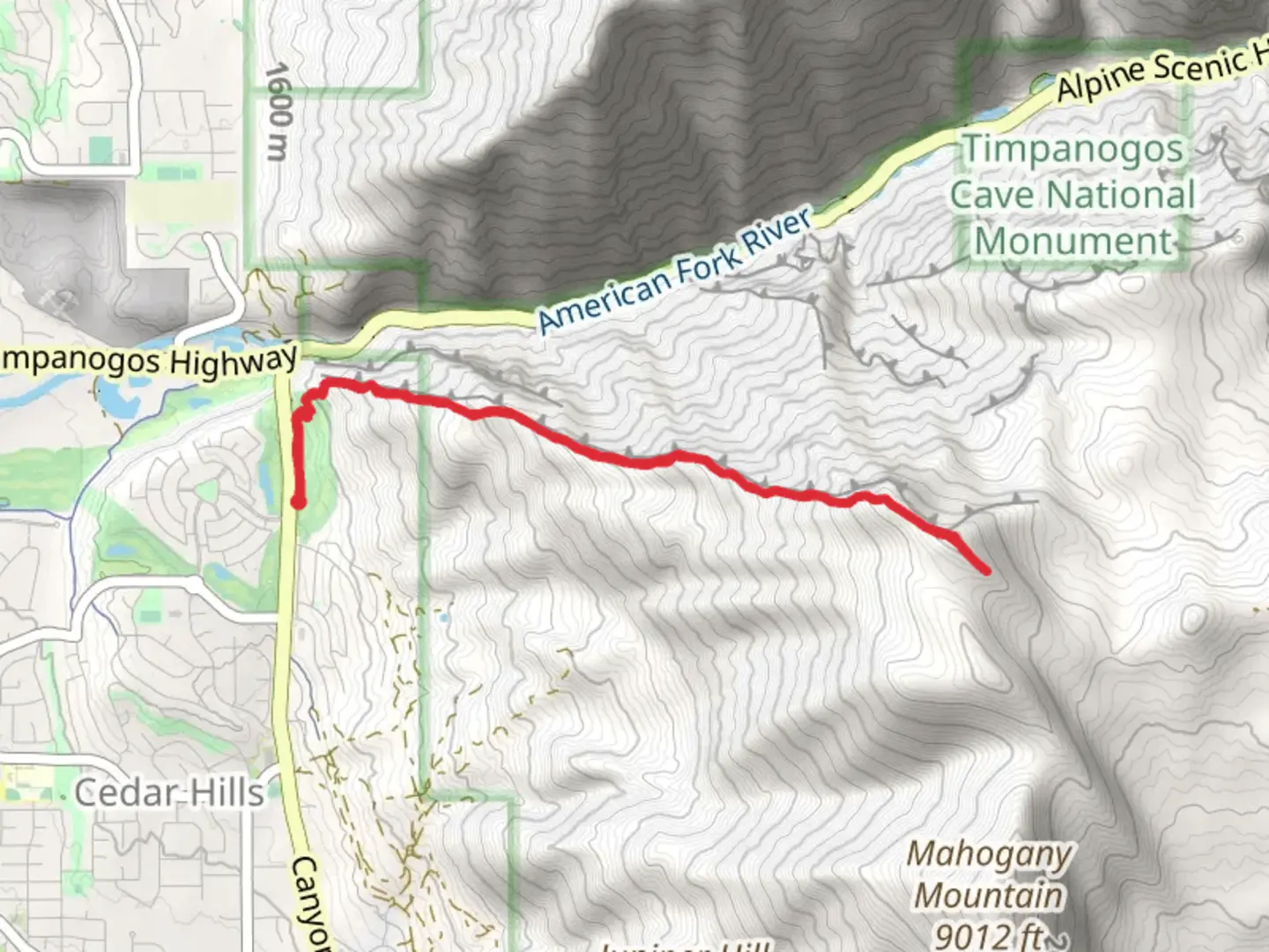
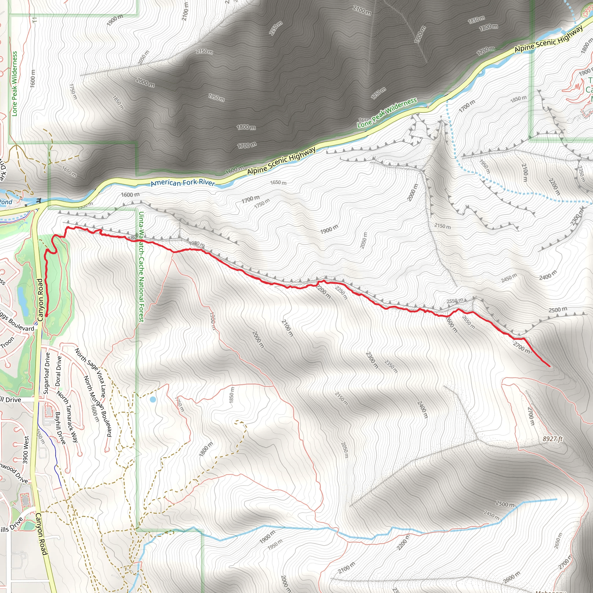
Starting your hike near Utah County, Utah, the Mahogany Northwest Ridge trail offers a challenging yet rewarding experience. This out-and-back trail spans approximately 9 km (5.6 miles) with an elevation gain of around 1200 meters (3937 feet). The trailhead is accessible by car, with parking available near the Dry Canyon Trailhead. For those using public transport, the nearest significant landmark is the city of Pleasant Grove, from where you can take a local taxi or rideshare service to the trailhead.
Initial Ascent and Terrain The trail begins with a steady ascent through a mixed forest of mahogany and scrub oak. The initial 2 km (1.2 miles) will see you gaining about 300 meters (984 feet) in elevation. The path is well-trodden but can be rocky and uneven, so sturdy hiking boots are recommended. As you climb, you'll notice the vegetation gradually thinning, giving way to more open terrain.
Mid-Trail Landmarks and Views Around the 4 km (2.5 miles) mark, you'll reach a prominent ridge that offers panoramic views of Utah Valley and the surrounding mountains. This is a great spot to take a break and hydrate. The elevation gain at this point will be approximately 700 meters (2297 feet). Keep an eye out for local wildlife such as mule deer and various bird species, including hawks and eagles that often soar above the ridges.
Final Push to the Summit The last 1.5 km (0.9 miles) to the summit is the most strenuous, with an additional elevation gain of about 500 meters (1640 feet). The trail becomes steeper and more exposed, so be prepared for strong winds and cooler temperatures. The summit offers breathtaking 360-degree views, making the effort well worth it. On clear days, you can see as far as the Great Salt Lake to the northwest.
Historical Significance The region around Mahogany Northwest Ridge has a rich history. The area was originally inhabited by the Ute Native American tribe, and you may come across ancient petroglyphs on some of the rock faces. During the late 19th century, the trail was used by early settlers and miners, adding a layer of historical intrigue to your hike.
Navigation and Safety Given the elevation and terrain, it's crucial to use reliable navigation tools. HiiKER is an excellent app for this trail, providing detailed maps and real-time updates. Always check the weather forecast before heading out, as conditions can change rapidly at higher elevations. Carry sufficient water, snacks, and a first-aid kit.
Flora and Fauna The trail is home to a diverse range of flora and fauna. In spring and early summer, you'll find wildflowers such as Indian paintbrush and lupine in full bloom. The higher elevations are dotted with hardy alpine plants and shrubs. Wildlife sightings are common, so keep your camera ready but maintain a respectful distance.
Getting There If you're driving, take I-15 to the Pleasant Grove exit and follow local roads to the Dry Canyon Trailhead. For those relying on public transport, the nearest significant landmark is Pleasant Grove, from where a local taxi or rideshare can take you to the trailhead. Ensure you have all necessary supplies before starting your hike, as there are no facilities along the trail.
Prepare well, respect the natural environment, and enjoy the stunning vistas and rich history that the Mahogany Northwest Ridge trail has to offer.
What to expect?
Activity types
Comments and Reviews
User comments, reviews and discussions about the Mahogany northwest Ridge, Utah.
4.52
average rating out of 5
23 rating(s)
