Download
Preview
Add to list
More
16.6 km
~1 day 0 hrs
1522 m
Out and Back
“Embark on a 17-km journey through lush forests, alpine meadows, and historic peaks to stunning Emerald Lake.”
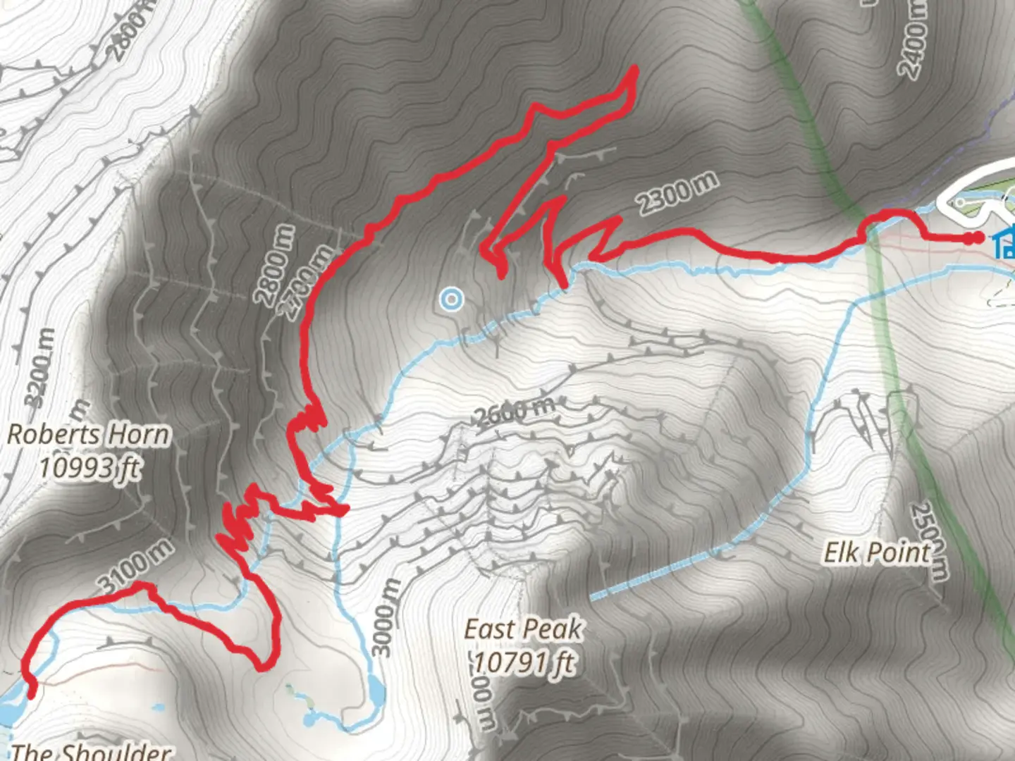
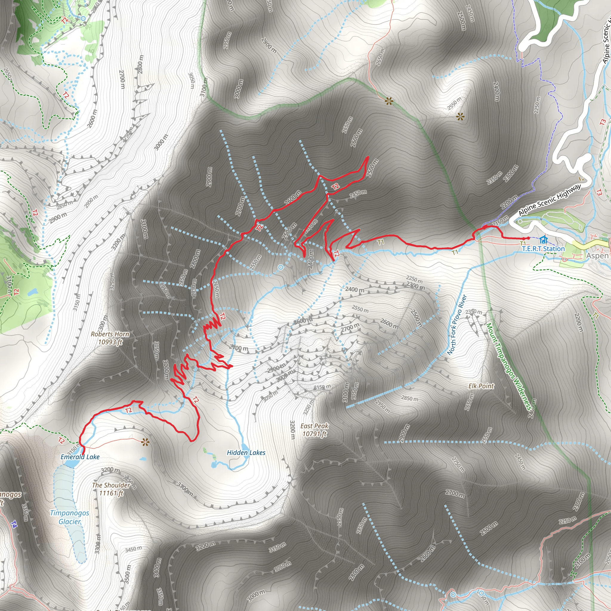
Starting your journey near Utah County, Utah, the trailhead for the Emerald Lake via Mount Timpanogos Trail is accessible by car, with parking available at the Timpooneke Campground. If you're using public transport, the nearest major city is Provo, from where you can take a bus to the American Fork Canyon area and then a taxi or rideshare to the trailhead.The trail spans approximately 17 kilometers (10.5 miles) round trip, with an elevation gain of around 1500 meters (4921 feet). This out-and-back trail is rated as medium difficulty, making it suitable for moderately experienced hikers.### Initial Ascent and Forested Sections The first part of the trail takes you through lush, forested areas filled with aspen and pine trees. The initial ascent is gradual, allowing you to acclimate to the elevation. Keep an eye out for wildlife such as deer and various bird species. The forest provides ample shade, making this section of the hike quite pleasant even during warmer months.### Reaching the Alpine Meadow At around the 5-kilometer (3.1-mile) mark, you'll emerge from the forest into an expansive alpine meadow. This area is particularly stunning in late spring and early summer when wildflowers like lupine and Indian paintbrush are in full bloom. The meadow offers panoramic views of the surrounding peaks and valleys, making it a perfect spot for a short break and some photography.### Climbing to the Saddle The trail then begins a steeper ascent towards the saddle, a prominent ridge that offers sweeping views of the Utah Valley and the Great Salt Lake in the distance. This section is more exposed, so be prepared for wind and sun. The climb to the saddle is about 3 kilometers (1.9 miles) with an elevation gain of approximately 600 meters (1968 feet). The terrain here is rocky, so sturdy hiking boots are recommended.### Historical Significance Mount Timpanogos holds significant historical and cultural importance. The mountain is named after the Timpanogots, a band of the Ute Tribe. The area was also explored by early Mormon settlers in the 19th century. The mountain and its surroundings have long been a source of inspiration and reverence for both Native Americans and settlers alike.### Final Push to Emerald Lake From the saddle, the trail continues for another 2.5 kilometers (1.6 miles) to Emerald Lake. This section is less steep but still challenging due to the high altitude. The lake itself is a glacial tarn, nestled in a cirque surrounded by towering cliffs. The emerald-green waters are crystal clear, reflecting the surrounding peaks. This is a great spot to rest, have lunch, and take in the breathtaking scenery.### Wildlife and Flora Throughout the hike, you may encounter various forms of wildlife, including mountain goats, marmots, and even the occasional black bear. The flora changes with elevation, from dense forests at lower altitudes to alpine tundra near the lake. Always practice Leave No Trace principles to preserve this beautiful environment.### Navigation and Safety Given the trail's length and elevation gain, it's crucial to be well-prepared. Use the HiiKER app for accurate navigation and trail conditions. Weather can change rapidly, especially at higher elevations, so bring layers and be prepared for sudden temperature drops. Ensure you have enough water, as there are limited sources along the trail.This hike offers a rewarding experience with its diverse landscapes, rich history, and stunning natural beauty. Whether you're a seasoned hiker or looking to challenge yourself, the Emerald Lake via Mount Timpanogos Trail is a must-visit.
What to expect?
Activity types
Comments and Reviews
User comments, reviews and discussions about the Emerald Lake via Mount Timpanogos Trail, Utah.
4.5
average rating out of 5
22 rating(s)
