Download
Preview
Add to list
More
6.3 km
~2 hrs 26 min
707 m
Out and Back
“A rewarding 6 km hike near Provo with moderate challenges, stunning views, and rich natural beauty.”
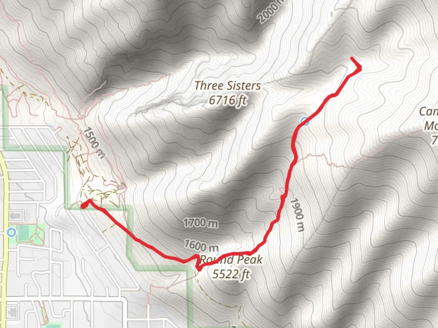
Starting near Utah County, Utah, this 6 km (approximately 3.7 miles) out-and-back trail offers a moderate challenge with an elevation gain of around 700 meters (about 2,300 feet). The trailhead is conveniently located near the city of Provo, making it accessible for both locals and visitors.
Getting There To reach the trailhead, you can drive or use public transportation. If driving, head towards Provo and follow signs to the Bonneville Shoreline Trail (BST) access points. The nearest significant landmark is the Rock Canyon Trailhead, located at 2620 N 1200 E, Provo, UT 84604. For those using public transport, the Utah Transit Authority (UTA) offers bus services that can get you close to the trailhead. From the Provo Central Station, you can take a bus towards the Rock Canyon area and walk a short distance to the trailhead.
Trail Overview The BST and Camel Ridge trail begins with a gradual ascent, offering stunning views of the surrounding Utah Valley and the Wasatch Mountain Range. The first kilometer (0.6 miles) is relatively easy, with a gentle incline that allows hikers to warm up before the more challenging sections.
Key Landmarks and Elevation At around the 1.5 km (0.9 miles) mark, you'll encounter a steeper climb as you approach Camel Ridge. This section is more strenuous, with an elevation gain of approximately 300 meters (984 feet) over a short distance. The ridge itself offers panoramic views that are well worth the effort, providing a perfect spot for a rest and some photography.
Continuing along the trail, you'll reach the highest point at around 3 km (1.86 miles) from the trailhead. Here, the elevation gain totals around 700 meters (2,300 feet). This vantage point offers breathtaking views of the valley below and the distant peaks of the Wasatch Range.
Flora and Fauna The trail is rich in natural beauty, with diverse flora and fauna. In spring and early summer, wildflowers such as lupine and Indian paintbrush dot the landscape. Keep an eye out for local wildlife, including mule deer, red foxes, and a variety of bird species like hawks and eagles.
Historical Significance The region has a rich history, with the Bonneville Shoreline Trail tracing the ancient shoreline of Lake Bonneville, a prehistoric lake that once covered much of Utah. Camel Ridge itself is named for its distinctive shape, reminiscent of a camel's back, and has been a notable landmark for centuries.
Navigation and Safety Given the moderate difficulty of the trail, it's advisable to use a reliable navigation tool like HiiKER to stay on track. The trail is well-marked, but having a digital map can be invaluable, especially in areas where the path may be less clear.
Final Stretch The return journey follows the same path, allowing you to enjoy the views from a different perspective. The descent can be tough on the knees, so take your time and use trekking poles if needed.
This trail offers a rewarding hike with a mix of moderate challenges and stunning natural beauty, making it a must-visit for anyone in the Utah County area.
What to expect?
Activity types
Comments and Reviews
User comments, reviews and discussions about the BST and Camel Ridge, Utah.
4.4
average rating out of 5
10 rating(s)
