Download
Preview
Add to list
More
36.8 km
~2 day
2054 m
Point-to-Point
“Journey through Utah's diverse landscapes on the challenging 37-kilometer Stansbury Front Trail with stunning views.”
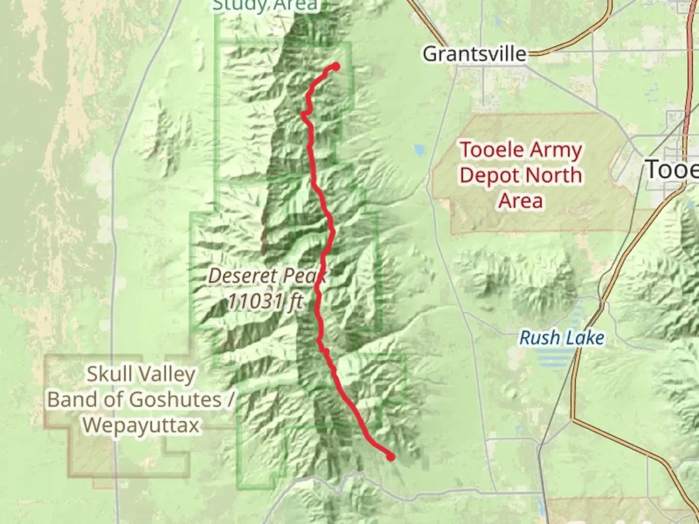
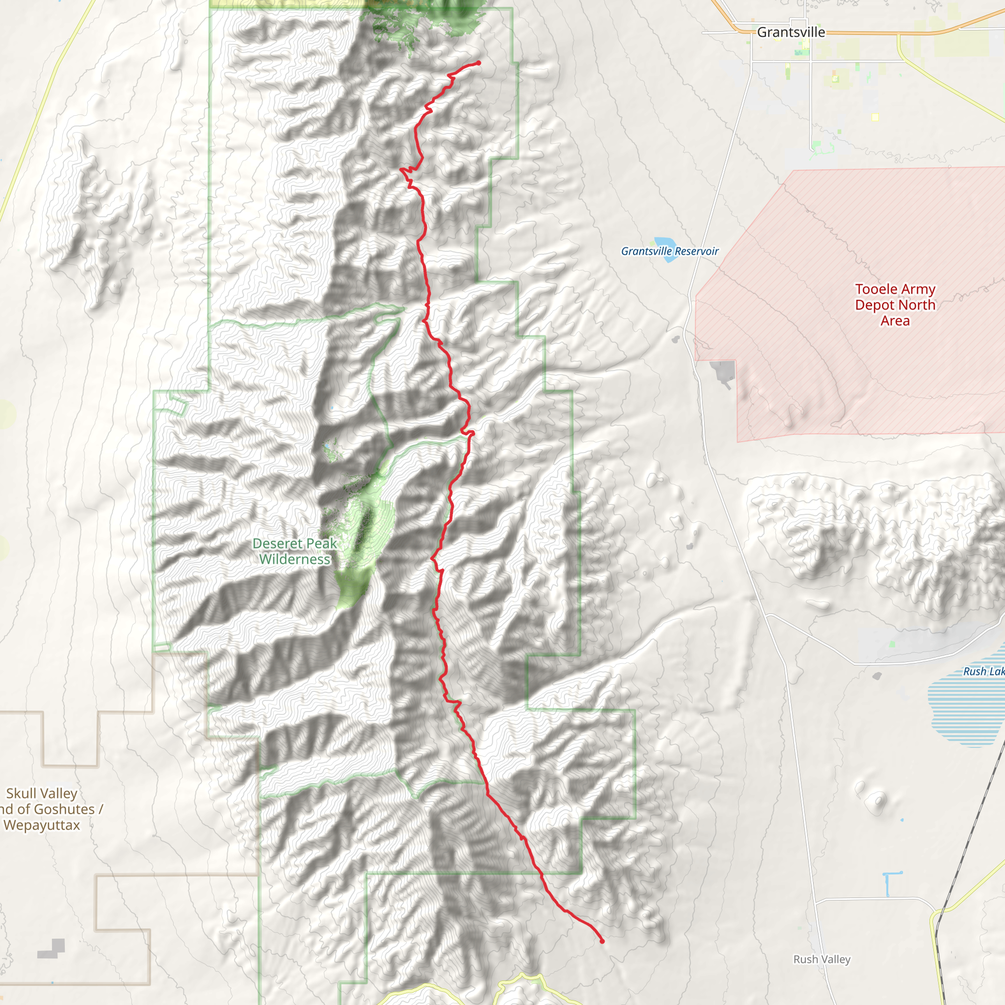
Starting near Tooele County, Utah, the Stansbury Front Trail Point to Point stretches approximately 37 kilometers (about 23 miles) with an elevation gain of around 2000 meters (6562 feet). This trail is classified as medium difficulty and offers a diverse range of landscapes, from rugged mountain terrain to serene valleys.
Getting There To reach the trailhead, you can drive or use public transportation. If driving, head towards the nearest significant landmark, the town of Tooele. From there, follow local roads to the trailhead. Public transport options include buses that run from Salt Lake City to Tooele, where you can then take a taxi or rideshare service to the trailhead.
Trail Overview The trail begins with a gradual ascent, offering panoramic views of the Great Salt Lake and the surrounding valleys. As you progress, the terrain becomes more challenging, with steep inclines and rocky paths. The first significant landmark is the South Willow Canyon, located about 8 kilometers (5 miles) from the start. This area is known for its lush vegetation and seasonal streams, making it a great spot for a short rest.
Mid-Trail Highlights Around the 15-kilometer (9-mile) mark, you'll encounter Deseret Peak, the highest point in the Stansbury Range. The peak stands at 3,353 meters (11,000 feet) and offers breathtaking views of the entire region. This section of the trail is particularly strenuous, with a steep elevation gain of approximately 1000 meters (3281 feet) over a short distance. Be prepared for rocky and uneven terrain.
Flora and Fauna The trail is home to a variety of wildlife, including mule deer, mountain goats, and occasionally black bears. Birdwatchers will enjoy spotting species like the golden eagle and peregrine falcon. The flora varies with elevation; lower sections are dominated by sagebrush and juniper, while higher elevations feature alpine meadows and bristlecone pines.
Historical Significance The Stansbury Front Trail traverses land that has historical significance dating back to the Native American tribes who originally inhabited the area. The trail also passes near old mining sites from the 19th century, remnants of Utah's rich mining history. Keep an eye out for old mining equipment and structures, particularly around the 25-kilometer (15.5-mile) mark.
Navigation and Safety Given the trail's length and varying difficulty, it's crucial to be well-prepared. Use HiiKER for accurate navigation and trail information. Ensure you have enough water, food, and appropriate gear for changing weather conditions. Cell service can be spotty, so downloading offline maps on HiiKER is advisable.
Final Stretch The last segment of the trail descends gradually, offering a respite from the earlier strenuous climbs. You'll pass through open meadows and forested areas before reaching the endpoint near the town of Grantsville. This section is relatively easier, making it a pleasant end to a challenging hike.
By the time you reach the end, you'll have experienced a diverse range of Utah's natural beauty, from high alpine peaks to lush valleys, all while traversing a trail rich in history and wildlife.
What to expect?
Activity types
Comments and Reviews
User comments, reviews and discussions about the Stansbury Front Trail Point to Point, Utah.
4.4
average rating out of 5
10 rating(s)
