Download
Preview
Add to list
More
19.4 km
~1 day 0 hrs
886 m
Out and Back
“Embark on the 19-kilometer Shingle Creek Trail for stunning landscapes, rich history, and vibrant wildlife.”
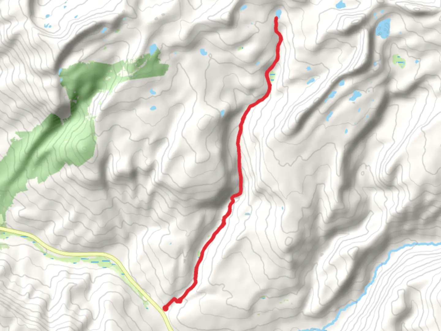
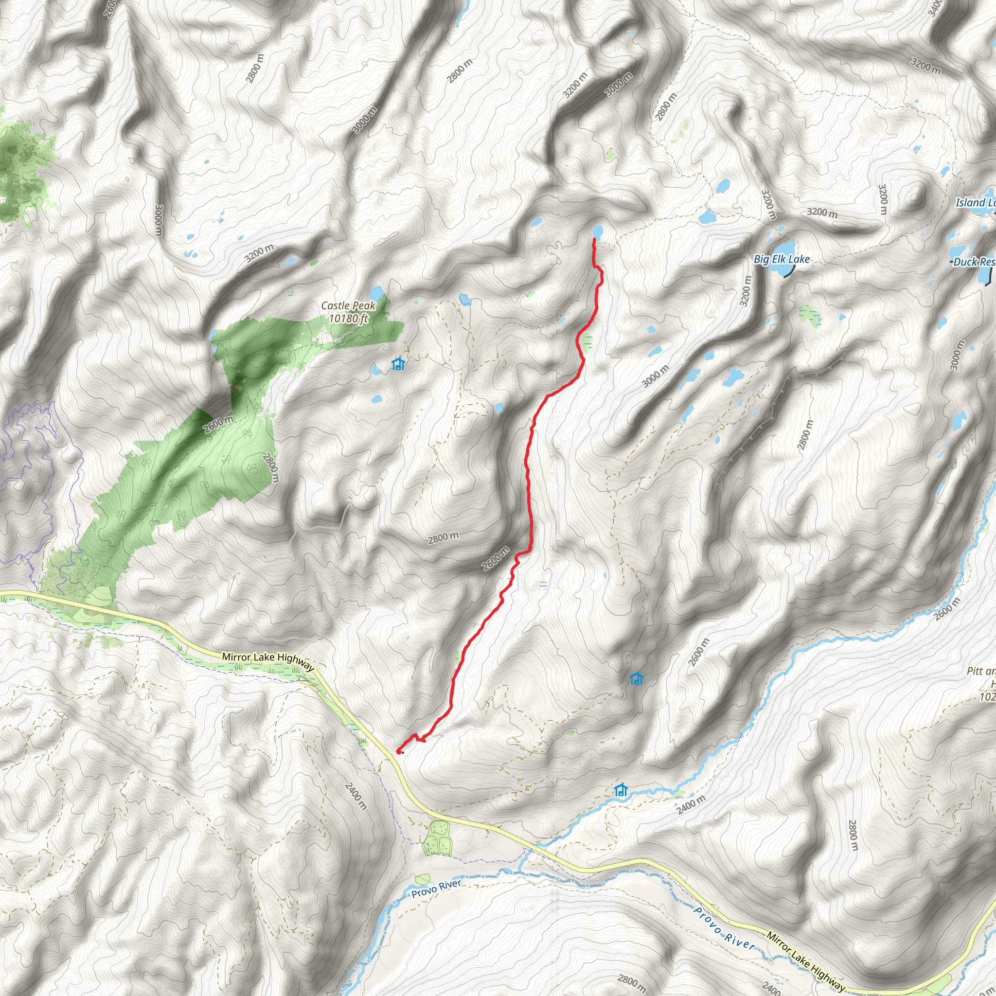
Starting your journey near Summit County, Utah, the East Shingle Creek Lake via Shingle Creek Trail is a captivating out-and-back trail that spans approximately 19 kilometers (around 12 miles) with an elevation gain of about 800 meters (roughly 2,625 feet). This medium-difficulty trail offers a blend of serene landscapes, diverse wildlife, and historical significance, making it a rewarding experience for hikers.
Getting There
To reach the trailhead, you can drive or use public transportation. If you're driving, head towards Summit County, Utah, and look for the trailhead near the Shingle Creek Campground. For those relying on public transport, the nearest significant landmark is Kamas, Utah. From Kamas, you can take a local taxi or rideshare service to the trailhead, which is approximately 20 kilometers (12.4 miles) away.
Trail Overview
The trail begins at the Shingle Creek Campground, a well-known starting point for many hikers. As you set off, you'll find yourself surrounded by lush forests of aspen and pine, providing ample shade and a cool atmosphere, especially during the summer months. The initial part of the trail is relatively gentle, allowing you to ease into the hike.
Key Landmarks and Elevation
At around 3 kilometers (1.9 miles) in, you'll encounter the first significant elevation gain. The trail starts to ascend more steeply, and you'll notice the terrain becoming rockier. This section offers stunning views of the surrounding Uinta Mountains, so take a moment to appreciate the scenery.
Wildlife and Flora
As you continue, keep an eye out for local wildlife. Deer and elk are commonly spotted in this area, and if you're lucky, you might even see a moose. Birdwatchers will also enjoy the variety of species that inhabit the region, including hawks and woodpeckers. The flora is equally diverse, with wildflowers blooming in the spring and summer, adding vibrant colors to the landscape.
Historical Significance
The Uinta Mountains, where this trail is located, have a rich history. Native American tribes, including the Ute and Shoshone, once roamed these lands. The area is also known for its mining history in the late 19th and early 20th centuries. As you hike, you might come across remnants of old mining equipment and cabins, offering a glimpse into the past.
Reaching East Shingle Creek Lake
After about 9.5 kilometers (5.9 miles), you'll reach East Shingle Creek Lake. This pristine alpine lake is the perfect spot for a break. The clear waters reflect the surrounding peaks, creating a picturesque setting. It's an ideal location for a picnic or simply to rest and take in the natural beauty.
Navigation and Safety
Given the trail's moderate difficulty, it's essential to be prepared. Ensure you have a reliable navigation tool like HiiKER to keep you on track. The trail is well-marked, but having a digital map can be incredibly helpful, especially in areas where the path might be less clear.
Return Journey
The return journey follows the same path, allowing you to revisit the beautiful landscapes and perhaps notice details you missed on the way up. The descent is generally easier, but still requires caution, especially on the steeper sections.
Final Tips
Make sure to carry enough water, as there are limited sources along the trail. Wearing sturdy hiking boots is advisable due to the rocky terrain. Also, be prepared for sudden weather changes, which are common in mountainous regions. Always check the weather forecast before setting out and inform someone about your hiking plans.
This trail offers a perfect blend of natural beauty, wildlife, and historical intrigue, making it a must-visit for any hiking enthusiast.
What to expect?
Activity types
Comments and Reviews
User comments, reviews and discussions about the East Shingle Creek Lake via Shingle Creek Trail, Utah.
4.63
average rating out of 5
19 rating(s)
