Download
Preview
Add to list
More
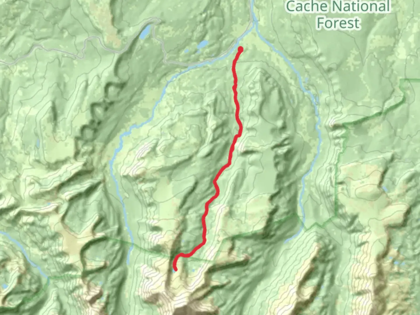
29.5 km
~1 day 2 hrs
863 m
Out and Back
“Explore Utah's Middle Fork Black Fork Trail to Bobs Lake for a scenic, moderately challenging adventure.”
Starting your adventure near Summit County, Utah, the trailhead for Bobs Lake via Middle Fork Black Fork Trail is accessible by car. If you're using public transport, the nearest significant landmark is Kamas, Utah. From Kamas, you can take a local taxi or rideshare service to the trailhead.The trail spans approximately 30 km (18.6 miles) with an elevation gain of around 800 meters (2,625 feet). This out-and-back trail is rated as medium difficulty, making it suitable for moderately experienced hikers.### Initial Ascent and Terrain The first section of the trail involves a steady ascent through dense forest, gaining about 200 meters (656 feet) in the first 5 km (3.1 miles). The path is well-trodden but can be rocky in places, so sturdy hiking boots are recommended. Keep an eye out for deer and elk, which are commonly seen in this area.### Middle Fork Black Fork River Around the 10 km (6.2 miles) mark, you'll encounter the Middle Fork Black Fork River. This is a great spot to take a break and enjoy the serene surroundings. The river is also a good place to refill your water supply, but make sure to use a water filter.### Historical Significance As you continue, you'll pass through areas that were historically significant to the Ute Native American tribe. The Utes used these trails for hunting and gathering, and you may come across ancient petroglyphs etched into the rocks. These are protected sites, so please respect them by not touching or defacing them.### Wildlife and Flora The trail is rich in biodiversity. You’ll traverse through meadows filled with wildflowers like lupine and Indian paintbrush, especially vibrant in late spring and early summer. Birdwatchers will be delighted by the variety of species, including hawks, eagles, and various songbirds.### Final Ascent to Bobs Lake The final 5 km (3.1 miles) involve a steeper ascent, gaining the remaining 400 meters (1,312 feet) in elevation. The trail becomes narrower and more rugged, so take your time and watch your footing. As you approach Bobs Lake, the tree line thins out, offering panoramic views of the surrounding peaks.### Bobs Lake Upon reaching Bobs Lake, you'll be rewarded with stunning views of the crystal-clear waters surrounded by alpine scenery. The lake is a perfect spot for a picnic or even a quick swim if you can brave the cold water. Fishing is also popular here, with the lake being home to various trout species.### Navigation and Safety For navigation, it's highly recommended to use the HiiKER app, which provides detailed maps and real-time updates. Cell service can be spotty, so download the map for offline use before you start your hike. Always carry a first aid kit, extra layers, and sufficient food and water.### Return Journey The return journey follows the same path, offering a different perspective on the landscape. Descending can be easier on the legs but be cautious on the rocky sections to avoid slips and falls.This trail offers a mix of natural beauty, historical significance, and moderate physical challenge, making it a rewarding experience for those who undertake it.

What to expect?
Activity types
Comments and Reviews
User comments, reviews and discussions about the Bobs Lake via Middle Fork Black Fork Trail, Utah.
4.33
average rating out of 5
12 rating(s)