Download
Preview
Add to list
More
11.5 km
~3 hrs 40 min
823 m
Loop
“Explore Utah's Upper Albion Meadows Trail and Mount Baldy loop for stunning views, wildlife, and historical relics.”
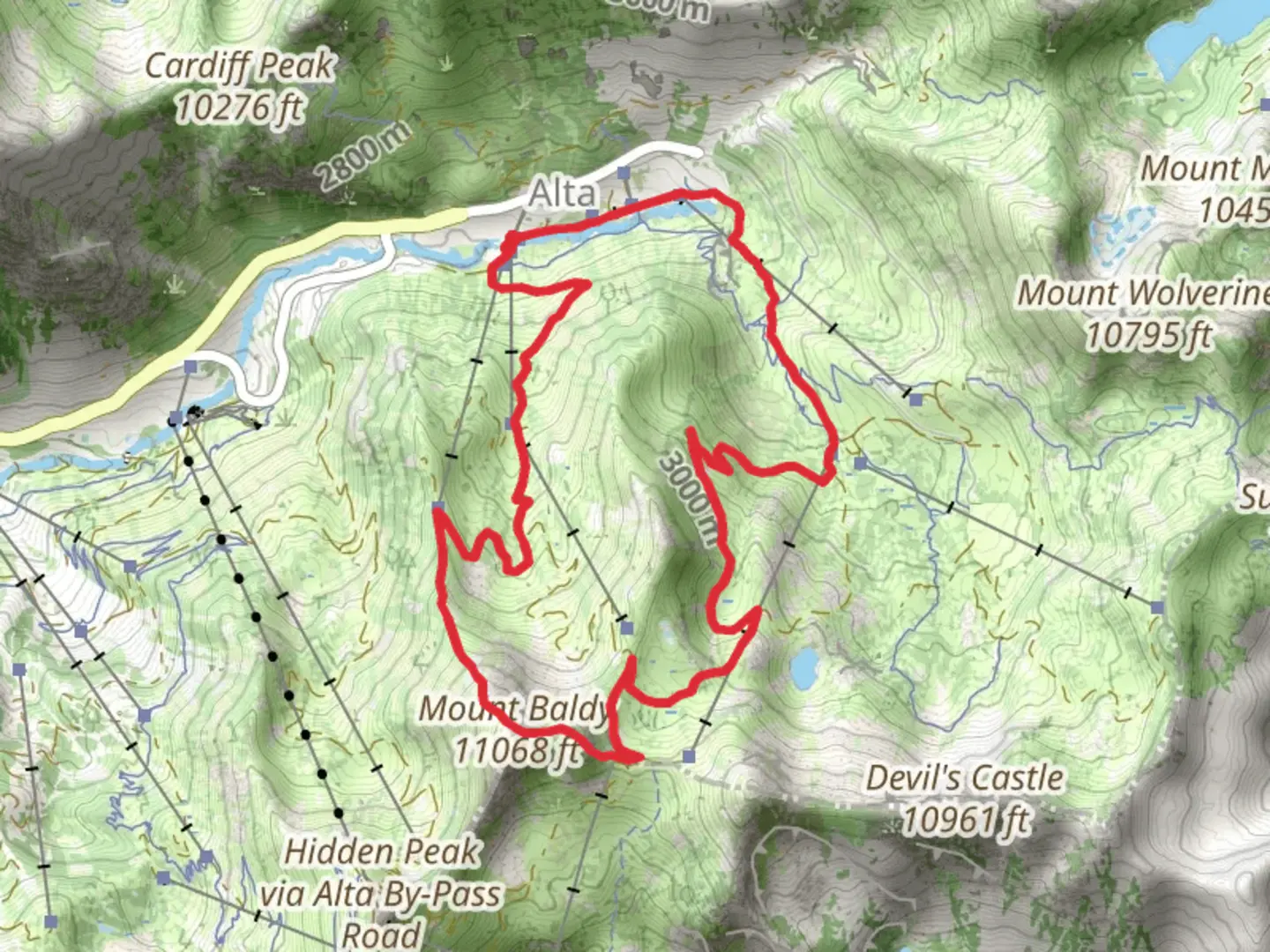
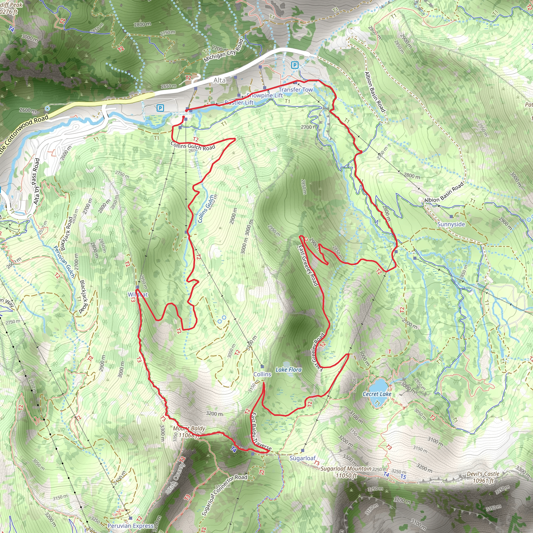
Starting near Salt Lake County, Utah, the Upper Albion Meadows Trail and Mount Baldy loop spans approximately 11 kilometers (around 6.8 miles) with an elevation gain of about 800 meters (2,625 feet). This medium-difficulty trail offers a rich blend of natural beauty, historical significance, and diverse wildlife, making it a rewarding experience for hikers.### Getting There To reach the trailhead, you can drive or use public transportation. If driving, head towards the Alta Ski Area, located at 10010 Little Cottonwood Canyon Rd, Alta, UT 84092. There is ample parking available near the Albion Base Area. For those using public transport, the Utah Transit Authority (UTA) offers bus services to the Alta Ski Area, particularly during the summer and winter seasons. Check the UTA website for the latest schedules and routes.### Trail Overview The trail begins at the Albion Base Area, where you will find a well-marked path leading into the Upper Albion Meadows. The initial section of the trail is relatively gentle, allowing you to acclimate to the altitude and enjoy the lush meadows filled with wildflowers during the summer months. As you progress, the trail starts to ascend more steeply, offering panoramic views of the surrounding Wasatch Mountains.### Significant Landmarks and Nature At approximately 2 kilometers (1.2 miles) into the hike, you will encounter Cecret Lake, a small but stunning alpine lake. This is a great spot to take a break and enjoy the serene environment. Continuing on, the trail becomes steeper as you approach the saddle between Mount Baldy and Sugarloaf Peak. This section is more challenging but offers breathtaking views of Little Cottonwood Canyon and the distant Salt Lake Valley.### Wildlife and Flora The area is home to a variety of wildlife, including mule deer, mountain goats, and a plethora of bird species. Keep an eye out for marmots and pikas in the rocky areas. The flora is equally diverse, with wildflowers such as Indian paintbrush, lupine, and columbine adding splashes of color to the landscape.### Historical Significance The region has a rich mining history dating back to the late 19th century. As you hike, you may notice remnants of old mining equipment and structures, particularly near the Albion Basin. These relics serve as a reminder of the area's past and its transformation into a recreational haven.### Navigation and Safety Given the elevation gain and varying terrain, it's advisable to use a reliable navigation tool like HiiKER to stay on track. The trail is well-marked, but weather conditions can change rapidly, especially at higher elevations. Always check the weather forecast before heading out and be prepared with appropriate gear, including layers, a hat, sunscreen, and plenty of water.### Final Ascent and Descent The final push to Mount Baldy's summit is steep and rocky, requiring careful footing. Once at the top, you'll be rewarded with 360-degree views that are truly spectacular. The descent follows a loop back towards the Albion Base Area, passing through more meadows and forested sections, providing a different perspective of the landscape you ascended through.This trail offers a comprehensive experience of Utah's natural beauty, historical depth, and diverse ecosystems, making it a must-visit for any hiking enthusiast.
What to expect?
Activity types
Comments and Reviews
User comments, reviews and discussions about the Upper Albion Meadows Trail and Mount Baldy, Utah.
4.67
average rating out of 5
18 rating(s)
