Download
Preview
Add to list
More
6.0 km
~1 hrs 37 min
260 m
Out and Back
“The Upper Albion Meadows Trail offers stunning vistas, rich history, and diverse wildlife for moderately experienced hikers.”
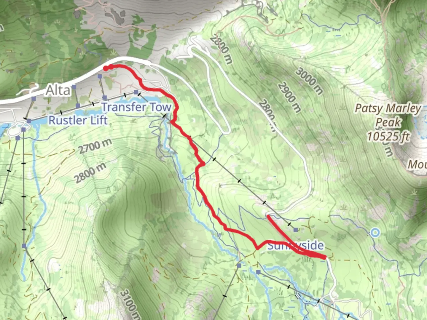
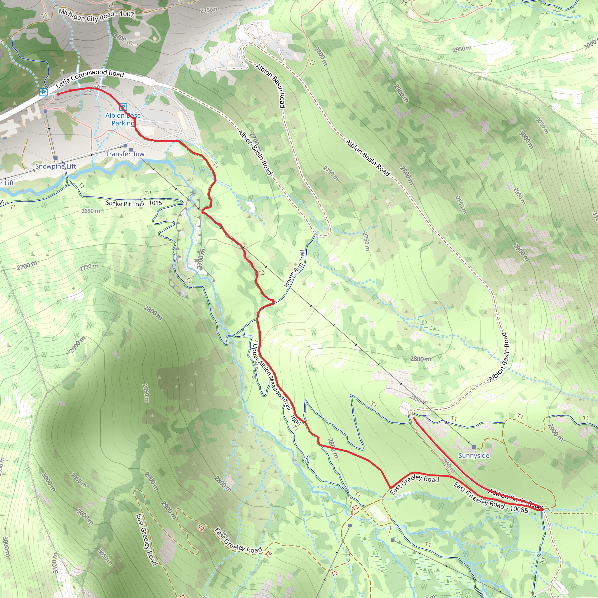
Starting near Salt Lake County, Utah, the Upper Albion Meadows Trail is an inviting out-and-back trail that spans approximately 6 kilometers (around 3.7 miles) with an elevation gain of about 200 meters (656 feet). This trail is rated as medium difficulty, making it suitable for moderately experienced hikers.
Getting There To reach the trailhead, you can drive or use public transportation. If driving, head towards the Alta Ski Area, which is a well-known landmark in the region. The trailhead is located near the Albion Basin Campground. For those using public transport, you can take a bus to the Alta Ski Area, which is serviced by several routes from Salt Lake City. From there, it's a short walk to the trailhead.
Trail Navigation Using HiiKER for navigation is highly recommended to ensure you stay on the correct path and to track your progress. The trail is well-marked, but having a reliable navigation tool can enhance your hiking experience.
Trail Description The trail begins with a gentle ascent through lush meadows filled with wildflowers during the summer months. Early on, you'll encounter a mix of subalpine and alpine environments, offering a diverse range of flora. The first kilometer (0.6 miles) is relatively easy, with a gradual incline that allows you to acclimate to the elevation.
Significant Landmarks As you progress, you'll come across several significant landmarks. Around the 2-kilometer (1.2-mile) mark, you'll reach a viewpoint that offers stunning vistas of the surrounding mountains and valleys. This is a great spot to take a break and soak in the scenery.
Continuing on, the trail becomes steeper as you approach the 3-kilometer (1.8-mile) point. Here, you'll find yourself surrounded by towering pine trees and the occasional sighting of local wildlife, such as mule deer and various bird species. Keep an eye out for marmots, which are often seen sunning themselves on the rocks.
Historical Significance The Albion Basin area has a rich history tied to the mining boom of the late 19th and early 20th centuries. Remnants of old mining equipment and structures can still be seen along the trail, offering a glimpse into the past. This region was once bustling with miners seeking silver and other precious metals, and the trail itself follows some of the old mining routes.
Final Stretch The final stretch of the trail leads you to the upper meadows, where the elevation gain becomes more noticeable. The trail culminates in a panoramic viewpoint that offers breathtaking views of the surrounding peaks and valleys. This is the perfect spot to rest, take photos, and enjoy a snack before heading back down.
Wildlife and Flora Throughout the hike, you'll be treated to a variety of plant and animal life. The meadows are home to an array of wildflowers, including Indian paintbrush, lupine, and columbine. The diverse ecosystem supports a range of wildlife, so be sure to carry binoculars if you're interested in birdwatching.
Return Journey The return journey follows the same path, allowing you to enjoy the scenery from a different perspective. The descent is easier on the legs, but still requires caution, especially in steeper sections.
This trail offers a perfect blend of natural beauty, historical intrigue, and moderate physical challenge, making it a rewarding experience for any hiker.
What to expect?
Activity types
Comments and Reviews
User comments, reviews and discussions about the Upper Albion Meadows Trail, Utah.
4.46
average rating out of 5
24 rating(s)
