Download
Preview
Add to list
More
8.5 km
~2 hrs 48 min
664 m
Loop
“Explore diverse landscapes and historical sites on the scenic and challenging Sugarloaf Mountain and Cecret Lake Trail.”
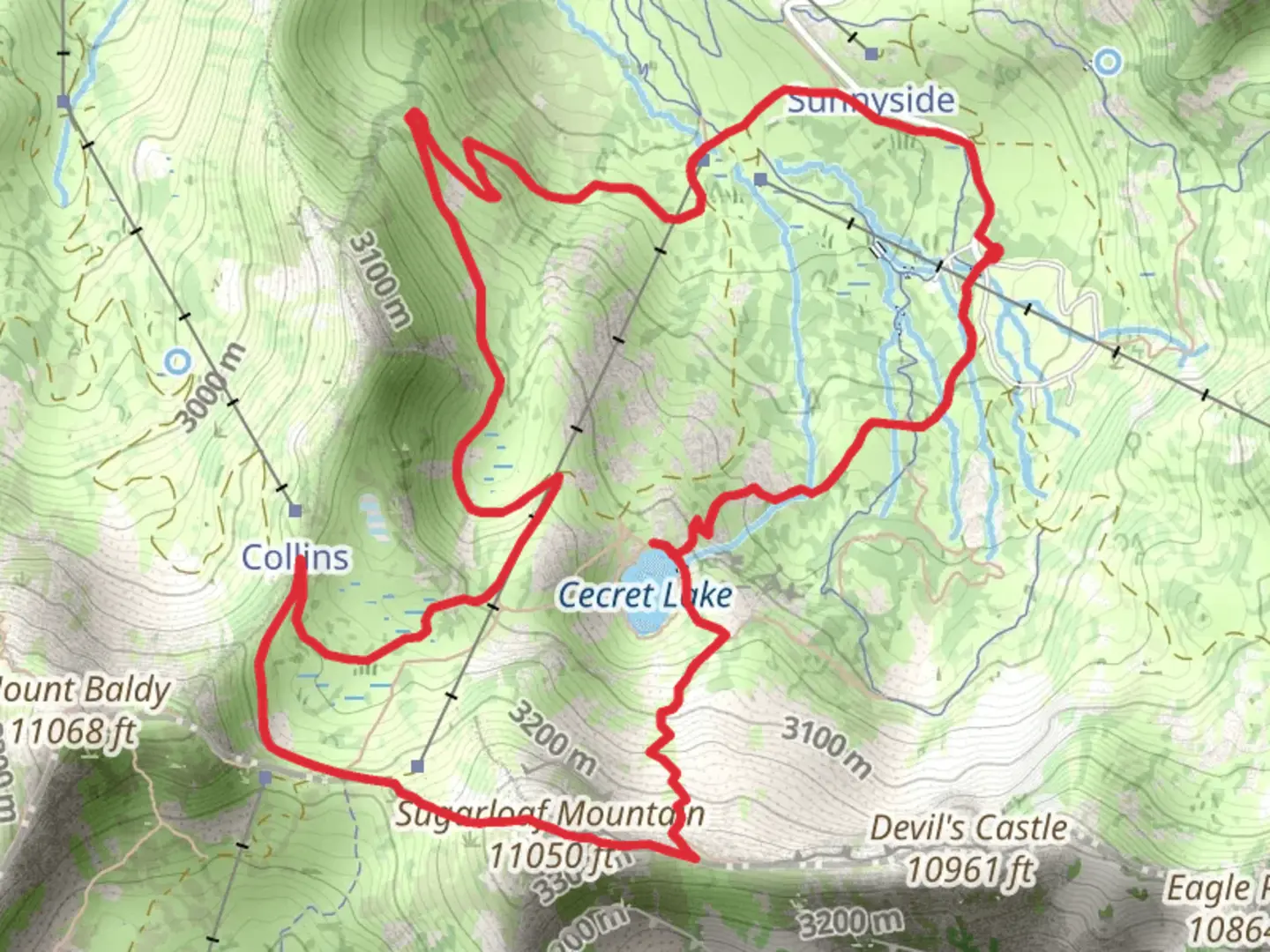
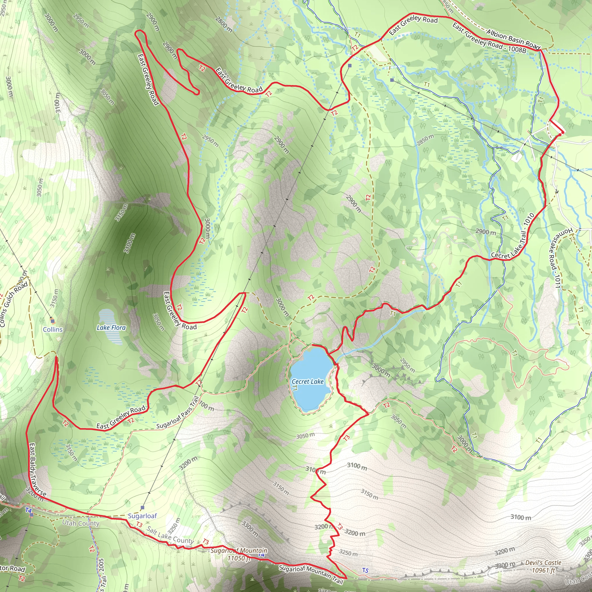
Starting your adventure near Salt Lake County, Utah, the trailhead for the Sugarloaf Mountain and Cecret Lake Trail is conveniently accessible by car or public transport. If you're driving, head towards the Albion Basin Campground, which is a well-known landmark and offers ample parking. For those using public transport, you can take a bus to the Alta Ski Area and then walk a short distance to the trailhead.
The trail spans approximately 8 kilometers (around 5 miles) and features an elevation gain of about 600 meters (approximately 2,000 feet), making it a moderately challenging hike. The loop trail offers a variety of landscapes and experiences, from alpine meadows to rocky outcrops.
Initial Ascent and Cecret Lake
Starting from the trailhead, the first segment of the hike takes you through lush meadows filled with wildflowers during the summer months. After about 1.5 kilometers (roughly 1 mile), you'll reach Cecret Lake, a stunning alpine lake that sits at an elevation of around 2,750 meters (9,022 feet). This is a great spot to take a break, enjoy the scenery, and perhaps spot some local wildlife, including marmots and various bird species.
Climbing Sugarloaf Mountain
From Cecret Lake, the trail becomes steeper as you begin your ascent of Sugarloaf Mountain. The climb is rocky and requires careful footing, but the panoramic views make it worthwhile. After another 2 kilometers (1.2 miles) and an elevation gain of about 300 meters (1,000 feet), you'll reach the summit of Sugarloaf Mountain. At an elevation of approximately 3,500 meters (11,482 feet), the summit offers breathtaking views of the surrounding Wasatch Range and the Great Salt Lake in the distance.
Descent and Return Loop
The descent from Sugarloaf Mountain is equally scenic, taking you through rocky terrain and alpine meadows. As you make your way back towards the trailhead, you'll pass through areas rich in geological history. The Wasatch Range is known for its ancient rock formations, some of which date back over 250 million years. This region was also historically significant for the Native American tribes who once inhabited the area, and later for the miners during the silver rush in the late 19th century.
Navigation and Safety
Given the varied terrain and elevation changes, it's advisable to use a reliable navigation tool like HiiKER to keep track of your progress and ensure you stay on the correct path. The trail is well-marked, but weather conditions can change rapidly, especially at higher elevations, so be prepared with appropriate gear.
Flora and Fauna
Throughout the hike, you'll encounter a diverse range of flora and fauna. The lower elevations are home to dense forests of aspen and pine, while the higher elevations feature alpine tundra and wildflowers such as Indian paintbrush and columbine. Wildlife is abundant, with chances to see mule deer, mountain goats, and a variety of bird species, including golden eagles and peregrine falcons.
Getting There
To reach the trailhead, drive towards the Albion Basin Campground near the Alta Ski Area. If using public transport, take a bus to the Alta Ski Area and walk a short distance to the trailhead. The area is well-signposted, making it easy to find your starting point.
This trail offers a mix of natural beauty, challenging terrain, and historical significance, making it a rewarding experience for hikers of all levels.
What to expect?
Activity types
Comments and Reviews
User comments, reviews and discussions about the Sugerloaf Mountain and Cecret Lake Trail, Utah.
4.41
average rating out of 5
17 rating(s)
