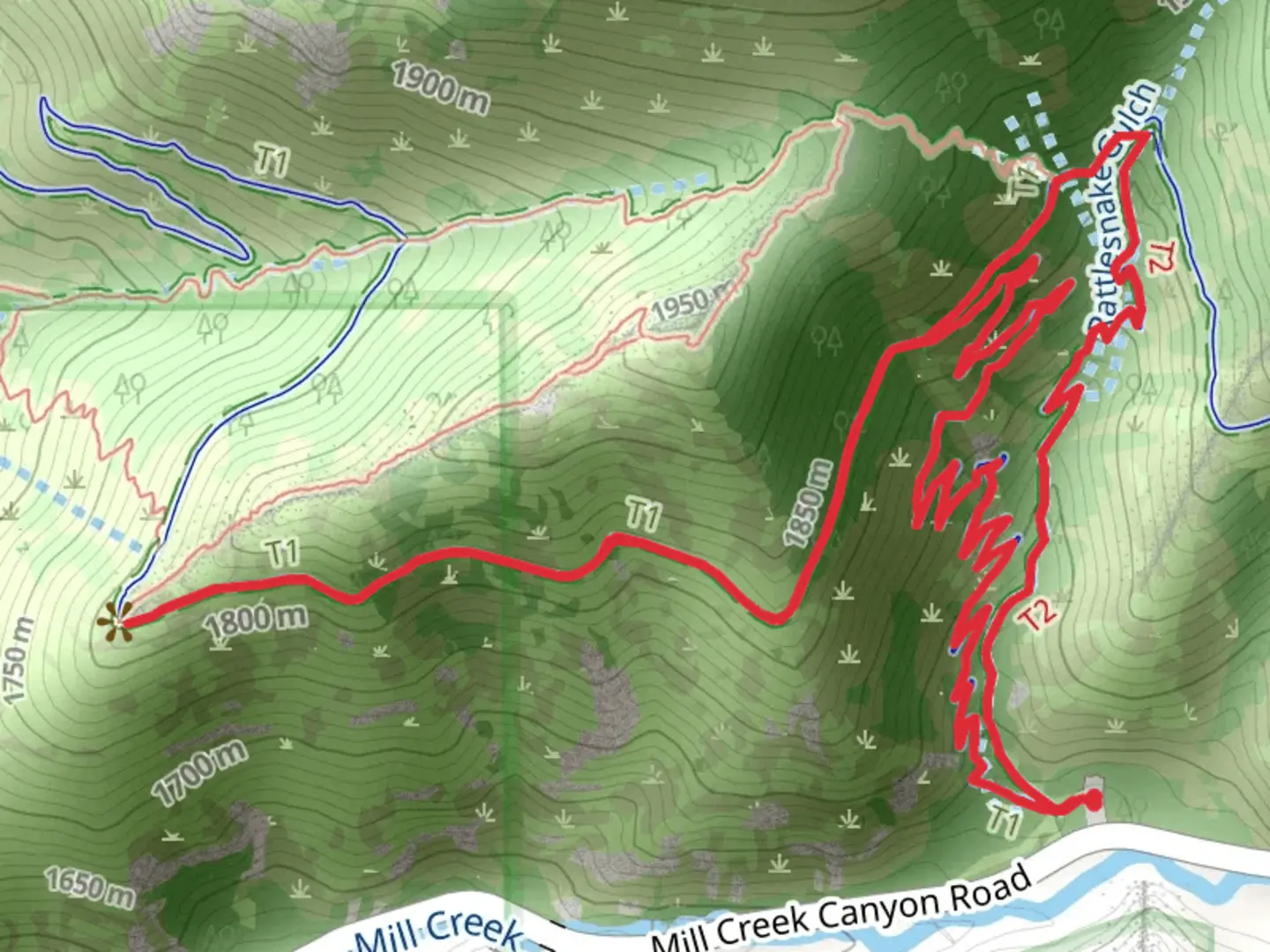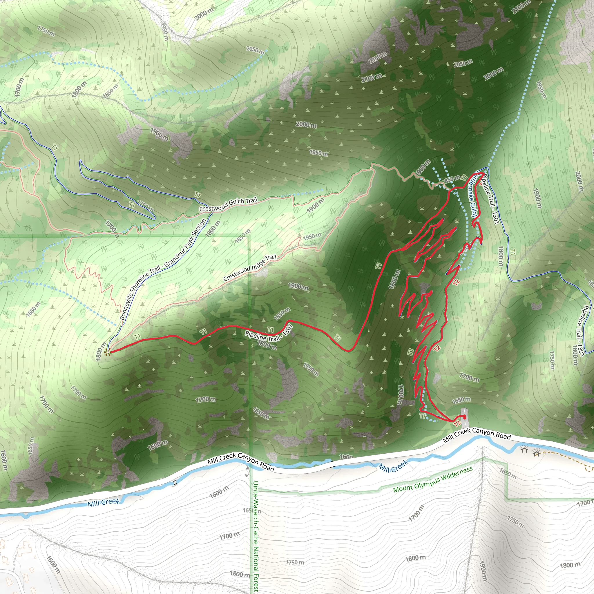
Rattlesnake Gulch trail, Pipeline Trail and Bonneville Shoreline Trail
Download
Preview
Add to list
More
6.2 km
~1 hrs 50 min
366 m
Loop
“Explore a scenic 6-km loop featuring panoramic views, historical trails, and diverse wildlife near Salt Lake County.”
Starting your adventure near Salt Lake County, Utah, the trailhead for this loop can be accessed conveniently by car or public transport. If driving, head towards the Rattlesnake Gulch Trailhead, located near the intersection of Wasatch Boulevard and 3800 South. For those using public transport, the Utah Transit Authority (UTA) offers bus services that can drop you off within a short walking distance of the trailhead.
Trail Overview
The Rattlesnake Gulch, Pipeline, and Bonneville Shoreline Trail loop spans approximately 6 km (3.7 miles) with an elevation gain of around 300 meters (984 feet). This medium-difficulty trail offers a mix of scenic views, historical landmarks, and diverse wildlife, making it a rewarding experience for hikers of various skill levels.
Key Sections and Landmarks
#### Rattlesnake Gulch Trail
Starting from the trailhead, the Rattlesnake Gulch Trail ascends gradually through a series of switchbacks. After about 1.5 km (0.9 miles), you'll reach the first significant viewpoint, offering panoramic views of the Salt Lake Valley. This section of the trail is known for its rocky terrain and occasional sightings of rattlesnakes, so be cautious and stay on the marked path.
#### Pipeline Trail
At approximately 2 km (1.2 miles) into your hike, you'll intersect with the Pipeline Trail. This segment is relatively flat and follows the old pipeline route that once supplied water to the city. The trail here is well-maintained and offers a more relaxed pace, allowing you to enjoy the surrounding flora, including sagebrush and wildflowers in the spring and summer months.
#### Bonneville Shoreline Trail
Around the 4 km (2.5 miles) mark, you'll transition onto the Bonneville Shoreline Trail. This historic trail traces the ancient shoreline of Lake Bonneville, a prehistoric lake that once covered much of Utah. The elevation gain here is moderate, and the trail offers stunning views of the Wasatch Mountains to the east and the Salt Lake Valley to the west. Keep an eye out for interpretive signs that provide insights into the geological history of the area.
Wildlife and Nature
The trail is home to a variety of wildlife, including mule deer, red foxes, and numerous bird species such as hawks and eagles. The diverse plant life ranges from scrub oak and juniper to vibrant wildflowers, depending on the season. Always carry a map and use the HiiKER app for real-time navigation and updates on trail conditions.
Preparation and Safety
Given the medium difficulty rating, it's essential to come prepared. Wear sturdy hiking boots, bring plenty of water, and pack snacks or a light meal. Weather can change rapidly in this region, so dressing in layers and carrying a rain jacket is advisable. The trail can be rocky and uneven in places, so trekking poles might be beneficial for added stability.
Getting There
For those driving, ample parking is available near the trailhead at the intersection of Wasatch Boulevard and 3800 South. If using public transport, the UTA bus routes can get you close to the trailhead, with a short walk required to reach the starting point. Always check the latest bus schedules and routes on the UTA website or app before heading out.
Embark on this loop trail to experience a blend of natural beauty, historical significance, and a moderate physical challenge, all within a short distance from Salt Lake County.
What to expect?
Activity types
Comments and Reviews
User comments, reviews and discussions about the Rattlesnake Gulch trail, Pipeline Trail and Bonneville Shoreline Trail, Utah.
4.43
average rating out of 5
14 rating(s)
