Download
Preview
Add to list
More
8.5 km
~3 hrs 17 min
954 m
Loop
“Embark on the Kesler Peak and Relsek Trail loop for breathtaking views and a rewarding challenge.”
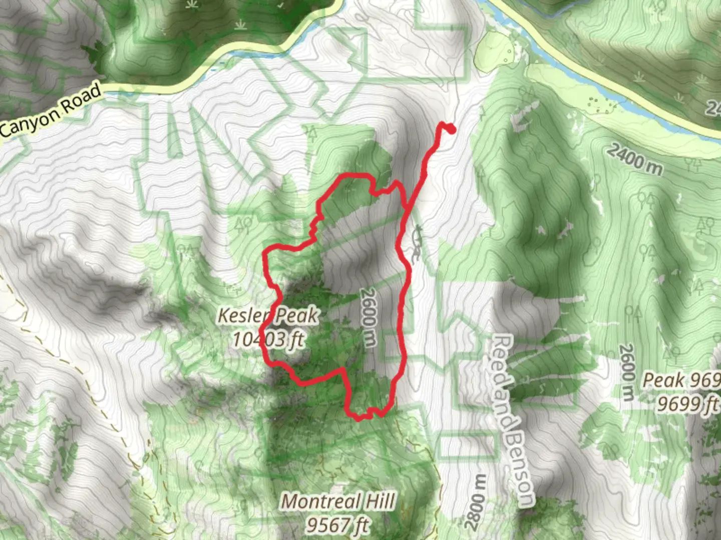
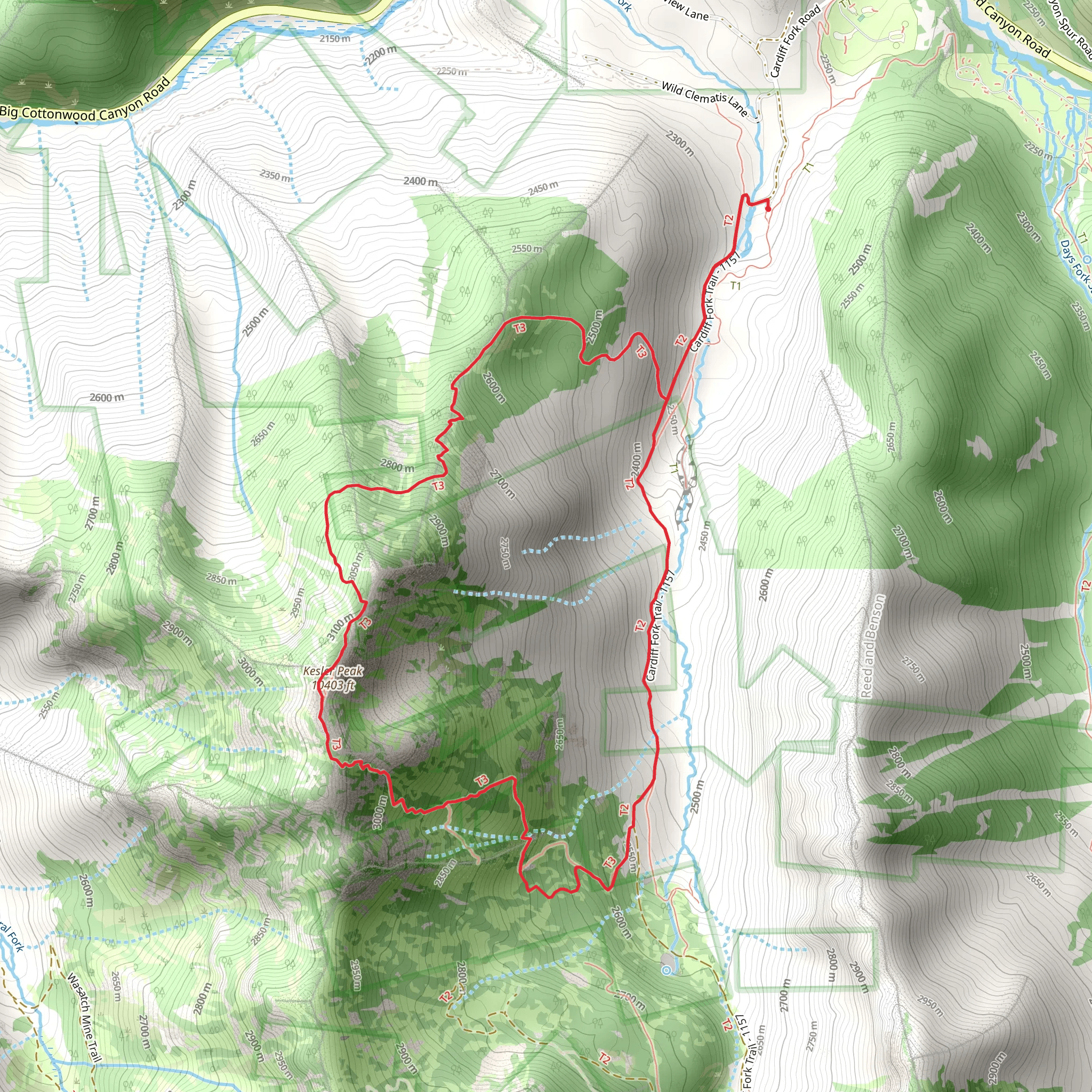
Starting your adventure near Salt Lake County, Utah, the Kesler Peak Trail and Relsek Trail offer a captivating loop hike that spans approximately 9 km (5.6 miles) with an elevation gain of around 900 meters (2,950 feet). This medium-difficulty trail promises a rewarding experience for those prepared to tackle its challenges.
Getting There To reach the trailhead, head towards the Big Cottonwood Canyon area. If you're driving, you can park near the Mill D North Fork Trailhead, which is a well-known starting point for several hikes in the region. For those relying on public transport, the Utah Transit Authority (UTA) offers bus services that can get you close to the canyon entrance, but you may need to arrange a taxi or rideshare for the final stretch to the trailhead.
Trail Navigation Using HiiKER for navigation is highly recommended, as the trail can be tricky in some sections. The loop begins with a steady ascent, and you'll want to keep an eye on your map to ensure you stay on course, especially at junctions where other trails intersect.
The Ascent The initial part of the hike takes you through dense forest, where you'll be surrounded by towering pines and the occasional aspen grove. About 2 km (1.2 miles) in, you'll start to notice the trail becoming steeper. This is where the elevation gain begins to make itself known. As you climb, the forest opens up, offering glimpses of the surrounding peaks and valleys.
Midway Point and Kesler Peak At approximately 4 km (2.5 miles), you'll reach the midway point and the summit of Kesler Peak. Here, the elevation gain is most pronounced, and you'll be rewarded with panoramic views of the Wasatch Range. This is a great spot to take a break, hydrate, and enjoy the scenery. On clear days, you can see as far as the Great Salt Lake.
Descent and Relsek Trail The descent begins as you transition onto the Relsek Trail. This part of the loop is less steep but requires careful footing, especially if the ground is wet or icy. The trail meanders through alpine meadows, where wildflowers bloom in the spring and summer months. Keep an eye out for local wildlife, including mule deer and various bird species.
Historical Significance The region around Kesler Peak has a rich history, with roots in both Native American heritage and early pioneer exploration. The area was once traversed by the Ute tribes, and later, it became a route for settlers moving westward. Remnants of old mining operations can occasionally be spotted off the trail, offering a glimpse into the area's past.
Final Stretch As you approach the final 2 km (1.2 miles) of the loop, the trail re-enters the forest, providing a shaded and serene end to your hike. The descent here is more gradual, allowing you to reflect on the journey as you make your way back to the trailhead.
Preparation Tips Given the elevation gain and varying terrain, it's essential to wear sturdy hiking boots and bring plenty of water. Weather can change rapidly in the mountains, so pack layers and be prepared for sudden shifts in temperature. Using HiiKER will help you stay on track and provide real-time updates on trail conditions.
Embarking on the Kesler Peak Trail and Relsek Trail loop is a fulfilling endeavor, offering both physical challenge and natural beauty. Whether you're a seasoned hiker or looking to push your limits, this trail provides an unforgettable experience in the heart of Utah's wilderness.
What to expect?
Activity types
Comments and Reviews
User comments, reviews and discussions about the Kesler Peak Trail and Relsek Trail, Utah.
4.22
average rating out of 5
9 rating(s)
