Download
Preview
Add to list
More
9.9 km
~3 hrs 5 min
670 m
Out and Back
“Discover the invigorating 10-kilometer Catherine's Pass Trail, offering scenic views, moderate challenge, and historical intrigue.”
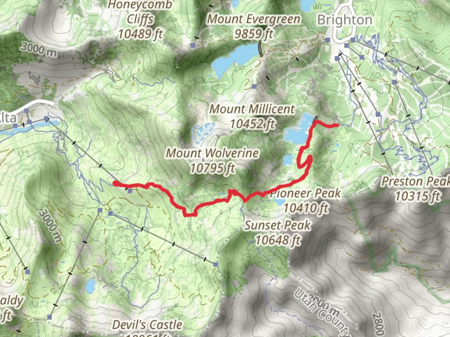
Starting near Salt Lake County, Utah, the Catherine's Pass Trail is an invigorating out-and-back hike that spans approximately 10 kilometers (6.2 miles) with an elevation gain of around 600 meters (1,968 feet). This trail is rated as medium difficulty, making it suitable for moderately experienced hikers.### Getting There To reach the trailhead, you can drive or use public transportation. If driving, head towards the Brighton Ski Resort area, which is a well-known landmark. The trailhead is located near the resort, and ample parking is available. For those using public transport, you can take a bus to the Brighton Ski Resort from Salt Lake City. The nearest bus stop is at the resort itself, making it convenient for hikers to start their journey.### Trail Overview The trail begins with a gentle ascent through a lush forest of aspen and pine trees. The initial 1.5 kilometers (0.9 miles) are relatively easy, with a gradual elevation gain of about 100 meters (328 feet). This section is perfect for warming up your legs and getting accustomed to the terrain.### Mid-Trail Highlights As you continue, the trail becomes steeper, and you'll encounter a series of switchbacks. Around the 3-kilometer (1.9-mile) mark, you'll reach a scenic overlook that offers breathtaking views of the surrounding mountains and valleys. This is a great spot to take a short break and hydrate.Continuing onward, the trail opens up into a meadow filled with wildflowers during the summer months. This section is relatively flat and stretches for about 1 kilometer (0.6 miles). Keep an eye out for local wildlife such as mule deer and various bird species that frequent the area.### Reaching Catherine's Pass The final push to Catherine's Pass is the most challenging part of the hike. The last 2 kilometers (1.2 miles) involve a steep ascent with an elevation gain of approximately 300 meters (984 feet). The trail here is rocky and can be slippery, so make sure to wear sturdy hiking boots and consider using trekking poles for added stability.Upon reaching Catherine's Pass, you'll be rewarded with panoramic views of the surrounding peaks, including Mount Tuscarora and Mount Wolverine. This vantage point is a perfect spot for photography and offers a sense of accomplishment for making it to the top.### Historical Significance The area around Catherine's Pass has a rich history, with roots tracing back to Native American tribes who used these trails for hunting and gathering. In the late 19th and early 20th centuries, the region saw an influx of miners searching for precious metals. Remnants of old mining equipment and cabins can still be found along some of the nearby trails, adding a historical dimension to your hike.### Navigation and Safety For navigation, it's highly recommended to use the HiiKER app, which provides detailed maps and real-time updates. The trail is well-marked, but having a reliable navigation tool ensures you stay on track, especially in areas where the path may be less defined.### Final Tips - Start early to avoid the midday heat and ensure you have enough daylight for the return trip. - Bring plenty of water, snacks, and a first-aid kit. - Weather can change rapidly in the mountains, so pack layers and be prepared for sudden shifts in temperature. - Always practice Leave No Trace principles to keep the trail pristine for future hikers.This hike offers a blend of natural beauty, moderate challenge, and historical intrigue, making it a rewarding experience for those who take it on.

What to expect?
Activity types
Comments and Reviews
User comments, reviews and discussions about the Catherine's Pass Trail, Utah.
4.57
average rating out of 5
28 rating(s)