Download
Preview
Add to list
More
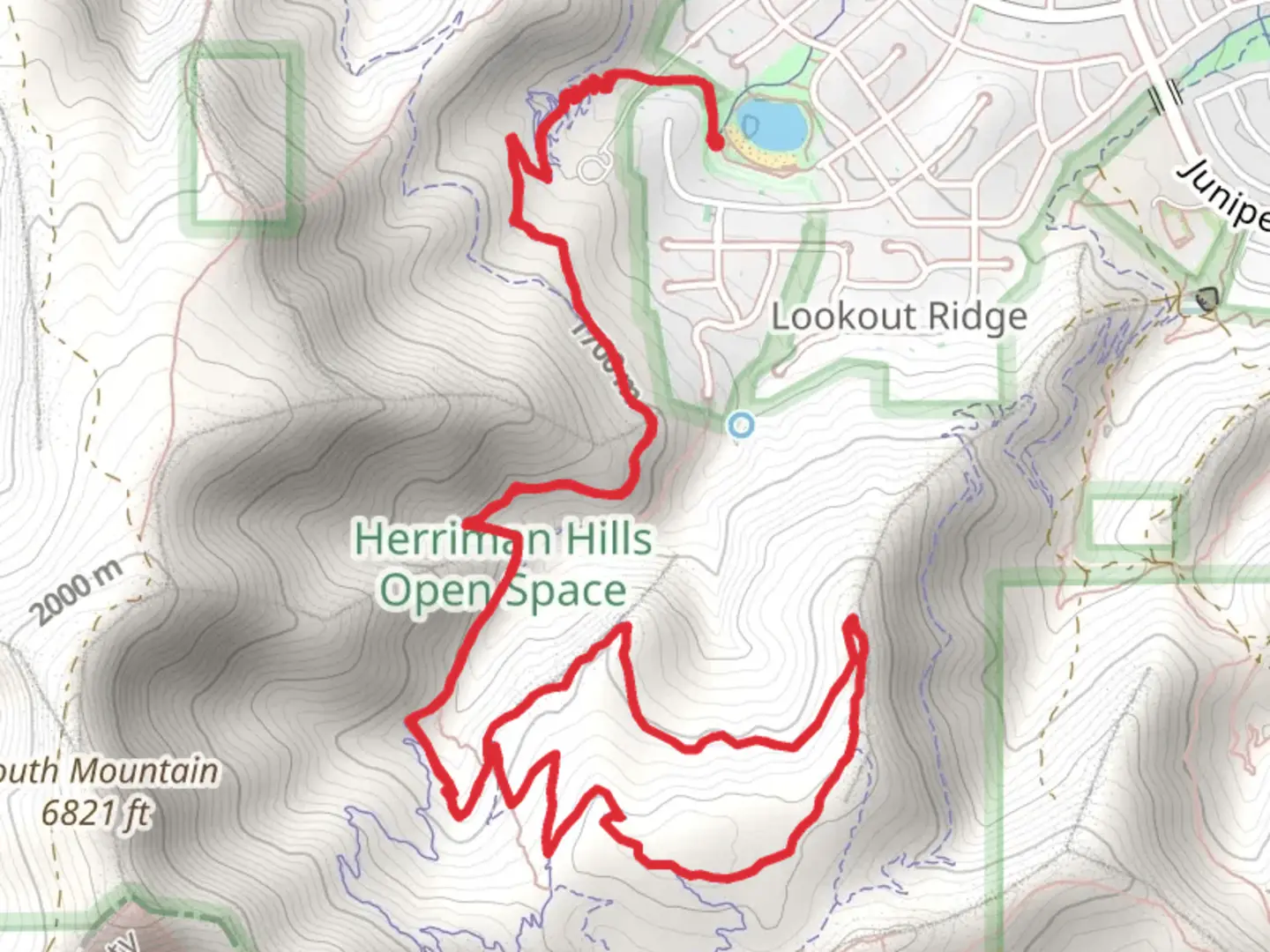
10.7 km
~2 hrs 59 min
509 m
Loop
“Explore the scenic 11 km Blackridge and Eric's Trail loop, rich in natural beauty, wildlife, and history.”
Starting near Salt Lake County, Utah, the Blackridge Trail and Eric's Trail form a scenic loop of approximately 11 kilometers (around 6.8 miles) with an elevation gain of about 500 meters (1,640 feet). This medium-difficulty trail offers a blend of natural beauty, wildlife, and historical significance, making it a rewarding experience for hikers.
Getting There To reach the trailhead, you can drive or use public transportation. If driving, head towards the Blackridge Reservoir, located at 15000 S Ashland Ridge Dr, Herriman, UT 84096. There is ample parking available near the reservoir. For those using public transport, take the UTA bus route 248 to the Herriman Main St @ 13000 S stop, and from there, it's a short walk to the trailhead.
Trail Overview The loop begins at the Blackridge Reservoir, a popular spot for locals to swim and relax. From here, the trail ascends gradually, offering panoramic views of the Salt Lake Valley. The first 2 kilometers (1.2 miles) involve a steady climb, gaining about 150 meters (492 feet) in elevation. This section is well-marked and relatively easy to navigate.
Key Landmarks and Nature As you continue, you'll encounter a variety of landscapes, from open meadows to dense forests. Around the 4-kilometer (2.5-mile) mark, you'll reach a viewpoint that offers stunning vistas of the Oquirrh Mountains. This is a great spot to take a break and enjoy the scenery.
The trail then transitions into Eric's Trail, which is known for its diverse flora and fauna. Keep an eye out for mule deer, red foxes, and a variety of bird species. The trail meanders through groves of aspen and pine trees, providing ample shade and a cool respite during the warmer months.
Historical Significance This region has a rich history, with remnants of early settler activity visible along the trail. Around the 7-kilometer (4.3-mile) mark, you'll come across an old mining site, a testament to the area's mining heritage. Informational plaques provide insights into the lives of the miners who once worked here.
Final Stretch The last 4 kilometers (2.5 miles) of the trail involve a descent back towards the reservoir. This section can be a bit steep, so take your time and watch your footing. The trail is well-maintained, but it's always a good idea to have a reliable navigation tool like HiiKER to ensure you stay on track.
Preparation Tips Given the elevation gain and varied terrain, it's advisable to wear sturdy hiking boots and bring plenty of water. The trail can be quite exposed in certain sections, so sun protection is essential. Weather can change rapidly in this region, so pack a light jacket or windbreaker.
Overall, the Blackridge Trail and Eric's Trail offer a well-rounded hiking experience with beautiful landscapes, wildlife, and a touch of history. Whether you're a seasoned hiker or a beginner looking for a challenge, this trail has something for everyone.

What to expect?
Activity types
Comments and Reviews
User comments, reviews and discussions about the Blackridge Trail and Eric's Trail, Utah.
4.73
average rating out of 5
11 rating(s)