Download
Preview
Add to list
More
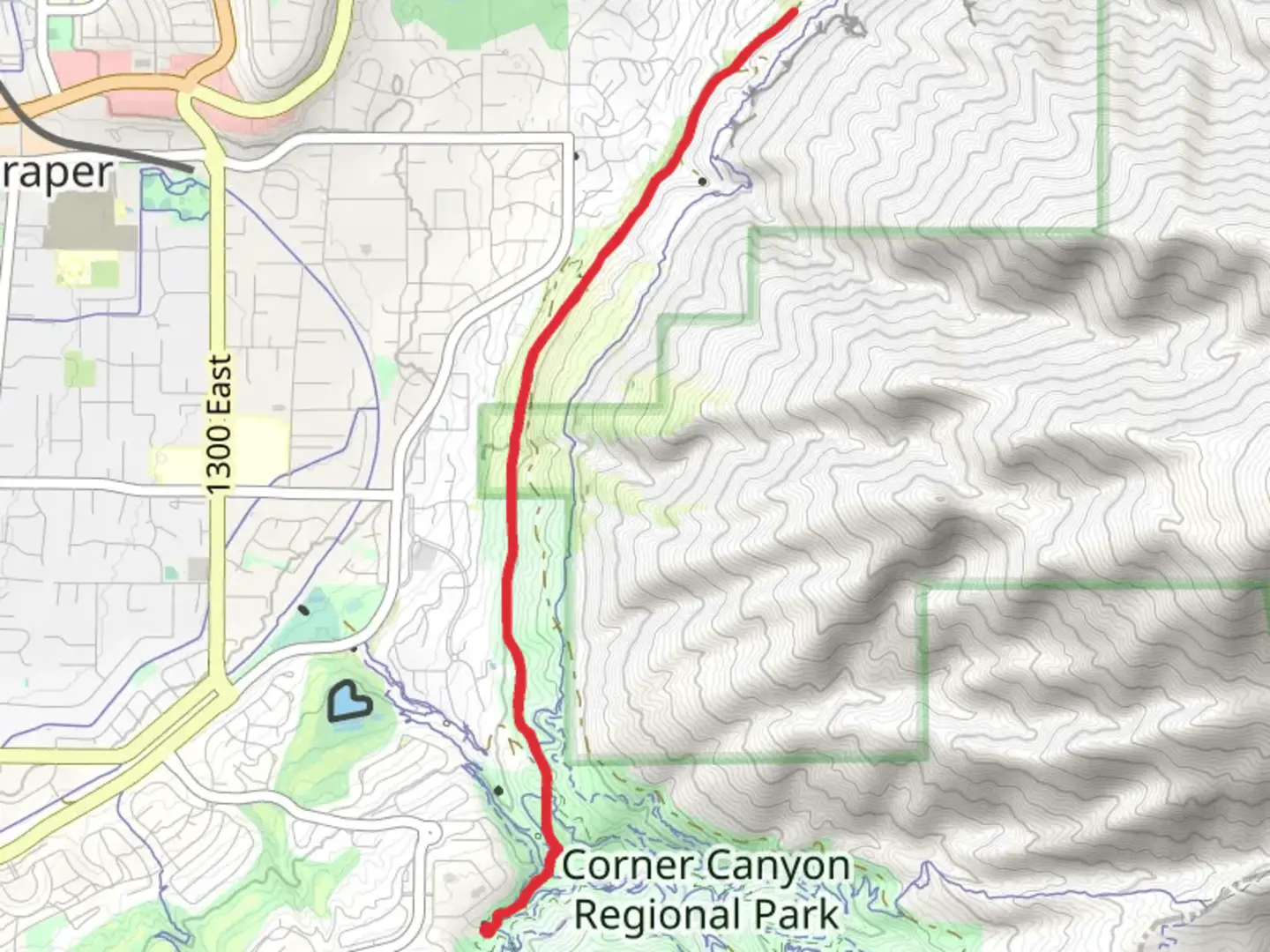
10.0 km
~2 hrs 26 min
264 m
Out and Back
“Discover the Aqueduct Trail: a 10 km hike through nature, history, and panoramic views near Salt Lake County.”
Starting near Salt Lake County, Utah, the Aqueduct Trail offers a moderately challenging hike with a total distance of around 10 km (6.2 miles) and an elevation gain of approximately 200 meters (656 feet). This out-and-back trail is perfect for those looking to enjoy a mix of natural beauty and historical significance.
Getting There To reach the trailhead, you can drive or use public transportation. If driving, head towards the nearest known address, which is the intersection of Wasatch Boulevard and Little Cottonwood Road. There is a parking area nearby where you can leave your car. For those using public transport, take a bus to the Wasatch Boulevard and Little Cottonwood Road stop, which is serviced by several local bus routes.
Trail Overview The trail begins with a gentle ascent, making it accessible for hikers of varying skill levels. As you start, you'll notice the well-maintained path that winds through a mix of open meadows and shaded forest areas. The initial 2 km (1.2 miles) are relatively easy, with a gradual elevation gain of about 50 meters (164 feet).
Significant Landmarks Around the 3 km (1.9 miles) mark, you'll come across the remnants of an old aqueduct, which gives the trail its name. This structure dates back to the early 20th century and was part of the water supply system for the surrounding communities. It's a great spot to take a break and snap some photos.
Nature and Wildlife As you continue, the trail becomes more challenging, with steeper sections and rocky terrain. Keep an eye out for local wildlife, including deer, rabbits, and various bird species. The flora is equally impressive, with wildflowers blooming in the spring and summer months, and vibrant foliage in the fall.
Midpoint and Turnaround At approximately 5 km (3.1 miles), you'll reach the highest point of the trail, offering panoramic views of the Salt Lake Valley and the surrounding mountains. This is a great place to rest and enjoy a snack before heading back. The elevation gain at this point is around 200 meters (656 feet), so be prepared for a bit of a workout.
Navigation and Safety For navigation, it's recommended to use the HiiKER app, which provides detailed maps and real-time updates. The trail is well-marked, but having a reliable navigation tool can enhance your hiking experience and ensure you stay on track.
Return Journey The return journey follows the same path, allowing you to enjoy the scenery from a different perspective. The descent is easier on the legs, but still requires caution, especially on the steeper sections.
Historical Significance The Aqueduct Trail not only offers natural beauty but also a glimpse into the region's history. The old aqueduct system is a testament to the engineering feats of the early 20th century and provides an interesting backdrop to your hike.
Whether you're a seasoned hiker or a beginner looking for a moderate challenge, the Aqueduct Trail near Salt Lake County, Utah, offers a rewarding experience with its mix of natural beauty, wildlife, and historical landmarks.

What to expect?
Activity types
Comments and Reviews
User comments, reviews and discussions about the Aqueduct Trail, Utah.
4.7
average rating out of 5
20 rating(s)