Download
Preview
Add to list
More
37.8 km
~1 day 3 hrs
843 m
Point-to-Point
“The Hayduke Trail, Buckskin Gulch, and Paria River route offers stunning landscapes and moderate challenges for seasoned hikers.”
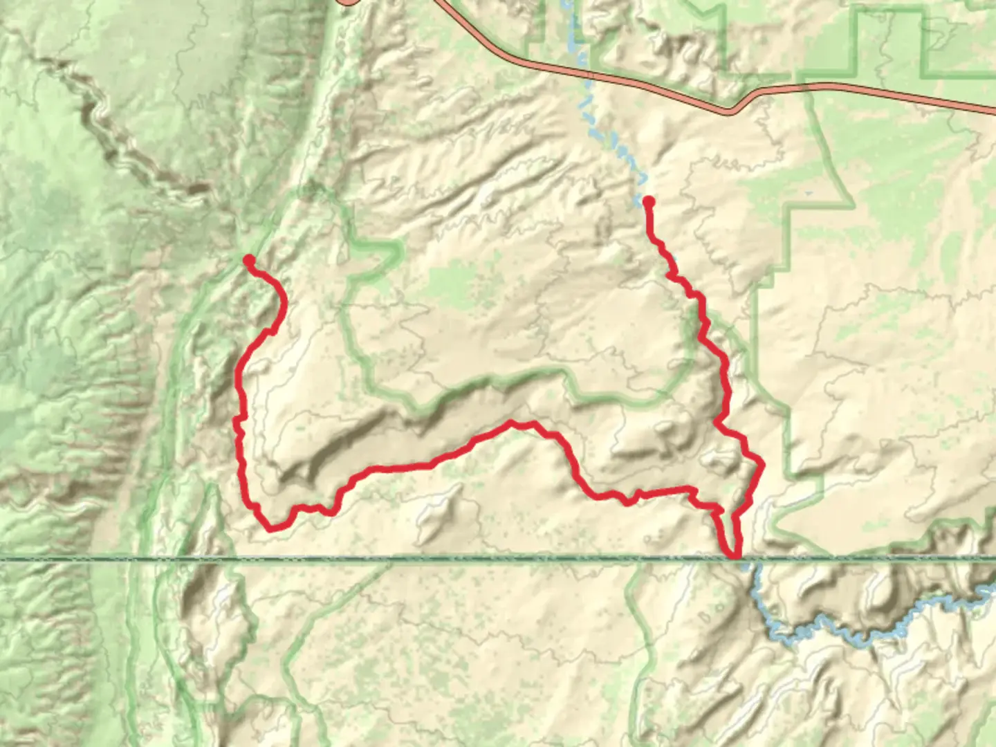
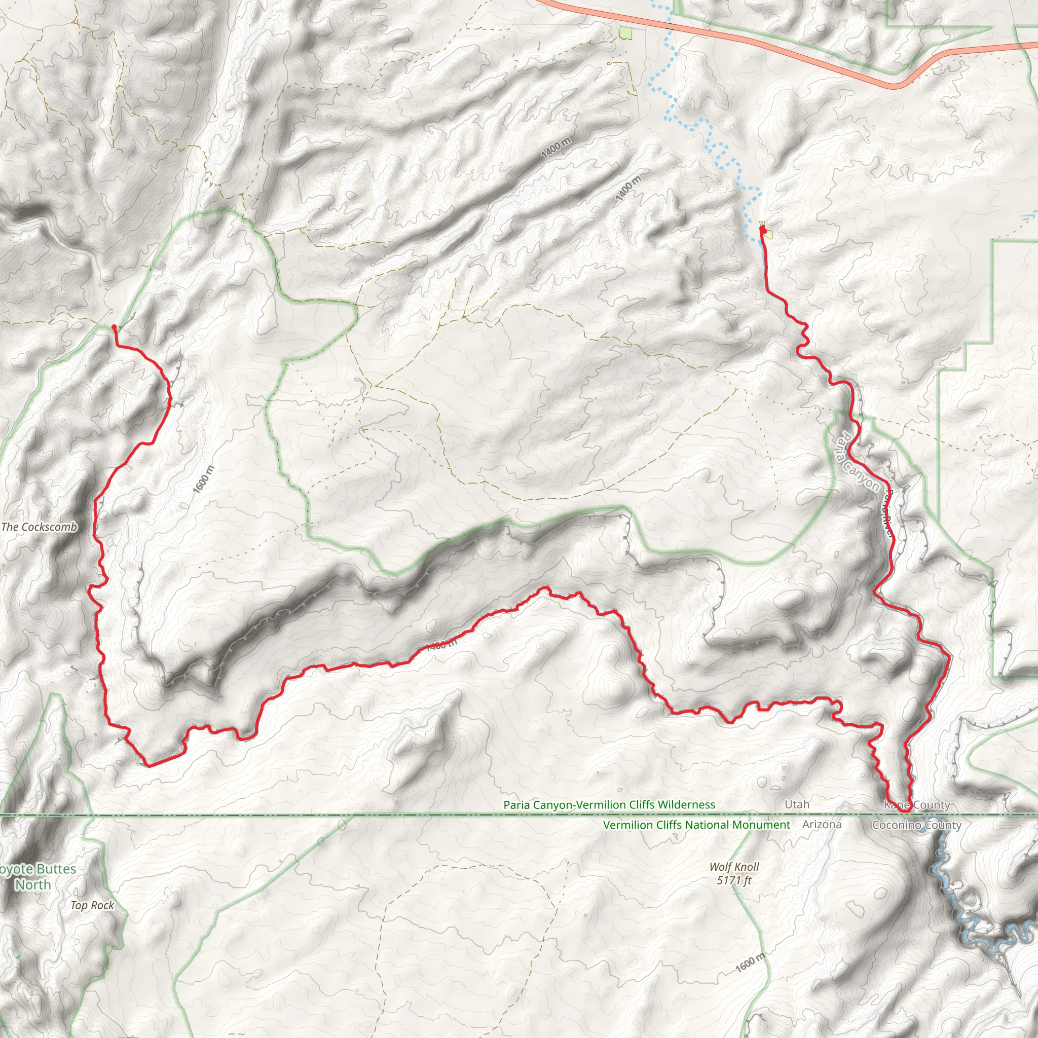
Starting near Kane County, Utah, the Hayduke Trail, Buckskin Gulch, and Paria River route spans approximately 38 kilometers (about 24 miles) with an elevation gain of around 800 meters (approximately 2,625 feet). This point-to-point trail is estimated to be of medium difficulty, making it suitable for moderately experienced hikers.
Getting There To reach the trailhead, you can drive to the Wire Pass Trailhead, which is the nearest significant landmark. If you're using public transport, the closest major city is Kanab, Utah. From Kanab, you can arrange a shuttle service or a taxi to the trailhead, which is about a 45-minute drive.
Trail Overview The trail begins at the Wire Pass Trailhead, leading you into the stunning Buckskin Gulch, one of the longest and deepest slot canyons in the world. The first few kilometers (miles) are relatively flat, allowing you to ease into the hike. As you progress, the canyon walls narrow dramatically, creating a surreal and otherworldly atmosphere. Be prepared for some scrambling and wading through water, especially after rain.
Buckskin Gulch Buckskin Gulch is renowned for its towering sandstone walls, which can reach heights of up to 150 meters (500 feet). The narrowest sections can be as tight as a meter (3 feet) across, requiring careful navigation. Keep an eye out for petroglyphs etched into the rock walls, remnants of the ancient Native American cultures that once inhabited this region.
Paria River After approximately 20 kilometers (12 miles) in Buckskin Gulch, you'll reach the confluence with the Paria River. This marks a significant transition in the landscape. The Paria River section is more open, with wider canyon walls and a more varied terrain. The river itself is shallow but can be muddy, so waterproof footwear is advisable.
Wildlife and Flora Throughout the hike, you'll encounter a diverse range of flora and fauna. Look for desert plants like sagebrush, juniper, and various cacti. Wildlife sightings may include mule deer, coyotes, and a variety of bird species such as hawks and eagles. Be cautious of rattlesnakes, especially in the warmer months.
Historical Significance The area is rich in history, with evidence of ancient Native American cultures, including the Anasazi and Paiute tribes. The petroglyphs and pictographs found along the trail offer a glimpse into the lives of these early inhabitants. Additionally, the Paria River was a significant route for early explorers and settlers in the American Southwest.
Navigation and Safety Given the complexity of the terrain, it's crucial to have reliable navigation tools. The HiiKER app is highly recommended for this trail, providing detailed maps and real-time updates. Always check the weather forecast before setting out, as flash floods can occur in the canyons, making them extremely dangerous.
Final Stretch The final stretch of the trail takes you through the Paria Canyon, gradually ascending to the White House Trailhead. This section offers breathtaking views of the surrounding cliffs and mesas, making for a memorable end to your hike. The total elevation gain of around 800 meters (2,625 feet) is spread throughout the trail, with some steeper sections in the latter half.
This trail offers a unique blend of natural beauty, historical significance, and challenging terrain, making it a must-do for any avid hiker.
What to expect?
Activity types
Comments and Reviews
User comments, reviews and discussions about the Hayduke Trail, Buckskin Gulch and Paria River, Utah.
4.5
average rating out of 5
18 rating(s)
