Download
Preview
Add to list
More
4.9 km
~1 hrs 38 min
401 m
Out and Back
“Experience breathtaking views and diverse wildlife on the moderate 5-km Agua Canyon Connector Trail in Bryce Canyon.”
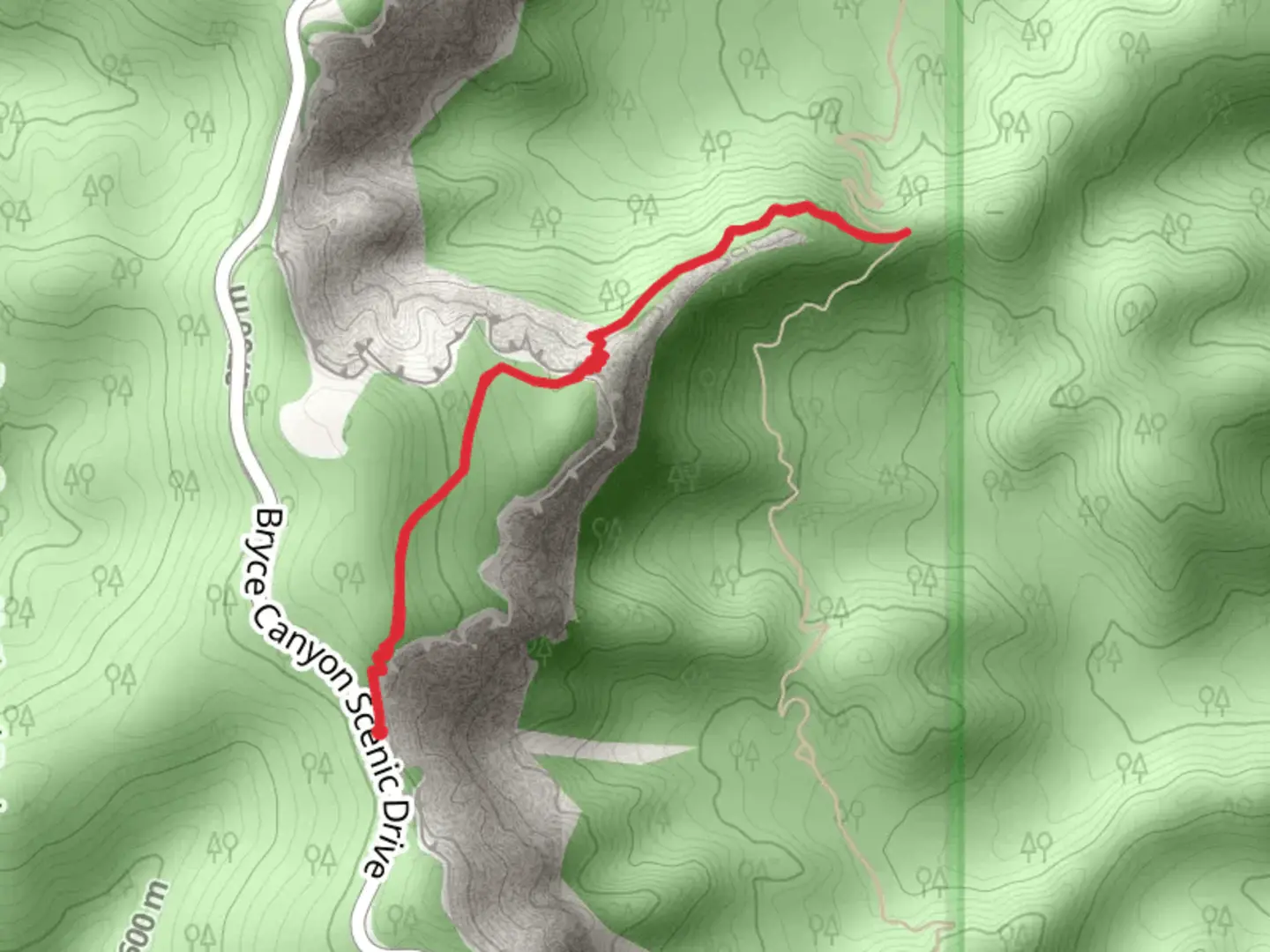
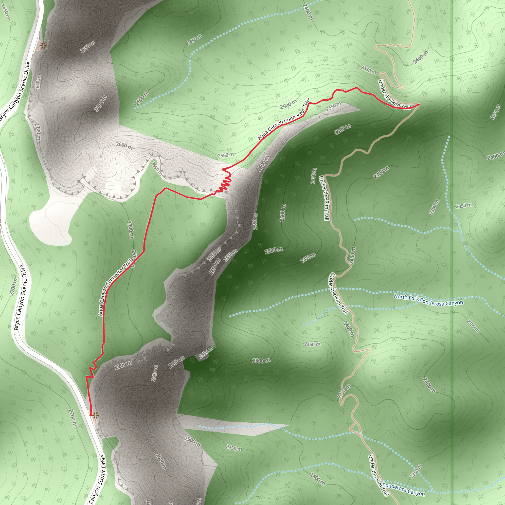
Starting near Kane County, Utah, the Agua Canyon Connector Trail is an invigorating out-and-back hike that spans approximately 5 kilometers (about 3.1 miles) with an elevation gain of around 400 meters (1,312 feet). This trail is nestled within the stunning Bryce Canyon National Park, offering hikers a medium difficulty level experience.
Getting There To reach the trailhead, you can drive or use public transportation. If you're driving, head towards Bryce Canyon National Park, and the nearest significant landmark is the Bryce Canyon Visitor Center. From there, follow the park's internal roads to the Agua Canyon viewpoint, where the trailhead is located. For those relying on public transport, shuttle services are available from nearby towns like Bryce and Tropic, which can drop you off at the Visitor Center. From the Visitor Center, you can catch a park shuttle to the Agua Canyon viewpoint.
Trail Overview The trail begins at the Agua Canyon viewpoint, offering immediate breathtaking views of the canyon's unique hoodoos and rock formations. As you start your hike, you'll descend slightly into the canyon, surrounded by towering limestone spires and vibrant red rock cliffs. The initial part of the trail is relatively gentle, making it accessible for most hikers.
Flora and Fauna As you progress, you'll notice a diverse range of flora, including Ponderosa pines, Douglas firs, and various shrubs that thrive in this high desert environment. Keep an eye out for wildlife such as mule deer, foxes, and a variety of bird species, including the Steller's jay and the peregrine falcon. The trail is particularly beautiful in the spring and early summer when wildflowers are in bloom.
Key Landmarks At approximately 1.5 kilometers (0.9 miles) into the hike, you'll come across a natural arch formation, a perfect spot for a short break and some photography. Continuing on, the trail gradually becomes steeper, with switchbacks that offer panoramic views of the canyon below. The elevation gain becomes more noticeable here, so take your time and enjoy the scenery.
Historical Significance Bryce Canyon National Park is rich in geological history, with rock formations dating back millions of years. The park was named after Ebenezer Bryce, a Mormon settler who homesteaded in the area in the late 19th century. The unique hoodoos and spires were formed through a combination of frost-wedging and the dissolving action of rainwater on the limestone, creating the surreal landscape you see today.
Navigation and Safety Given the trail's moderate difficulty, it's advisable to use a reliable navigation tool like HiiKER to keep track of your progress and ensure you stay on the correct path. The trail is well-marked, but having a digital map can be very helpful, especially if you decide to explore some of the connecting trails.
Final Stretch As you approach the 2.5-kilometer (1.55-mile) mark, the trail reaches its highest elevation point, offering a final, sweeping view of the canyon. This is a great spot to rest and take in the expansive vistas before turning back. The return journey follows the same path, allowing you to enjoy the scenery from a different perspective.
Remember to carry plenty of water, wear appropriate hiking shoes, and be prepared for changing weather conditions. Bryce Canyon's high elevation means temperatures can vary significantly, so layering your clothing is a good idea. Enjoy your hike on the Agua Canyon Connector Trail, a journey through one of Utah's most iconic landscapes.
What to expect?
Activity types
Comments and Reviews
User comments, reviews and discussions about the Agua Canyon Connector Trail, Utah.
4.0
average rating out of 5
1 rating(s)
