Download
Preview
Add to list
More
12.6 km
~3 hrs 43 min
725 m
Loop
“Embark on the Fairyland and Rim Loop Trail for mesmerizing vistas and unique geological wonders in Bryce Canyon.”
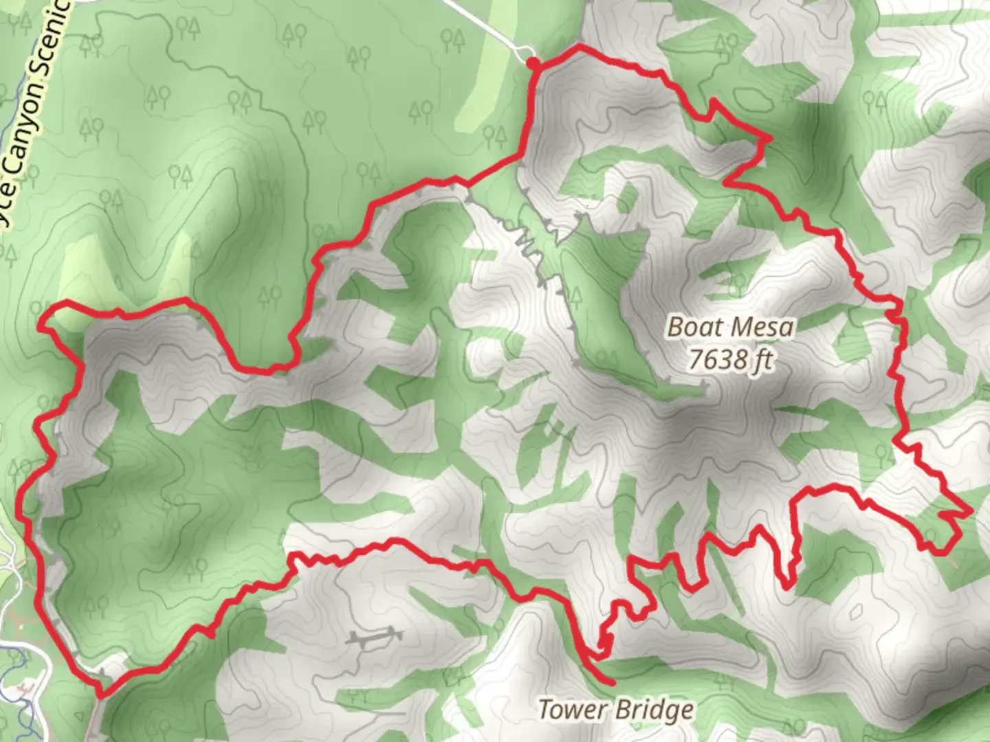
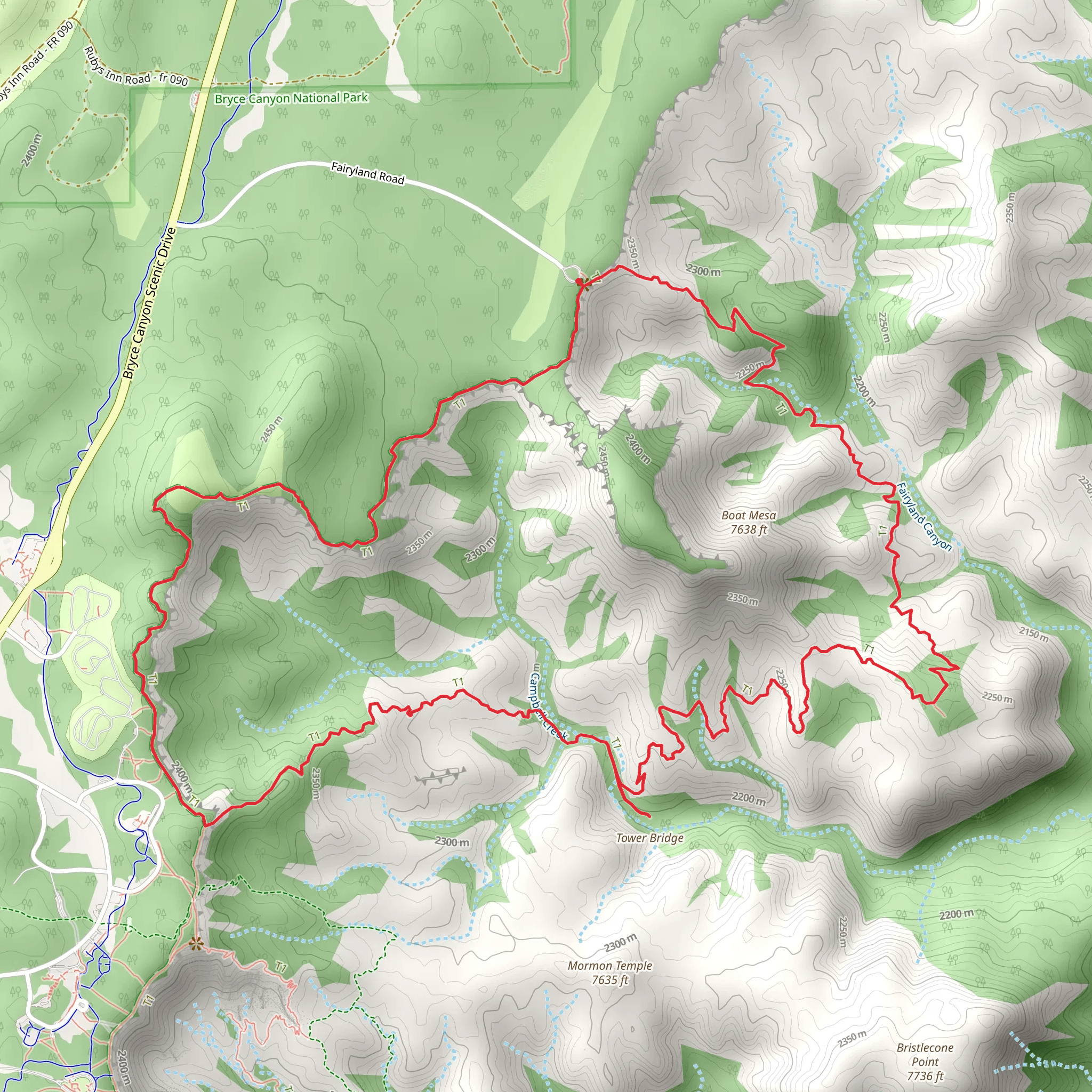
Starting your adventure near Garfield County, Utah, the Fairyland and Rim Loop Trail offers a captivating journey through Bryce Canyon National Park. This 13 km (8 miles) loop trail begins at the Fairyland Point parking area, easily accessible by car. For those relying on public transport, the Bryce Canyon Shuttle Service provides convenient access to the park, with stops at major trailheads including Fairyland Point.### Trail OverviewThe trail is rated as medium difficulty, with an elevation gain of approximately 700 meters (2,300 feet). As you embark on this loop, you'll be treated to a diverse array of geological formations, including hoodoos, spires, and natural bridges, all sculpted by millions of years of erosion.### Key Landmarks and Sections#### Fairyland Point to Tower BridgeStarting from Fairyland Point, the trail descends into the canyon, offering panoramic views of the Bryce Amphitheater. About 2.5 km (1.5 miles) in, you'll encounter the Tower Bridge, a natural rock formation resembling the famous London landmark. This section of the trail is relatively steep, so be prepared for a challenging descent and ascent.#### Tower Bridge to Fairyland CanyonContinuing from Tower Bridge, the trail meanders through Fairyland Canyon, a less crowded but equally stunning part of the park. This section is approximately 3 km (1.9 miles) long and features a variety of hoodoos and rock formations. Keep an eye out for the unique shapes and colors that make this area so enchanting.#### Fairyland Canyon to Rim TrailAfter exploring Fairyland Canyon, the trail ascends back towards the rim, gaining significant elevation over a 2 km (1.2 miles) stretch. This climb can be strenuous, so take your time and enjoy the breathtaking views. Once you reach the rim, you'll join the Rim Trail, which offers a more leisurely hike with minimal elevation change.#### Rim Trail to Fairyland PointThe final section of the loop follows the Rim Trail back to Fairyland Point, covering approximately 5.5 km (3.4 miles). This part of the trail provides expansive views of the canyon below and is a great opportunity to spot wildlife such as mule deer, prairie dogs, and various bird species. The Rim Trail is well-maintained and offers several viewpoints where you can rest and take in the scenery.### Historical SignificanceBryce Canyon National Park is named after Ebenezer Bryce, a Mormon settler who homesteaded in the area in the late 19th century. The park itself was established in 1928 and is renowned for its unique geological formations. The hoodoos, which are the park's most distinctive feature, were formed through a combination of frost-wedging and the dissolving action of rainwater on the limestone.### Navigation and SafetyFor navigation, the HiiKER app is highly recommended. It provides detailed maps and real-time GPS tracking, ensuring you stay on the right path. Always carry sufficient water, as the trail can be quite exposed and temperatures can vary significantly. Weather conditions can change rapidly, so be prepared for sudden rain or thunderstorms, especially during the summer months.### Getting ThereIf you're driving, head towards Bryce Canyon National Park via UT-12 and UT-63. The Fairyland Point parking area is well-signposted and offers ample parking. For those using public transport, the Bryce Canyon Shuttle Service operates from April to October and stops at Fairyland Point, making it a convenient option for hikers without a car.Embark on this trail with a sense of adventure and curiosity, and you'll be rewarded with some of the most spectacular landscapes Bryce Canyon has to offer.
What to expect?
Activity types
Comments and Reviews
User comments, reviews and discussions about the Fairyland and Rim Loop Trail, Utah.
4.61
average rating out of 5
23 rating(s)
