Download
Preview
Add to list
More
2.7 km
~45 min
138 m
Out and Back
“The Birdseye Trail in Garfield County, Utah, offers a rewarding hike with scenic views and historical landmarks.”
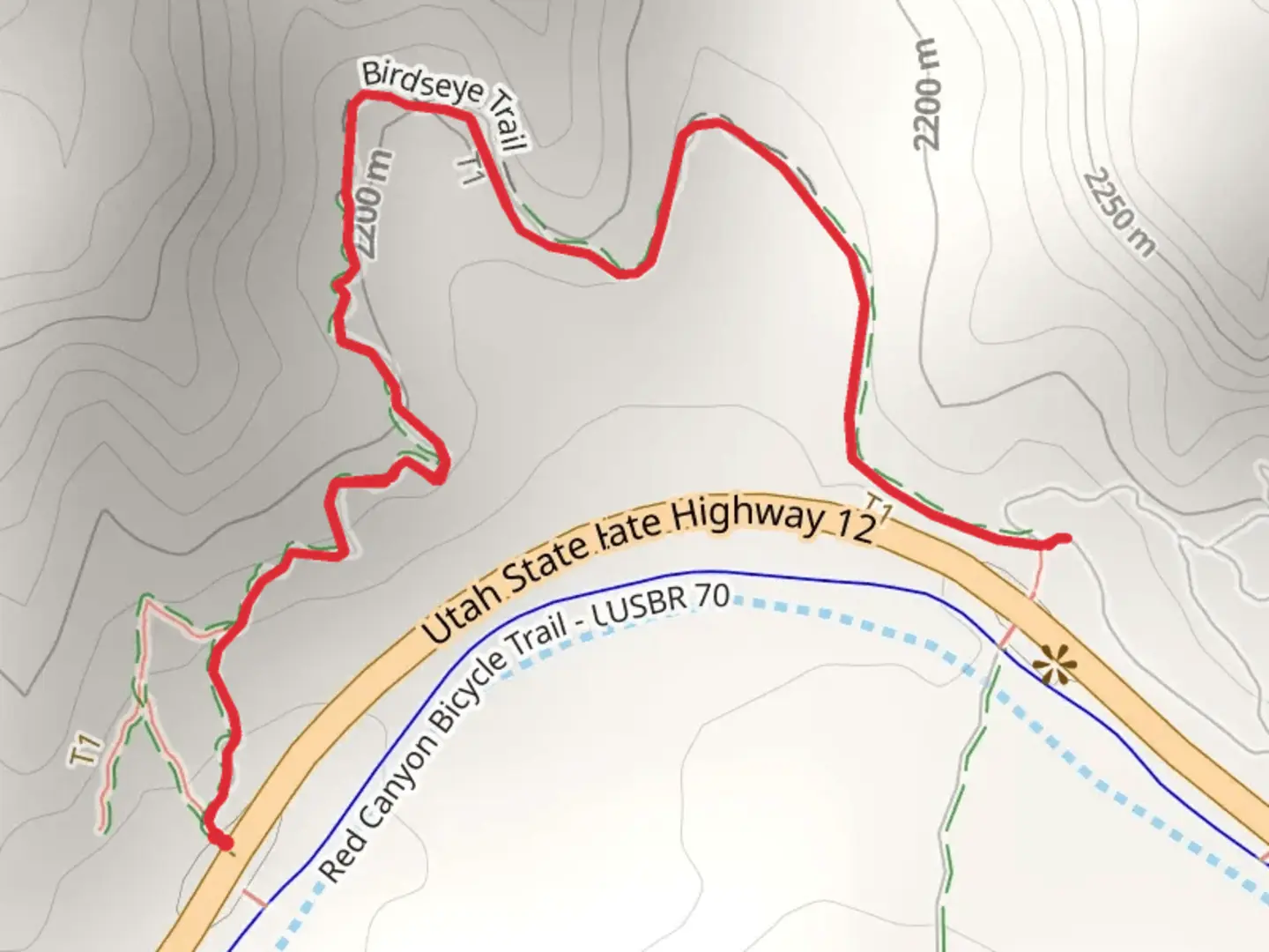
Starting near Garfield County, Utah, the Birdseye Trail is an engaging out-and-back hike that spans approximately 3 kilometers (1.86 miles) with an elevation gain of around 100 meters (328 feet). This trail is rated as medium difficulty, making it suitable for moderately experienced hikers.
Getting There
To reach the trailhead, you can drive or use public transport. If you're driving, head towards the town of Panguitch, Utah. From there, take US-89 South for about 10 miles until you reach the turnoff for the trailhead. For those using public transport, the nearest bus stop is in Panguitch, and from there, you may need to arrange a taxi or rideshare to the trailhead.
Trail Overview
The Birdseye Trail offers a variety of landscapes and natural features that make it a rewarding hike. Starting from the trailhead, the path initially winds through a dense forest of pinyon pines and junipers. The first 0.5 kilometers (0.3 miles) are relatively flat, allowing you to ease into the hike.
Significant Landmarks
#### Birdseye Rock
At approximately 1 kilometer (0.62 miles) into the hike, you'll encounter Birdseye Rock, a prominent geological formation that gives the trail its name. This rock offers a great spot for a short break and some photography. The rock's unique shape and the surrounding flora make it a picturesque landmark.
#### Scenic Overlook
Continuing on, the trail begins to ascend more steeply. Around the 2-kilometer (1.24 miles) mark, you'll reach a scenic overlook. This point offers panoramic views of the surrounding valleys and distant mountain ranges. The elevation gain to this point is about 70 meters (230 feet), and the effort is well worth the breathtaking vistas.
Flora and Fauna
The Birdseye Trail is home to a variety of plant and animal species. Keep an eye out for mule deer and wild turkeys, which are commonly seen along the trail. The area is also rich in birdlife, including hawks and eagles, making it a great spot for birdwatching.
Historical Significance
The region around Garfield County has a rich history, with evidence of Native American habitation dating back thousands of years. The trail itself passes through areas that were once used by indigenous tribes for hunting and gathering. Additionally, the nearby town of Panguitch has historical significance as a pioneer settlement, and its name means "big fish" in the Paiute language, reflecting the area's abundant natural resources.
Navigation
For navigation, it's recommended to use the HiiKER app, which provides detailed maps and real-time updates to ensure you stay on track. The trail is well-marked, but having a reliable navigation tool can enhance your hiking experience.
Final Stretch
The final stretch of the trail involves a gentle descent back to the trailhead, retracing your steps through the diverse landscapes you encountered on the way up. This section allows you to take in any sights you may have missed and offers a relaxing end to your hike.
Whether you're a seasoned hiker or someone looking to explore the natural beauty of Garfield County, the Birdseye Trail offers a fulfilling outdoor adventure with its mix of scenic views, historical context, and diverse wildlife.

What to expect?
Activity types
Comments and Reviews
User comments, reviews and discussions about the Birdseye Trail, Utah.
4.53
average rating out of 5
19 rating(s)