Download
Preview
Add to list
More
28.8 km
~1 day 2 hrs
1029 m
Out and Back
“Embark on a challenging 29 km journey through lush forests, alpine meadows, and historic landmarks to Clements Lake.”
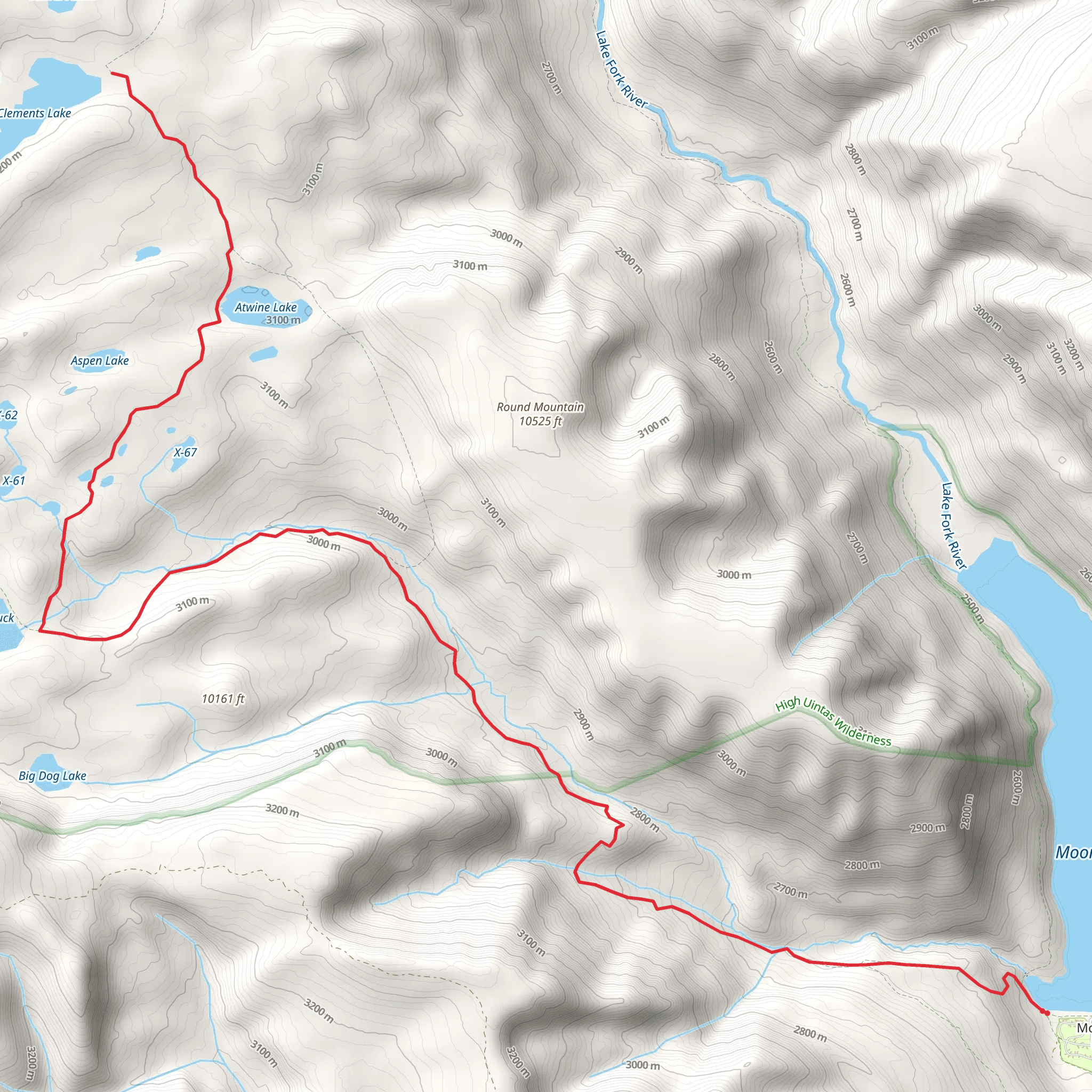
Starting your adventure near Duchesne County, Utah, the trailhead for Clements Lake via Pack Trail is accessible by car. From Duchesne, head east on US-40 E for about 30 miles (48 km) until you reach the turnoff for Forest Road 144. Follow this road for approximately 10 miles (16 km) to reach the trailhead. Public transport options are limited, so driving is the most reliable way to get there.
Trail Overview
The Clements Lake via Pack Trail is an out-and-back trail stretching around 29 km (18 miles) with an elevation gain of approximately 1000 meters (3280 feet). Rated as medium difficulty, this trail offers a mix of challenging ascents and rewarding descents, making it suitable for moderately experienced hikers.
Key Landmarks and Points of Interest
#### Mile 1-3 (0-5 km) The initial segment of the trail takes you through dense pine forests, offering a cool and shaded environment. Keep an eye out for mule deer and wild turkeys, which are commonly seen in this area. The trail gradually ascends, gaining about 200 meters (656 feet) in elevation over the first 5 km (3 miles).
#### Mile 4-6 (6-10 km) As you continue, the forest begins to thin out, and you’ll encounter several small streams. These are excellent spots to refill your water supply, but always use a water filter. The trail becomes steeper here, with an elevation gain of about 300 meters (984 feet) over the next 4 km (2.5 miles). You’ll also pass through meadows filled with wildflowers in the spring and summer months.
#### Mile 7-9 (11-14 km) Approaching the halfway point, you’ll reach a series of switchbacks that offer panoramic views of the surrounding Uinta Mountains. This section is particularly strenuous, with an elevation gain of 400 meters (1312 feet) over 3 km (1.8 miles). Take your time and enjoy the vistas; they are some of the most breathtaking on the trail.
Wildlife and Flora
The trail is home to a variety of wildlife, including black bears, elk, and numerous bird species. Always carry bear spray and make noise to avoid surprising any animals. The flora is equally diverse, with towering pines, aspens, and a variety of wildflowers depending on the season.
Historical Significance
The region around Duchesne County has a rich history, with evidence of Native American habitation dating back thousands of years. The Uinta Mountains were also explored by early trappers and settlers in the 19th century. As you hike, you may come across old cabins and remnants of mining operations, offering a glimpse into the area's past.
Navigation and Safety
Given the trail's length and elevation gain, it's crucial to be well-prepared. Use HiiKER for accurate trail maps and real-time updates. The trail is well-marked, but weather conditions can change rapidly, especially at higher elevations. Always check the weather forecast before you set out and be prepared for sudden changes.
Final Stretch to Clements Lake
The final 2 km (1.2 miles) to Clements Lake are relatively flat, allowing you to catch your breath and enjoy the serene environment. The lake itself is a pristine alpine gem, perfect for a refreshing dip or a quiet moment of reflection. The surrounding area is ideal for a picnic before you begin your return journey.
Return Journey
The return journey follows the same path, offering a different perspective on the landscapes you traversed earlier. The descent is generally easier, but take care on the steeper sections to avoid slipping.
This trail offers a comprehensive experience of Utah's natural beauty, from dense forests and alpine meadows to panoramic mountain views and historical landmarks.
What to expect?
Activity types
Comments and Reviews
User comments, reviews and discussions about the Clements Lake via Pack Trail, Utah.
4.5
average rating out of 5
6 rating(s)
