Download
Preview
Add to list
More
4.9 km
~1 hrs 49 min
511 m
Out and Back
“Discover the rewarding Delano Peak Trail's panoramic views, wildlife, and rich history in this 3.1-mile adventure.”
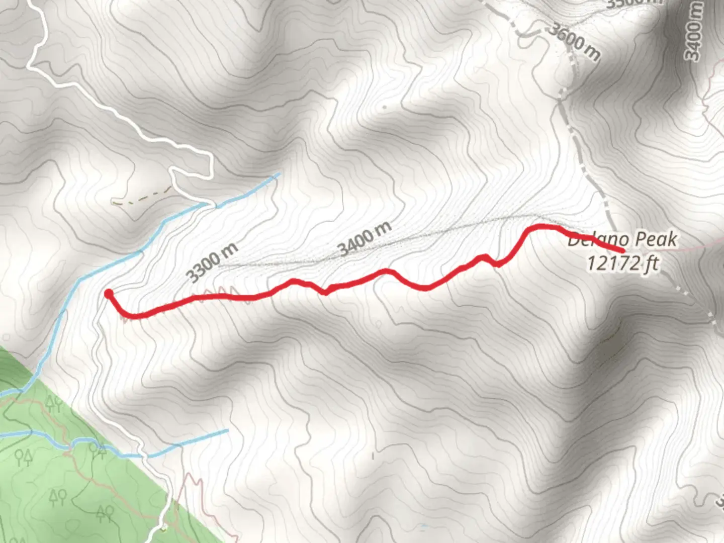
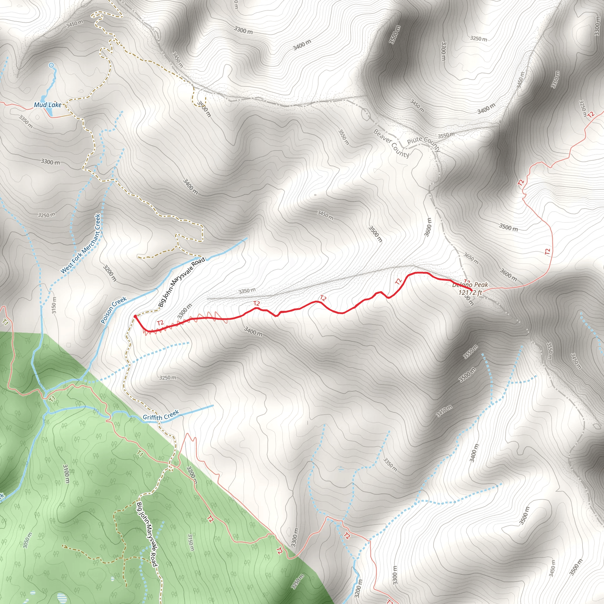
Starting your adventure near Beaver County, Utah, the Delano Peak Trail offers a rewarding hike with a distance of approximately 5 kilometers (around 3.1 miles) and an elevation gain of about 500 meters (1,640 feet). This out-and-back trail is rated as medium difficulty, making it suitable for moderately experienced hikers.
Getting There
To reach the trailhead, you can drive or use public transport. If driving, head towards Beaver County, Utah, and look for the trailhead near the well-known Eagle Point Resort. For those using public transport, the nearest significant town is Beaver, Utah. From Beaver, you can take a local taxi or rideshare service to the trailhead, which is approximately 20 miles (32 kilometers) away.
Trail Overview
The trail begins with a gradual ascent through a mixed forest of aspen and pine trees. Early on, you'll notice the crisp mountain air and the serene sounds of nature. The first kilometer (0.6 miles) is relatively gentle, gaining about 100 meters (328 feet) in elevation. This section is perfect for warming up your legs and getting into the rhythm of the hike.
Mid-Trail Highlights
As you continue, the trail becomes steeper, with the next 2 kilometers (1.2 miles) gaining an additional 300 meters (984 feet) in elevation. Here, the forest starts to thin out, offering stunning views of the Tushar Mountains. Keep an eye out for wildlife; mule deer and various bird species are commonly spotted in this area.
Reaching the Peak
The final stretch to Delano Peak is the most challenging, with the last kilometer (0.6 miles) gaining the remaining 100 meters (328 feet) in elevation. The terrain becomes rocky, and the trail narrows, requiring careful footing. Upon reaching the summit, you'll be rewarded with panoramic views of the surrounding landscape, including the Fishlake National Forest and the distant peaks of the Great Basin.
Historical Significance
The region around Delano Peak has a rich history. The Tushar Mountains were named after the Tushar Indians, a subgroup of the Ute tribe, who once inhabited the area. The mountains were also a significant site during the mining boom of the late 19th and early 20th centuries. Remnants of old mining operations can still be found scattered throughout the region, adding a historical layer to your hike.
Navigation and Safety
For navigation, it's highly recommended to use the HiiKER app, which provides detailed maps and real-time updates. The trail is well-marked, but weather conditions can change rapidly, so always check the forecast before heading out. Carry sufficient water, snacks, and a first-aid kit, and be prepared for sudden temperature drops, especially near the peak.
Flora and Fauna
The Delano Peak Trail is a haven for nature enthusiasts. In the lower sections, you'll encounter a variety of wildflowers during the spring and summer months. As you ascend, the flora transitions to hardy alpine plants. Wildlife is abundant, with sightings of marmots, pikas, and even the occasional black bear.
Final Tips
Start your hike early in the day to avoid afternoon thunderstorms, which are common in the summer. Wear sturdy hiking boots with good ankle support, and consider using trekking poles for the steeper sections. Always practice Leave No Trace principles to preserve the natural beauty of the trail for future hikers.
Embark on this journey well-prepared, and you'll find the Delano Peak Trail to be a memorable and enriching experience.
What to expect?
Activity types
Comments and Reviews
User comments, reviews and discussions about the Delano Peak Trail, Utah.
4.38
average rating out of 5
21 rating(s)
