Download
Preview
Add to list
More
46.7 km
~3 days
1673 m
Multi-Day
“Embark on a rugged 29-mile Big Bend loop, ascending Chisos Mountains and delving into desert history.”
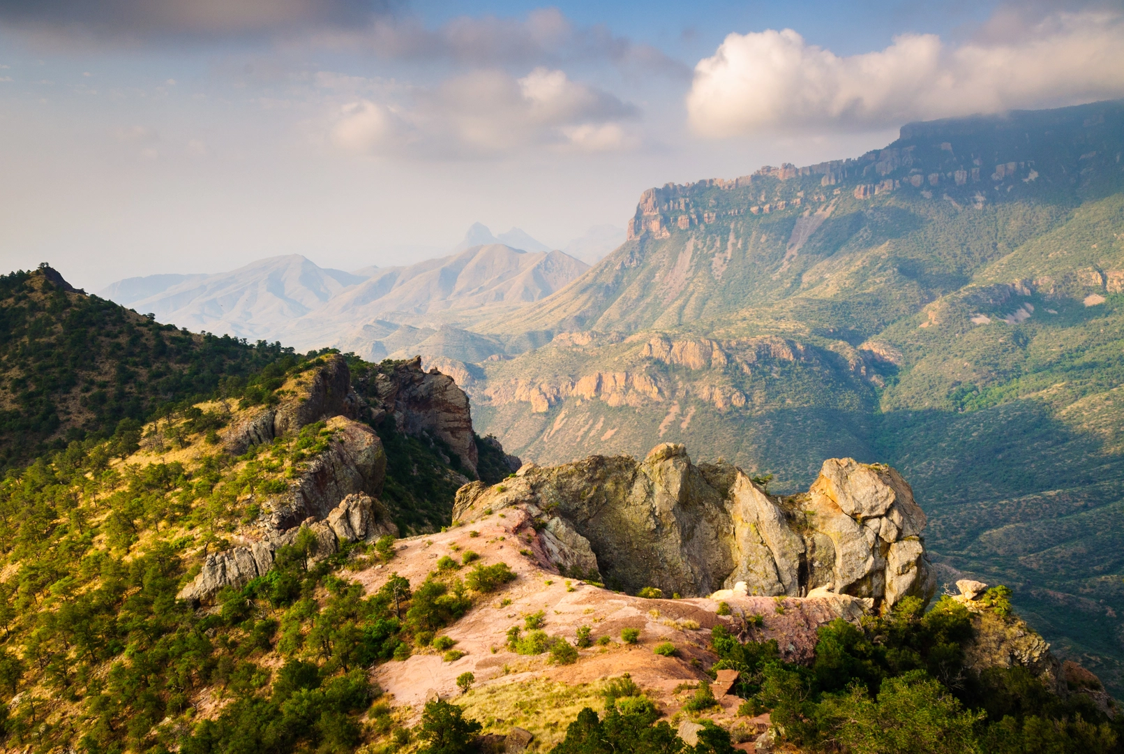
Embarking on the Big Bend National Park Loop, you'll traverse approximately 47 kilometers (29 miles) of diverse and rugged terrain, with an elevation gain of around 1600 meters (5250 feet). This challenging loop, rated as difficult, begins near Brewster County, Texas, and takes you through some of the most stunning landscapes the Chihuahuan Desert has to offer.### Getting to the TrailheadTo reach the trailhead, if you're driving, you'll want to head towards Big Bend National Park, located in West Texas. The closest significant landmark is Panther Junction Visitor Center, which is a good reference point for navigation. For those relying on public transport, options are limited due to the remote nature of the park. However, there are shuttle services from nearby towns like Alpine, TX, which is accessible by train or bus. From there, you can arrange for a shuttle or taxi service to take you to the park entrance.### The Journey BeginsStarting your hike, you'll be immediately immersed in the vast desert landscape, dotted with resilient flora such as creosote bushes, ocotillo, and various species of cacti. The initial stretch is relatively flat, allowing you to acclimate to the desert conditions as you make your way towards the Chisos Mountains.### Ascending the ChisosAs you approach the Chisos Basin, the trail begins to ascend more steeply. Here, you'll gain the majority of your elevation, and the views will become increasingly dramatic. The Chisos Mountains are an isolated mountain range, and as you climb, you'll notice the vegetation changing, with pinyon pines, junipers, and oaks providing some shade.### Landmarks and WildlifeOne of the most iconic landmarks you'll encounter is Emory Peak, the highest point in the park, which offers an optional detour for those looking to summit. The South Rim is another highlight, providing breathtaking vistas of the desert below. Keep an eye out for wildlife, including black bears, mountain lions, and a variety of bird species, such as the Colima warbler and peregrine falcon.### Historical SignificanceThe region is rich in history, with evidence of human habitation dating back thousands of years. The indigenous peoples of the area, including the Chisos and Apache, have left behind artifacts and pictographs. More recently, in the early 20th century, miners and ranchers tried to make a living in this harsh environment before it was designated a national park in 1944.### Navigating the TrailFor navigation, HiiKER is an excellent tool to use while on the trail. It will help you keep track of your progress and ensure you stay on the correct path, as some sections can be less clearly marked than others. Remember to download the maps beforehand, as cell service is unreliable in the park.### Preparing for the HikeDue to the trail's difficulty and remote nature, it's crucial to be well-prepared. Carry plenty of water—at least one gallon per person per day—as sources are scarce. Be mindful of the heat, especially in summer, and start your hike early to avoid the midday sun. Proper hiking boots, sun protection, and layers for temperature changes are also essential.### ConclusionThe Big Bend National Park Loop is a challenging but rewarding experience, offering a deep connection with the natural beauty and history of this unique desert landscape. With careful planning and respect for the environment, hikers will find this loop to be an unforgettable adventure.

What to expect?
Activity types
Comments and Reviews
User comments, reviews and discussions about the Big Bend National Park Loop, Texas.
4.25
average rating out of 5
4 rating(s)