Download
Preview
Add to list
More
2.5 km
~38 min
92 m
Loop
“Embark on the scenic Max Patch Loop Trail for breathtaking Appalachian vistas and rich natural history.”
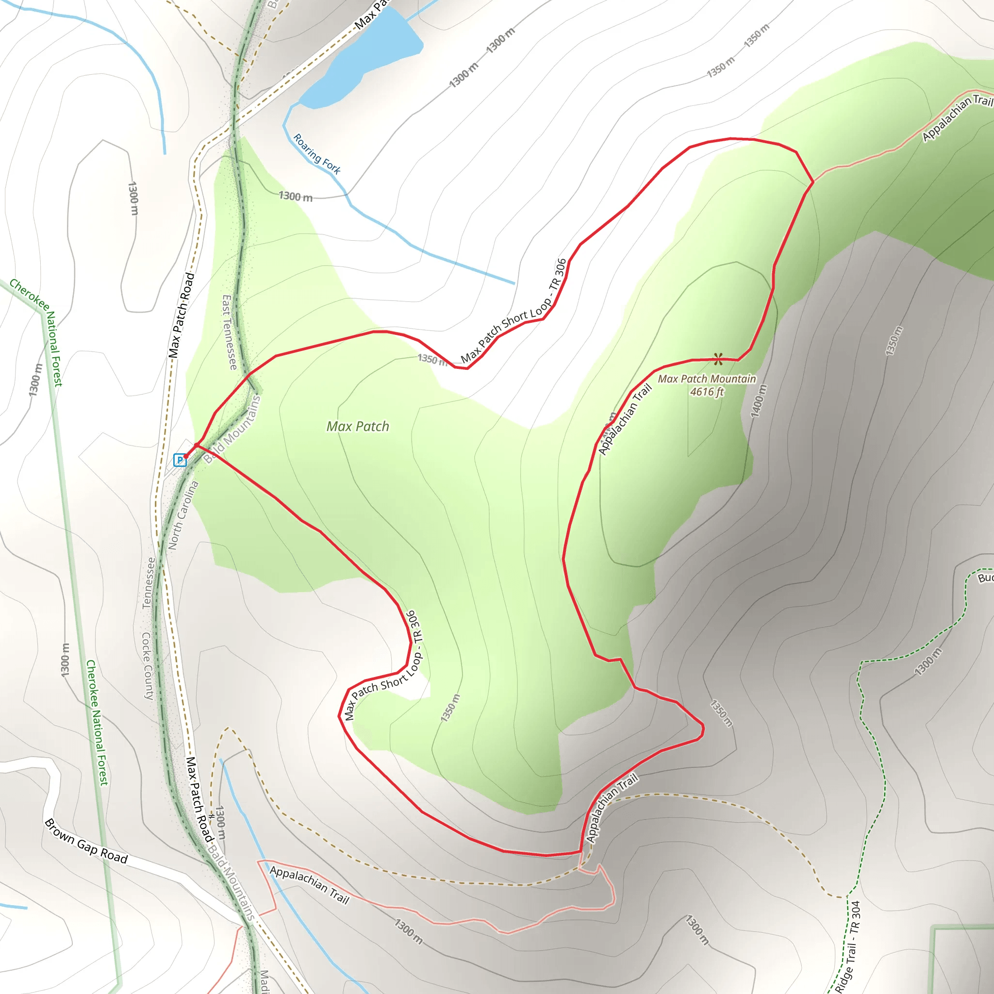
Nestled in the Appalachian Mountains near Cocke County, Tennessee, the Max Patch Loop Trail offers a relatively short but rewarding hike that spans approximately 2 kilometers (1.24 miles) with minimal elevation gain, making it accessible to hikers of varying abilities. The trailhead can be found just off Max Patch Road, which is reachable by car. Public transport options are limited in this rural area, so driving is the most feasible option for reaching the start of the hike.Getting to the TrailheadTo reach the trailhead by car, hikers should navigate towards Max Patch Road, which is the nearest significant landmark to the lonlat coordinates provided. From Asheville, North Carolina, take I-40 West to exit 7 for Harmon Den. Follow Cold Springs Road, which becomes Max Patch Road, and look for the parking area designated for Max Patch. The trailhead is located a short walk from the parking area.Trail ExperienceAs you embark on the Max Patch Loop Trail, you'll be greeted by a well-trodden path that meanders through a mix of hardwood forests and rolling hills. The trail is marked by signs and is easy to follow, but carrying a navigation tool like HiiKER can enhance your experience by providing detailed maps and waypoints.Natural Beauty and WildlifeThe highlight of the hike is undoubtedly the summit of Max Patch Mountain, which offers a panoramic 360-degree view of the surrounding Blue Ridge and Smoky Mountains. The bald summit is a result of past clearing and grazing activities, and it's now a popular spot for picnics and even flying kites on a breezy day. The area is rich in biodiversity, with wildflowers blooming in spring and summer, and a variety of bird species that can be spotted throughout the year.Historical SignificanceMax Patch holds historical significance as part of the larger Appalachian Trail, a famed 2,200-mile (3,540 km) long hiking trail that stretches from Georgia to Maine. The area has a storied past with ties to early settlers and has been a cherished landmark for outdoor enthusiasts for generations.Preparation and PlanningBefore setting out, hikers should be prepared with appropriate clothing for changing weather conditions, as the open summit can be quite windy and cooler than the forested sections. It's also advisable to bring water, snacks, and a camera to capture the stunning vistas. Remember to practice Leave No Trace principles to preserve the beauty of Max Patch for future visitors.ConclusionThe Max Patch Loop Trail is a must-visit for anyone looking to experience the natural splendor of the Appalachian region. Its easy accessibility and the rewarding views from the summit make it a popular choice for a day hike. Whether you're a seasoned hiker or a family looking for an outdoor adventure, Max Patch is a destination that won't disappoint.
Comments and Reviews
User comments, reviews and discussions about the Max Patch Loop Trail, Tennessee.
4.33
average rating out of 5
9 rating(s)

