Download
Preview
Add to list
More
299.2 km
~18 days
15760 m
Multi-Day
“Embark on the Walserweg for a historic and challenging trek through the Swiss Alps' breathtaking beauty.”
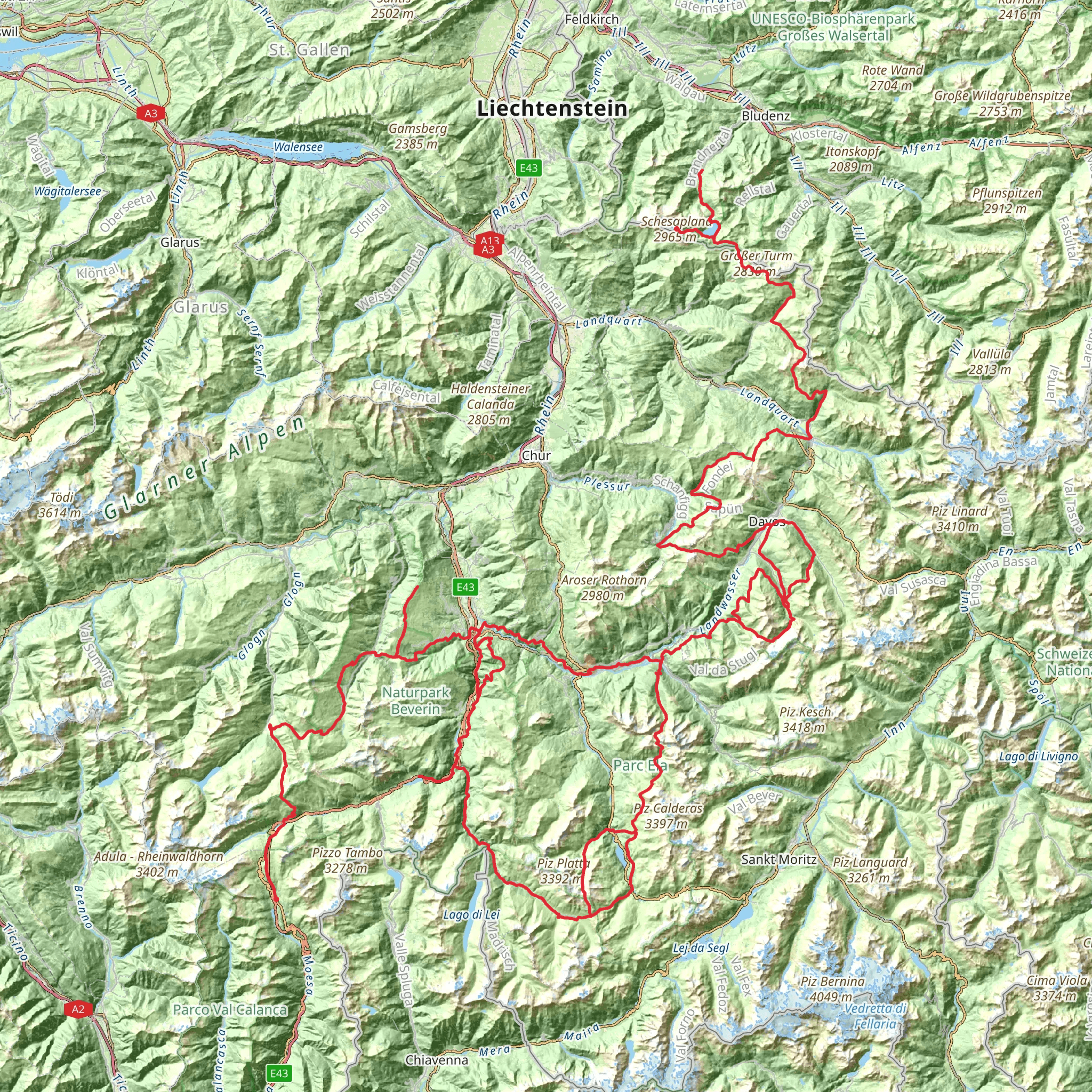
The Walserweg is a captivating journey through the Swiss Alps, stretching approximately 299 kilometers (about 186 miles) and featuring a significant elevation gain of around 15,700 meters (approximately 51,500 feet). This point-to-point trail begins near Moësa, Switzerland, and is considered difficult due to its length, elevation changes, and technical terrain. Hikers embarking on this adventure should be well-prepared for a challenging yet rewarding experience.
Getting to the Trailhead
To reach the starting point of the Walserweg, hikers can travel to Moësa by car or public transportation. The nearest significant landmark is the town of Bellinzona, which is well-connected by train to major Swiss cities. From Bellinzona, you can catch a bus to Moësa, where the trailhead is located. Parking is available for those who prefer to drive, but spaces can be limited during peak hiking seasons.
Navigating the Trail
Hikers can utilize the HiiKER app for detailed maps and navigation assistance throughout the Walserweg. The app provides real-time GPS tracking and offline maps, which are essential for navigating the remote sections of the trail.
Historical Significance and Landmarks
The Walserweg trail is steeped in history, tracing the migration paths of the Walser people, who settled in the high mountain regions of the Alps during the 13th and 14th centuries. As you traverse the trail, you'll encounter traditional Walser houses, chapels, and barns, offering a glimpse into the past and the unique architectural style of the Walser culture.
Natural Beauty and Wildlife
The trail boasts a diverse range of alpine landscapes, from lush valleys and rolling meadows to rugged peaks and glaciers. Hikers will be treated to breathtaking views of iconic mountains, including the Matterhorn and Monte Rosa. The region is also home to an abundance of wildlife, such as marmots, chamois, and ibexes, as well as a variety of alpine flora.
Trail Sections and Elevation
The Walserweg is divided into several sections, each with its own character and challenges. The initial segment from Moësa involves a gradual ascent through picturesque forests and meadows. As you progress, the trail becomes more demanding, with steep climbs and high-altitude passes. One of the most strenuous sections includes the ascent to the 2,502-meter-high (8,209 feet) Safierberg Pass, which offers panoramic views of the surrounding peaks.
Preparation and Safety
Due to the trail's difficulty, hikers should be in good physical condition and have experience with long-distance trekking. It's essential to carry appropriate gear, including sturdy hiking boots, weather-appropriate clothing, and sufficient food and water. Given the trail's length, hikers may choose to complete it in stages, taking advantage of the various mountain huts and accommodations along the route.
Weather Considerations
The weather in the Alps can be unpredictable, with sudden changes and the potential for severe conditions at higher elevations. It's crucial to check the forecast regularly and be prepared for all types of weather. The best time to hike the Walserweg is from June to September when the trails are generally clear of snow, and the weather is more stable.
Respect for the Environment
Hikers are encouraged to follow Leave No Trace principles to preserve the natural beauty of the Alps. This includes packing out all trash, staying on marked trails to prevent erosion, and respecting wildlife habitats.
By preparing adequately and respecting the trail's natural and historical significance, hikers can look forward to an unforgettable journey along the Walserweg, immersed in the stunning landscapes and rich cultural heritage of the Swiss Alps.
Comments and Reviews
User comments, reviews and discussions about the Walserweg, Switzerland.
4.86
average rating out of 5
7 rating(s)

