Download
Preview
Add to list
More
17.4 km
~4 hrs 13 min
439 m
Point-to-Point
“Explore the Bauernlehrpfad's harmonious blend of Swiss alpine splendor and rich agricultural lore.”
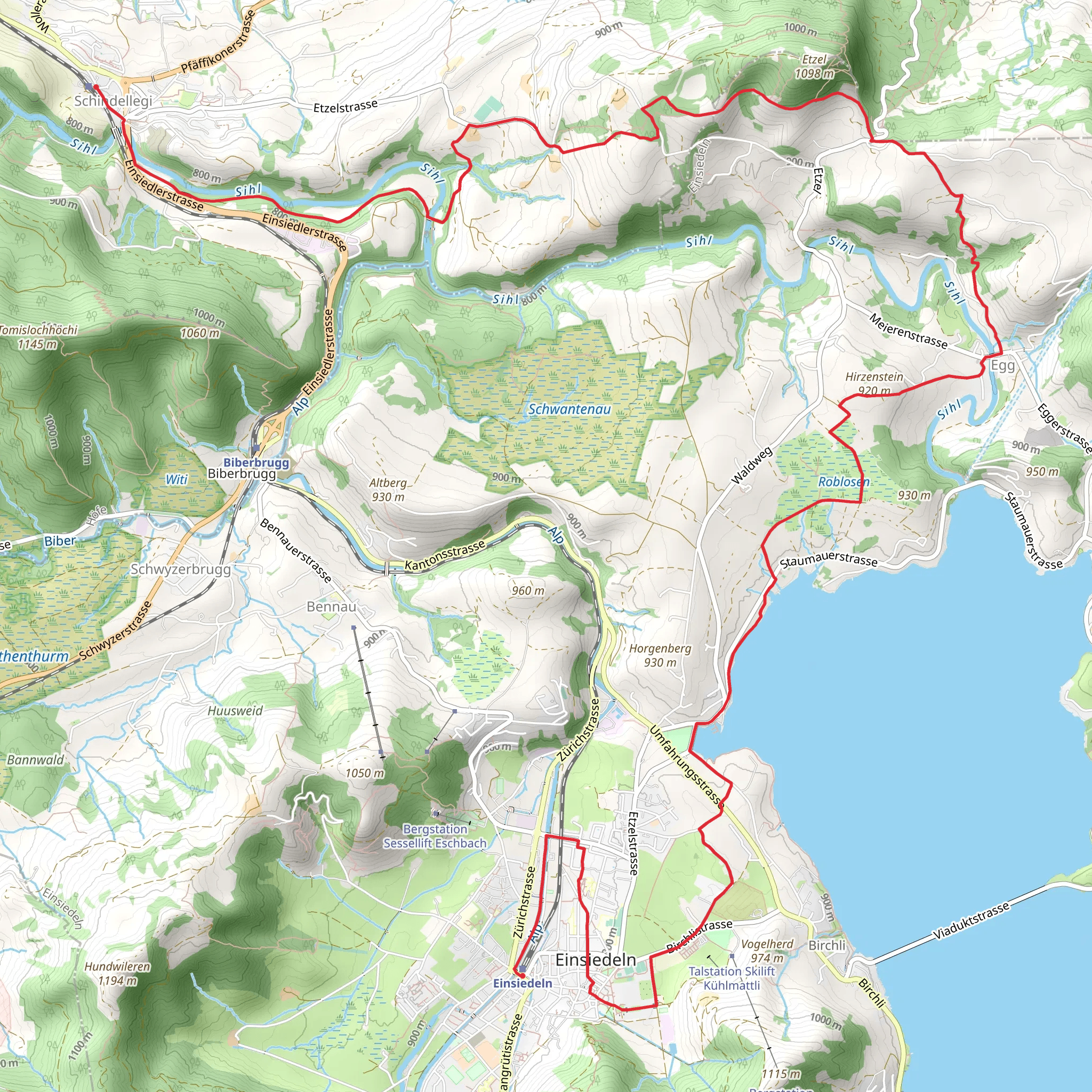
Embarking on the Bauernlehrpfad rund um den Etzel, hikers will traverse approximately 17 kilometers (about 10.5 miles) with an elevation gain of around 400 meters (roughly 1,300 feet), starting near the community of Höfe in Switzerland. This point-to-point trail is rated as medium difficulty, offering a blend of natural beauty and cultural insights into the region's agricultural heritage.
Getting to the Trailhead To reach the starting point of the trail, hikers can use public transportation by taking a train to Pfäffikon SZ, which is the nearest major railway station. From there, local buses can drop you close to the trailhead. If driving, you can navigate to the vicinity of Höfe, where parking options are available near the start of the hike.
Navigating the Trail The trail begins with a gentle ascent through lush meadows and farmlands, offering panoramic views of Lake Zurich and the surrounding mountains. Hikers can use the HiiKER app to follow the trail's route and ensure they stay on the correct path. The app provides detailed maps and waypoints that are particularly useful in areas where trail markers might be sparse.
Cultural and Historical Significance As you meander through the picturesque landscape, the trail lives up to its name as a 'Bauernlehrpfad' or 'Farmers' Educational Path.' Along the route, you'll encounter various information boards that provide insights into the local agricultural practices, flora, and fauna. The region is steeped in history, with the Etzel mountain itself being a significant landmark. It is associated with legends and historical events, including the story of William Tell, a folk hero of Switzerland.
Landmarks and Wildlife Approximately halfway through the hike, the trail reaches the Etzel Kulm, a vantage point that offers breathtaking views of the surrounding Alps. Here, you can take a moment to appreciate the alpine environment and possibly spot local wildlife such as deer, foxes, and a variety of bird species.
Terrain and Conditions The trail's terrain is diverse, with sections that include well-maintained paths, wooden bridges, and occasional steep inclines. The 400-meter elevation gain is spread out over the course of the hike, making it a steady but manageable climb. Hikers should be prepared for changing weather conditions and bring appropriate gear, including sturdy hiking boots, weather-appropriate clothing, and sufficient water and snacks.
Conclusion As you approach the end of the Bauernlehrpfad rund um den Etzel, the trail descends back towards the valley, where the hike concludes. Whether you're interested in the natural landscape, local wildlife, or the historical aspects of the Swiss countryside, this trail offers a rich and varied experience for hikers looking to explore the beauty of Switzerland.
Comments and Reviews
User comments, reviews and discussions about the Bauernlehrpfad rund um den Etzel, Switzerland.
average rating out of 5
0 rating(s)

