Download
Preview
Add to list
More
15.9 km
~2 days
637 m
Multi-Day
“Embark on a scenic Alpine journey rich in history and natural splendor from Val Canaria to Lake Ritom.”
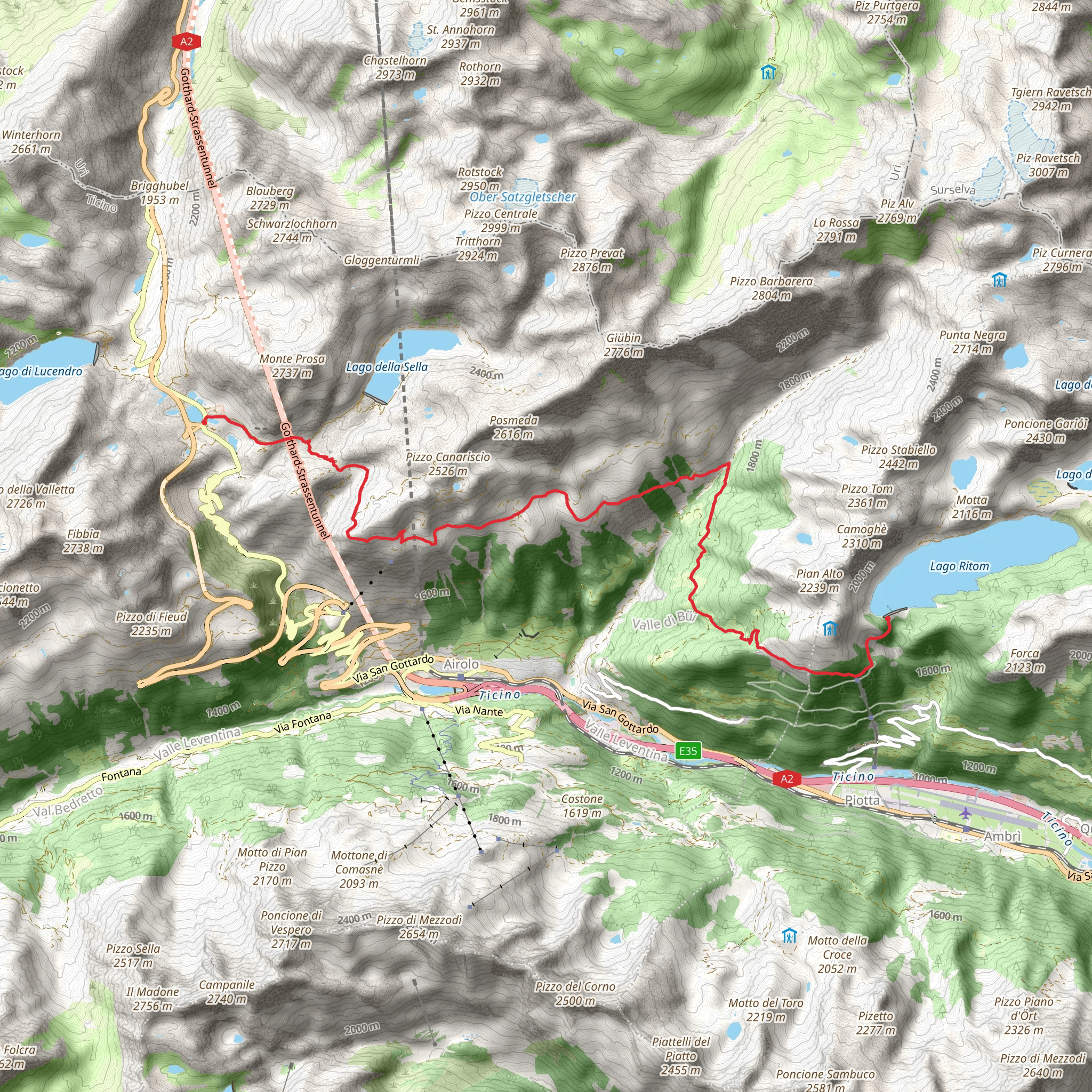
Embarking on the Val Canaria to Lake Ritom trail, hikers will traverse a picturesque route that spans approximately 16 kilometers (about 10 miles) with an elevation gain of around 600 meters (roughly 1970 feet). This point-to-point trail is nestled in the heart of the Swiss Alps, within the Distretto di Leventina, and is rated as medium difficulty, making it accessible to hikers with a reasonable level of fitness.
Getting to the Trailhead
The trailhead is conveniently located near Distretto di Leventina, Switzerland. For those opting for public transportation, the area is well-serviced by trains and buses. Hikers can take a train to Airolo and then catch a bus to the starting point near Val Canaria. If driving, parking is available in the vicinity of Val Canaria, where the trail commences.
The Journey Begins
Setting out from the trailhead, hikers will be greeted by the lush greenery of the Val Canaria area. The initial segment of the trail is a gentle ascent through mixed forests, offering a serene start to the hike. As you progress, the path becomes steeper, and the landscape opens up to reveal sweeping views of the surrounding mountains.
Historical Significance
The region is steeped in history, with the trail itself winding through areas that have been significant for local communities for centuries. The Swiss Alps have been a crossroads of culture and trade, and as you hike, you may encounter historical markers and remnants of old settlements that speak to the area's rich past.
Flora and Fauna
The trail boasts a diverse range of flora and fauna. Hikers can expect to see a variety of alpine plants and, if lucky, may spot wildlife such as mountain goats, marmots, and a range of bird species. The changing seasons bring different highlights, from wildflowers in spring and summer to the golden hues of larch trees in the fall.
Landmarks and Scenery
As the trail ascends, hikers will pass by several small alpine lakes, which are perfect spots for rest and reflection. The path meanders alongside streams and over wooden bridges, adding to the charm of the hike.
Reaching Lake Ritom
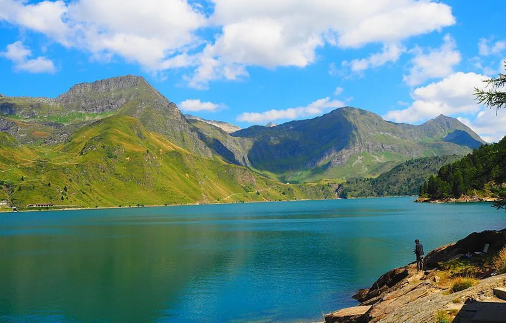
The final stretch of the trail involves a series of switchbacks leading up to Lake Ritom. This stunning alpine lake is a highlight of the hike, with its turquoise waters framed by rugged mountain peaks. The lake is situated at an elevation of approximately 1850 meters (6070 feet), providing a sense of accomplishment upon arrival.
Navigation
Throughout the hike, it's essential to stay on marked trails and use navigation tools to ensure you're on the right path. HiiKER is a useful app for this purpose, offering detailed maps and trail information that can assist in keeping you oriented.
Preparation and Safety
Hikers should prepare for varying weather conditions, as the mountains can be unpredictable. It's recommended to bring layers of clothing, sun protection, and plenty of water. Additionally, ensure you have a map, compass, or a digital navigation tool like HiiKER to aid in route finding.
Conclusion
The Val Canaria to Lake Ritom trail offers a rewarding experience for those seeking to immerse themselves in the natural beauty and historical richness of the Swiss Alps. With proper preparation and respect for the environment, hikers will find this trail to be a memorable adventure.
Comments and Reviews
User comments, reviews and discussions about the Val Canaria to Lake Ritom, Switzerland.
average rating out of 5
0 rating(s)

