Download
Preview
Add to list
More
314.3 km
~18 days
9623 m
Multi-Day
“Embark on the Jura Crest Trail for a scenic trek through Swiss history, wildlife, and breathtaking alpine vistas.”
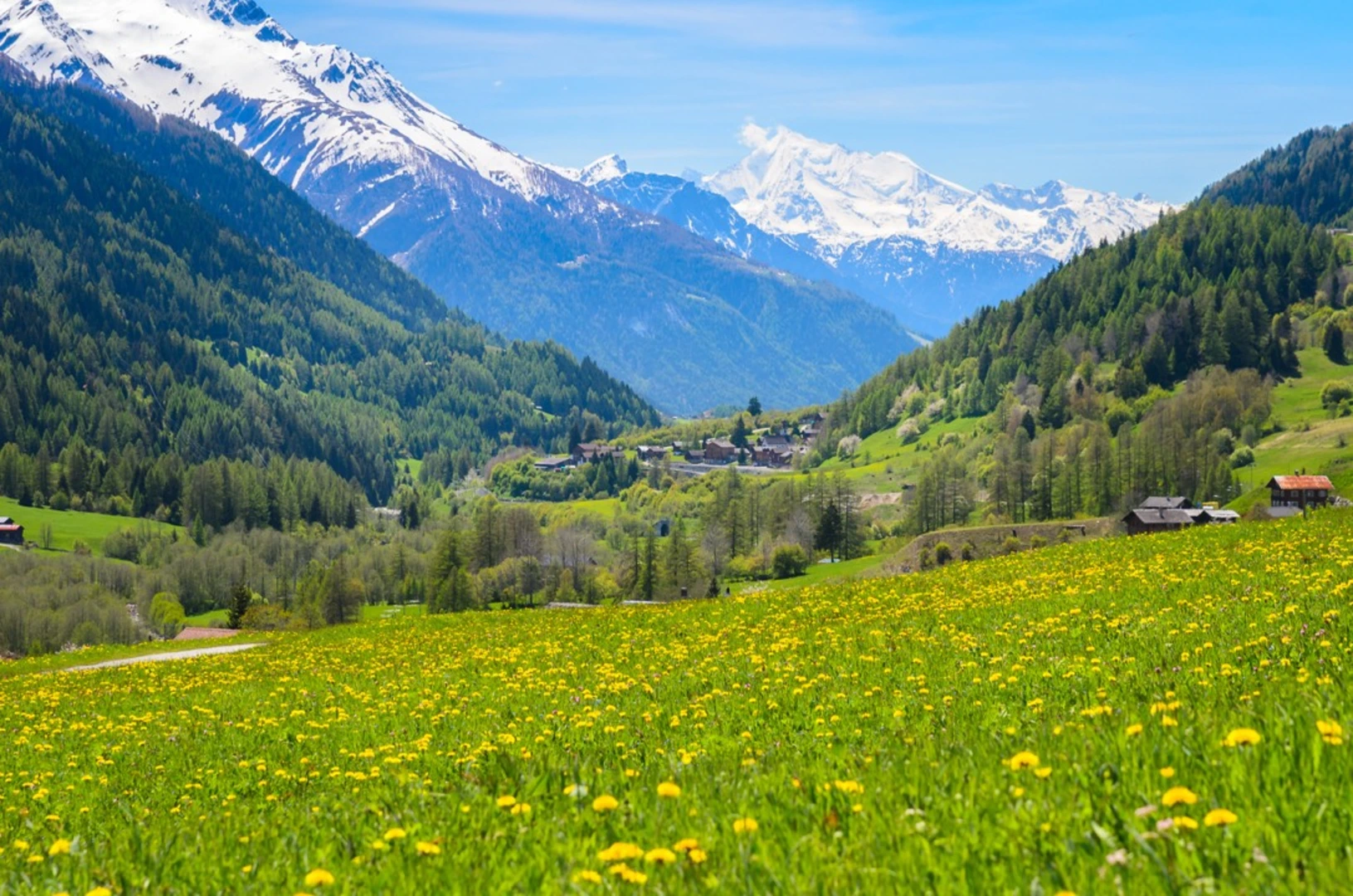
Embarking on the Jura Crest Trail, you'll traverse the length of the Jura mountain range in Switzerland, a journey that spans approximately 314 kilometers (about 195 miles) and encompasses an elevation gain of around 9600 meters (roughly 31,500 feet). This point-to-point trail is a medium-difficulty trek that offers a blend of pastoral landscapes, dense forests, and panoramic ridge walks.
Getting to the Trailhead
The trailhead is situated near Bezirk Dielsdorf, which is accessible by public transport. From Zurich, you can take a train to Dielsdorf and then a bus to reach the starting point. If you're driving, you can navigate to Bezirk Dielsdorf and find parking in the vicinity to begin your hike.
Navigating the Trail
As you set out, ensure you have the HiiKER app downloaded for up-to-date trail maps and navigation assistance. The trail is well-marked with the typical yellow signposts used in Switzerland, which makes it easy to follow.
Landmarks and Scenery
The Jura Crest Trail, known locally as the "Jura Höhenweg," is a journey through serene alpine meadows, past traditional Swiss farms, and along ridges that offer stunning views of the Alps and the surrounding valleys. Notable landmarks include the Chasseral peak, which at 1607 meters (5272 feet) is one of the highest points along the trail and provides breathtaking vistas.
Wildlife and Nature
The Jura mountains are home to a rich array of flora and fauna. Hikers can expect to see a variety of wildlife, including chamois, deer, and a diverse range of bird species. The trail also passes through several nature reserves, where the preservation of biodiversity is a priority.
Historical Significance
The region is steeped in history, with the Jura mountains playing a significant role in Swiss watchmaking. The trail passes through La Chaux-de-Fonds and Le Locle, which are UNESCO World Heritage Sites recognized for their contribution to the craft of watchmaking.
Preparation and Planning
Given the length of the trail, it's advisable to plan for multiple days of hiking, with accommodations ranging from mountain huts to guesthouses available along the route. Be prepared for variable weather conditions, and pack accordingly with layers, rain gear, and appropriate footwear.
Elevation and Distance
The trail's elevation gain is significant, with some days involving steep ascents and descents. It's important to pace yourself and be prepared for the physical demands of the trail. The total distance covered is around 314 kilometers, so plan your itinerary to include rest days and shorter hiking segments if needed.
Conclusion
The Jura Crest Trail offers an immersive experience in the natural beauty and cultural heritage of the Swiss Jura mountains. With careful planning and preparation, hikers can enjoy a rewarding trek through one of Switzerland's most picturesque landscapes.

Comments and Reviews
User comments, reviews and discussions about the Jura Crest Trail, Switzerland.
4.83
average rating out of 5
6 rating(s)