Download
Preview
Add to list
More
120.5 km
~10 days
10621 m
Multi-Day
“Embark on the GR 132 for a diverse and breathtaking trek through La Palma's landscapes and culture.”
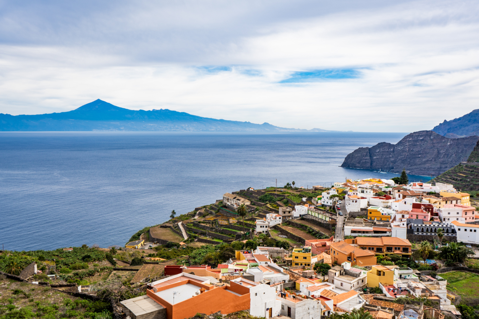
The GR 132 is a captivating long-distance trail that encircles the island of La Palma, one of the stunning Canary Islands off the coast of Spain. This trail offers hikers approximately 120 kilometers (about 75 miles) of diverse landscapes, from coastal paths to mountainous terrain, with an elevation gain of roughly 10,600 meters (about 34,800 feet).
Getting to the Trailhead
To begin your journey on the GR 132, you'll want to make your way to the trailhead near Santa Cruz de Tenerife. If you're arriving by air, the Tenerife North Airport is the closest major airport. From there, you can take a bus or rent a car to reach the trailhead. For those opting for public transport, buses regularly service the route to Santa Cruz de Tenerife, where you can find local buses or taxis to take you to the starting point of the trail.
Navigating the Trail
As you embark on the GR 132, it's essential to have a reliable navigation tool. HiiKER is an excellent resource for trail maps and navigation, ensuring you stay on the right path throughout your hike. The trail is well-marked with the characteristic red and white stripes of Grande Randonnée routes, but having a digital map can be invaluable, especially in areas where the trail may be less distinct.
Landmarks and Natural Beauty
The GR 132 will take you through a variety of landscapes, each with its own unique beauty. You'll traverse lush forests, volcanic landscapes, and rugged coastlines, offering breathtaking views at every turn. Notable landmarks along the trail include the Roque de Los Muchachos, the highest point on the island, and the Caldera de Taburiente National Park, known for its massive erosion crater.
As you hike, you'll encounter charming villages like Tazacorte and Fuencaliente, where you can experience local culture and history. The trail also passes through the historic town of Garafía, where ancient dragon trees and archaeological sites provide a glimpse into the island's past.
Flora and Fauna
La Palma's unique climate and geography support a rich biodiversity. The trail will introduce you to endemic species like the Canary Island Pine and the striking La Palma Blue Butterfly. Birdwatchers may spot the elusive Laurel Pigeon or the Bolle's Pigeon, both of which are native to the Canary Islands.
Preparing for the Hike
Given the trail's medium difficulty rating, it's suitable for hikers with some experience. The terrain can be challenging, with steep ascents and descents, so good physical condition is recommended. Be sure to pack plenty of water, as well as sun protection and layers for changing weather conditions. Sturdy hiking boots are a must, as the volcanic rock can be rough on footwear.
Accommodation and Supplies
Along the GR 132, you'll find a range of accommodation options, from campsites to guesthouses. It's wise to book in advance, especially during peak seasons. While there are opportunities to resupply in the villages, carrying enough food and water for the more remote sections of the trail is crucial.
Safety and Etiquette
Always let someone know your itinerary before setting out on the trail. In case of emergency, it's important to have a plan and the means to call for help. Respect the natural environment by staying on marked trails and practicing Leave No Trace principles.
The GR 132 is a journey that offers not just a physical challenge but also a deep connection with the natural and cultural heritage of La Palma. With careful preparation and a spirit of adventure, hikers will find this trail to be a rewarding experience.

Comments and Reviews
User comments, reviews and discussions about the GR 132, Spain.
5.0
average rating out of 5
3 rating(s)