Download
Preview
Add to list
More
12.2 km
~3 hrs 22 min
569 m
Loop
“Embark on the historic Path of the Winds PR CV 269, weaving through Agost's scenic vistas and cultural tapestry.”
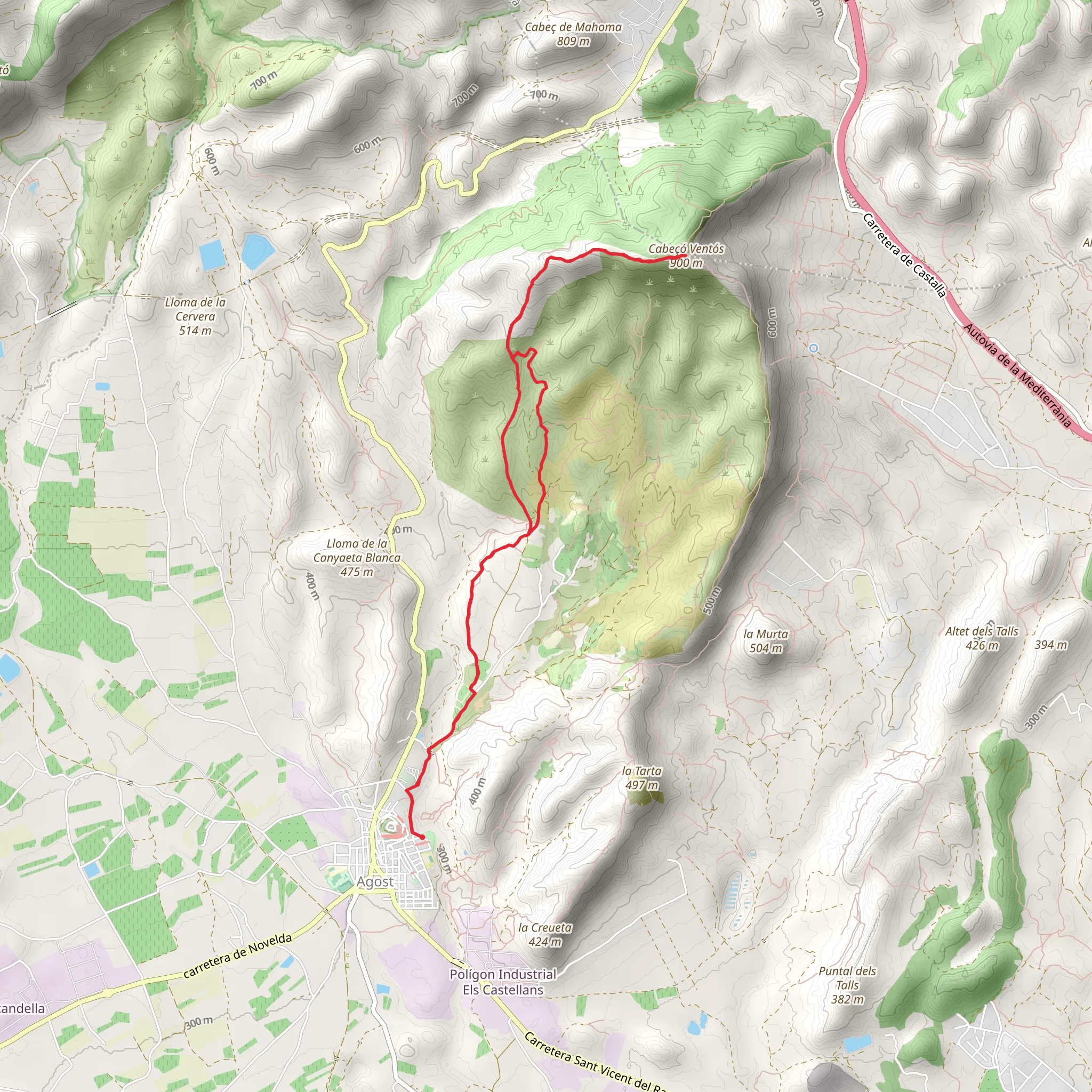
The Path of the Winds PR CV 269 is a captivating loop trail that spans approximately 12 kilometers (about 7.5 miles) and features an elevation gain of roughly 500 meters (about 1640 feet), offering a medium difficulty level suitable for hikers with some experience. The trailhead is conveniently located near Agost, Spain, a town known for its pottery and deep cultural heritage.
Getting to the Trailhead
To reach the starting point of the Path of the Winds, hikers can drive to the outskirts of Agost, where parking is available. For those preferring public transport, buses from nearby cities such as Alicante service Agost, and from there, the trailhead is a short taxi ride or a brisk walk away.
Navigating the Trail
As you embark on the Path of the Winds, you'll be greeted by the aromatic scents of Mediterranean flora. The initial segment of the trail is a gentle ascent, winding through olive groves and almond orchards, which are especially picturesque when in bloom. Hikers can use the HiiKER app to navigate the trail, ensuring they stay on the correct path while also being able to pinpoint their location and track their progress.
Historical Significance and Landmarks
The region around Agost is steeped in history, with the trail itself offering glimpses into the past. Approximately 3 kilometers (about 1.9 miles) into the hike, you'll encounter ancient terraces, a testament to the agricultural practices that have shaped the landscape over centuries. Further along, the ruins of old farmhouses dot the countryside, serving as a reminder of the rural life that once thrived here.
Flora and Fauna
As the trail ascends, the vegetation transitions to hardier species adapted to the higher elevation and rocky terrain. Keep an eye out for various species of birds of prey circling overhead, searching for their next meal. The trail also offers the chance to spot wild herbs such as rosemary and thyme, which add a fragrant dimension to the hike.
The Summit and Views
The highest point of the trail is marked by breathtaking panoramic views. On a clear day, hikers can see the vast expanse of the surrounding landscape, including the Alicante coastline and the rugged mountain ranges that frame the horizon. This is an excellent spot to take a rest and enjoy the natural beauty of the area.
Descent and Return
The descent back towards Agost is less steep, allowing for a leisurely pace to take in the surroundings. The trail loops back to the trailhead, where hikers can reflect on the journey they've completed.
Preparation and Safety
Hikers should come prepared with adequate water, as there are no water sources along the trail. Sun protection is also essential, as the Mediterranean climate can be quite warm, especially in the summer months. Sturdy hiking boots are recommended due to the rocky and uneven terrain encountered on parts of the trail.
Accessibility
The Path of the Winds PR CV 269 is accessible year-round, but the best times to hike are spring and fall when the temperatures are milder, and the natural scenery is at its most vibrant. Always check the weather forecast before setting out, as conditions can change rapidly in the mountains.
By following these guidelines and being prepared, hikers can fully enjoy the natural beauty and historical significance of the Path of the Winds PR CV 269.
Comments and Reviews
User comments, reviews and discussions about the Path of the Winds PR CV 269, Spain.
average rating out of 5
0 rating(s)

