Download
Preview
Add to list
More
24.5 km
~2 days
503 m
Multi-Day
“Embark on the historic Flume Trail, a picturesque hike through the Black Hills' storied and scenic wonders.”
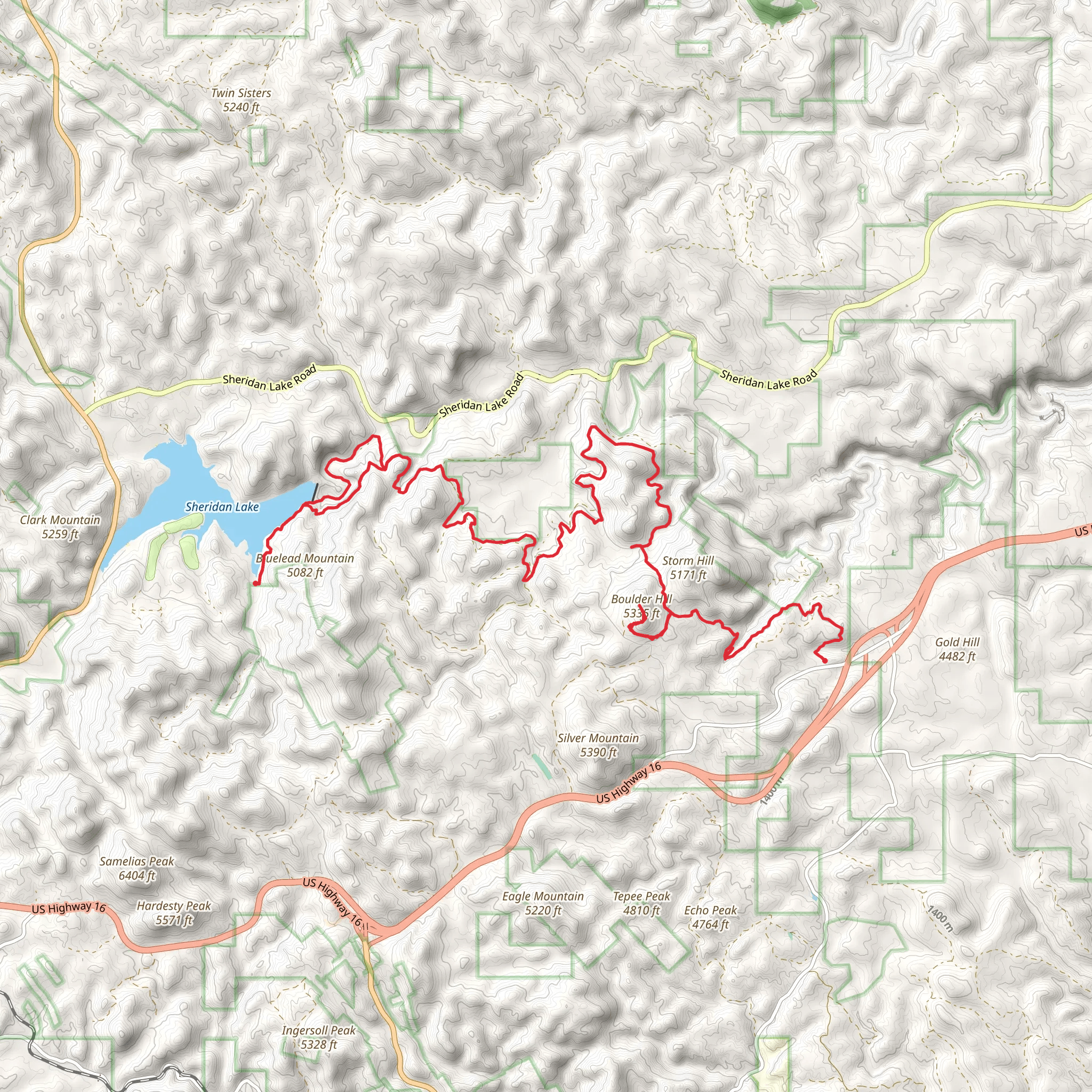
The Flume Trail, nestled in the Black Hills of South Dakota, offers hikers a journey through a landscape rich with history and natural beauty. Starting near the old mining town of Rockerville, which is now a ghost town, the trailhead is accessible via Silver Mountain Road. For those arriving by car, parking is available near the trailhead. Public transportation options are limited in this region, so driving is the most feasible option for reaching the starting point.
As you embark on the approximately 24 km (15 miles) point-to-point trail, you'll experience an elevation gain of around 500 meters (1640 feet), which provides a moderate challenge suitable for hikers with some experience. The trail is well-marked, but carrying a navigation tool like HiiKER is advisable to keep track of your progress and ensure you're on the right path.
Historical Significance and Landmarks
The Flume Trail is named after the Rockerville Flume, which was constructed in the late 19th century during the Black Hills Gold Rush. This flume carried water for gold mining operations over a distance of 20 miles. As you hike, you'll encounter remnants of this historical structure, offering a glimpse into the area's rich mining heritage.
Natural Features and Wildlife
The trail meanders through ponderosa pine forests, open meadows, and rugged hill terrain. You'll be treated to stunning views of the surrounding Black Hills and might even catch a glimpse of Mount Rushmore in the distance. The area is home to a variety of wildlife, including deer, elk, and wild turkeys. Birdwatchers will appreciate the diversity of bird species, especially near water sources along the trail.
Navigating the Trail
The first few miles of the trail are relatively easy, with gentle inclines as you make your way through the forest. As you continue, the path becomes more challenging with steeper sections, particularly as you approach the halfway mark. Here, the trail climbs more aggressively, and you'll need to navigate through rockier terrain.
Around the 12 km (7.5 miles) mark, you'll reach the highest elevation point, which offers panoramic views of the Black Hills. Take a moment to rest and enjoy the scenery before continuing on the descent.
The latter half of the trail is less strenuous, with a gradual decline in elevation. However, the path can be narrow and rocky in places, so watch your footing. As you near the end of the trail, you'll pass by the remains of the flume and other historical artifacts, a reminder of the area's past.
Preparation and Safety
Before setting out, ensure you have adequate water, as there are limited sources along the trail, and the weather can be warm during the summer months. Wear sturdy hiking boots to navigate the rocky and uneven terrain comfortably. It's also wise to carry a map or use HiiKER to track your route, as cell service can be spotty.
Check the weather forecast in advance and be prepared for sudden changes in conditions, as the Black Hills can experience rapid weather shifts. Lastly, always let someone know your hiking plans and expected return time for safety.
By following these guidelines and being prepared, you'll enjoy a memorable hike on the Flume Trail, steeped in history and natural splendor.
Comments and Reviews
User comments, reviews and discussions about the Flume Trail, South Dakota.
4.53
average rating out of 5
47 rating(s)

