Download
Preview
Add to list
More
105.5 km
~6 days
2122 m
Multi-Day
“Embark on the historic Cateran Trail, a captivating 106km loop through Scotland's diverse landscapes and medieval past.”
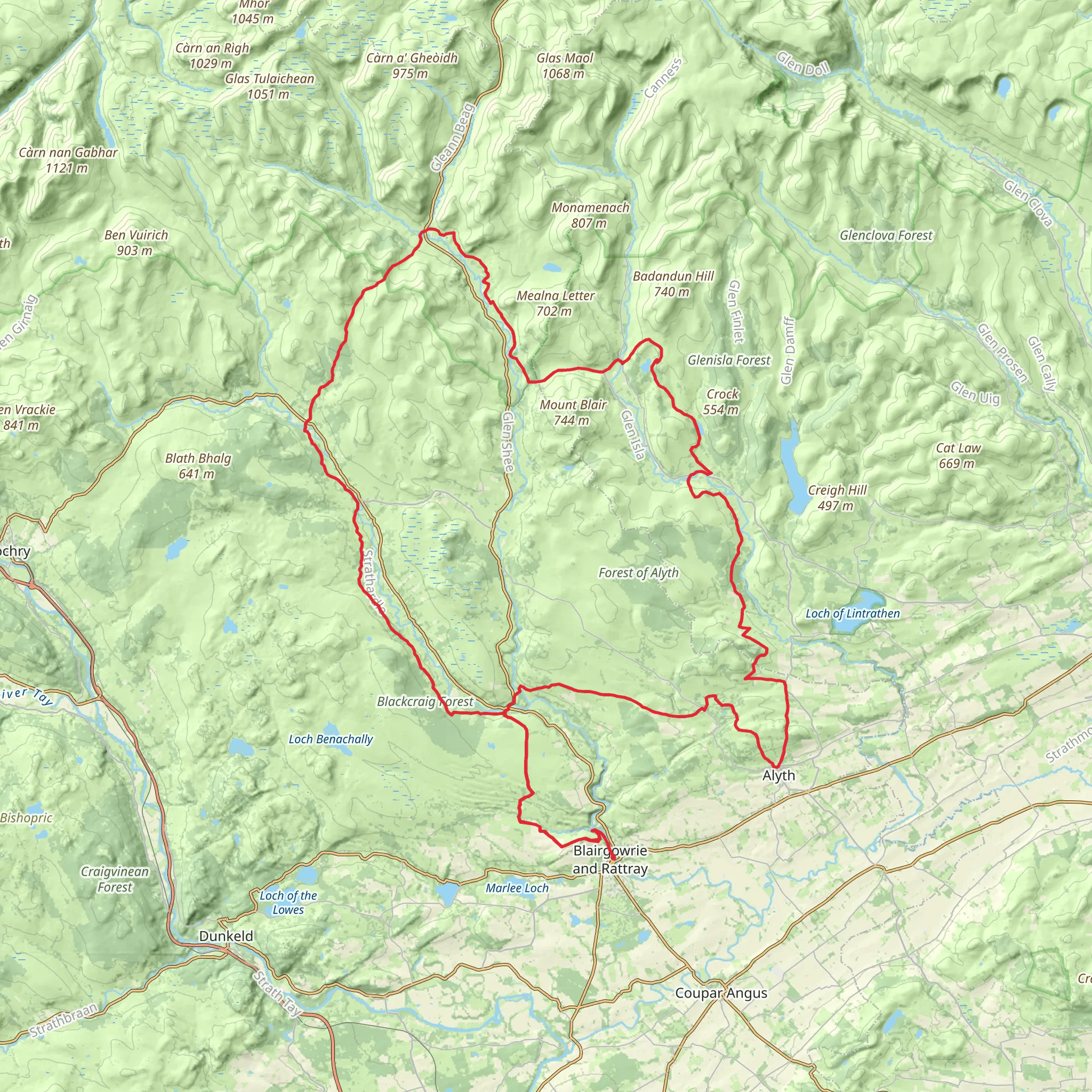
The Cateran Trail, a scenic loop of approximately 106 kilometers (about 66 miles) with an elevation gain of around 2100 meters (nearly 6890 feet), offers hikers a medium-difficulty trek through the heart of Scotland's Perth and Kinross region. This trail is steeped in history, following ancient drove roads used by cattle rustlers known as 'Caterans' in the Middle Ages.
Getting to the Trail Head
The trail head is conveniently located near the town of Blairgowrie, which is accessible by public transport or car. From Perth, you can take a bus directly to Blairgowrie, which is a short walk from the official starting point of the trail. If driving, Blairgowrie is about a 30-minute drive north of Perth. Parking is available in the town, allowing for easy access to the trail head.
Navigating the Trail
The Cateran Trail is well-marked with posts and signs, making navigation straightforward. For additional support, hikers can use the HiiKER app to access detailed maps and GPS tracking to ensure they stay on the correct path.
Key Sections and Landmarks
As you embark on the trail, you'll traverse a variety of landscapes, including serene farmland, open moorland, and dense woodland. The trail is divided into five main sections, each offering its own unique experience.
- Blairgowrie to Kirkmichael: The first section introduces you to gentle farmland and the rolling hills of Strathardle. Kirkmichael is a charming village where you can rest and find refreshments.
- Kirkmichael to Spittal of Glenshee: This stretch takes you through the scenic Glenshee, known for its ski resort. The elevation gain is more pronounced here, offering stunning views of the surrounding mountains.
- Spittal of Glenshee to Kirkton of Glenisla: Hikers will encounter the wild beauty of the Cairngorms National Park. Look out for the historic Dirnanean Garden, a hidden gem nestled in the landscape.
- Kirkton of Glenisla to Alyth: This section is rich in history, passing through farmland that has been worked for centuries. Alyth itself is home to the ruins of an old castle and a picturesque packhorse bridge.
- Alyth to Blairgowrie: The final leg returns you to Blairgowrie, completing the loop. This part of the trail offers a mix of woodland and riverside walking, with the River Ericht guiding you back to the start.
Wildlife and Nature
Throughout the hike, keep an eye out for local wildlife, including red squirrels, deer, and a variety of bird species. The trail also offers a chance to see Scotland's famous heather in bloom if you're hiking in late summer.
Historical Significance
The region's history is palpable as you walk the same routes once traveled by the Caterans. The trail also passes through sites of historical battles and ancient settlements, providing a glimpse into Scotland's turbulent past.
Preparation and Planning
Before setting out, ensure you have appropriate gear for variable weather conditions, as the Scottish climate can be unpredictable. Waterproof clothing, sturdy hiking boots, and navigation tools like the HiiKER app are essential. It's also wise to carry enough food and water, although there are opportunities to resupply in the villages along the route.
Accommodation and Amenities
For those looking to complete the trail over several days, there are various accommodation options available, from camping to cozy B&Bs. It's recommended to book in advance, especially during peak hiking season.
By preparing adequately and respecting the natural environment, hikers can fully enjoy the beauty and history of the Cateran Trail.
What to expect?
Activity types
Comments and Reviews
User comments, reviews and discussions about the Cateran Trail, Scotland.
4.63
average rating out of 5
32 rating(s)

