Download
Preview
Add to list
More
377.3 km
~22 days
8542 m
Multi-Day
“Embark on a wild Scottish odyssey, braving the untamed Cape Wrath Trail West for a historic, rugged trek.”
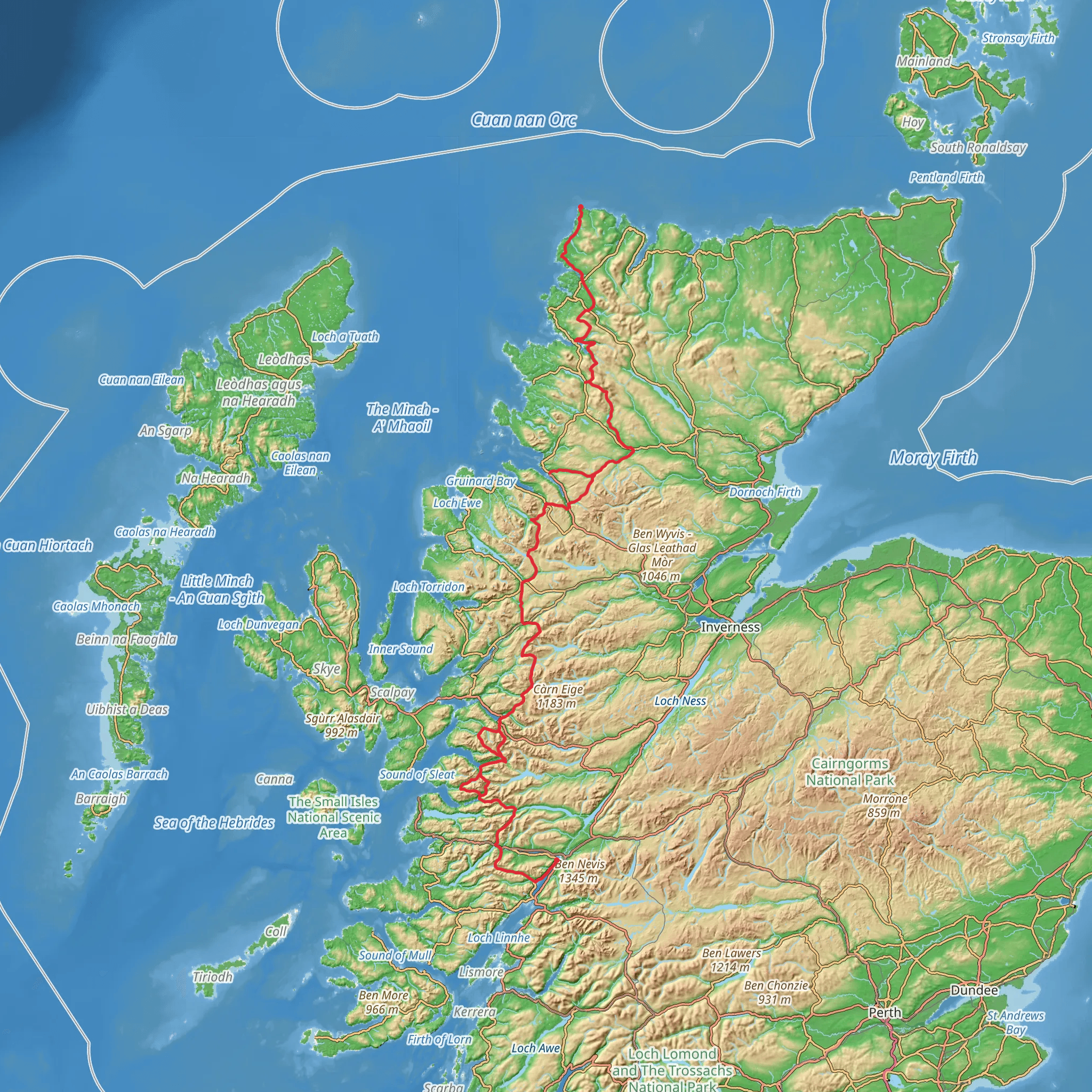
Embarking on the Cape Wrath Trail West, hikers will traverse approximately 377 kilometers (234 miles) of rugged Scottish landscapes, with an elevation gain of around 8500 meters (27,887 feet). This point-to-point trail begins near Fort William, a town in the Scottish Highlands, known as the outdoor capital of the UK. Getting to the TrailheadTo reach the starting point, adventurers can take a train or bus to Fort William from major Scottish cities such as Glasgow or Edinburgh. If driving, Fort William is accessible via the A82 road, which offers a scenic route through the Highlands. Parking is available in the town for those who wish to leave their vehicle.The Journey Through the HighlandsFrom the outset, hikers will be greeted by the shadow of Ben Nevis, the UK's highest peak. The trail meanders through ancient glens, alongside lochs, and across open moorlands, offering a true sense of wilderness. The path is unmarked in places, so a reliable navigation tool like HiiKER is essential for staying on course.Landmarks and Natural BeautyAs the trail progresses, hikers will encounter the iconic Glencoe, a valley carved by glaciers and volcanic explosions, steeped in history and with a haunting atmosphere from the infamous massacre of 1692. The path continues to the shores of Loch Linnhe, before heading into the remote Ardnamurchan Peninsula, the most westerly point of the British mainland.Wildlife EncountersThe region is rich in wildlife, with chances to spot red deer, golden eagles, and otters. The trail also passes through the Morar, Moidart, and Knoydart regions, known for their rugged terrain and the 'Rough Bounds' – an area that feels particularly untamed and isolated.Historical SignificanceThroughout the journey, hikers will walk in the footsteps of the past, from ancient clan battles to the Jacobite uprisings. The trail offers a deep dive into Scottish history, with ruins and relics dotting the landscape, including the well-preserved Castle Tioram, which dates back to the 13th century.Challenges and ConsiderationsThe trail is rated as medium difficulty, but it can be challenging due to its remoteness and the variable Scottish weather. Hikers should be prepared for river crossings, boggy ground, and steep ascents. It's essential to carry a comprehensive map, a compass, and a GPS device, with HiiKER being a recommended digital tool for up-to-date trail information.Accommodation and Resupply PointsThere are bothies and wild camping opportunities along the route, but planning is required for resupply points as they are few and far between. The villages of Kinloch Hourn, Shiel Bridge, and Strathcarron provide some options for restocking essentials.End of the TrailThe trail concludes at the lighthouse at Cape Wrath, the most northwesterly point of the Scottish mainland. To return to civilization, hikers can take a minibus to the ferry crossing at Kyle of Durness, which connects to a bus service towards Inverness.Preparation is KeyBefore setting out, it's crucial to check the weather forecast, pack appropriate gear for all conditions, and inform someone of your itinerary. The Cape Wrath Trail West is a journey through some of Scotland's most spectacular and challenging landscapes, promising an unforgettable adventure for those who are well-prepared.
What to expect?
Activity types
Comments and Reviews
User comments, reviews and discussions about the Cape Wrath Way West, Scotland.
4.6
average rating out of 5
35 rating(s)

