Download
Preview
Add to list
More
64.2 km
~3 days
2406 m
Multi-Day
“Embark on the Ausangate Trek: a high-altitude Andean odyssey steeped in natural splendor and ancient lore.”
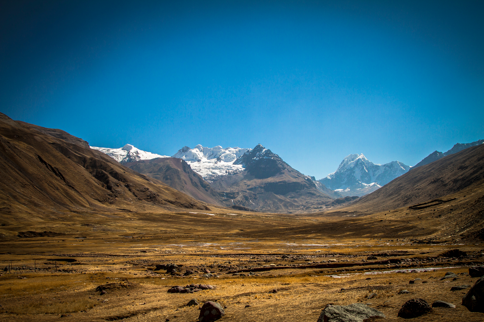
The Ausangate Trek is a breathtaking journey through the Peruvian Andes, offering hikers a chance to immerse themselves in the heart of the region's stunning landscapes and cultural heritage. Spanning approximately 64 kilometers (about 40 miles) with an elevation gain of around 2,400 meters (nearly 7,875 feet), this loop trail begins near the small town of Ocongate, roughly 100 kilometers southeast of Cusco.
Getting to the Trailhead To reach the trailhead, adventurers can take a bus or a shared taxi from Cusco to Tinqui, passing through Ocongate along the way. The journey typically takes around 3 to 4 hours. From Tinqui, the trailhead is accessible by a short walk or a local transport service, if available.
The Trek Experience Embarking on the Ausangate Trek, hikers will traverse diverse terrains, from lush valleys and high alpine meadows to glacial peaks and serene mountain lakes. The trail is well-marked, but carrying a reliable navigation tool like HiiKER is advisable to ensure you stay on the right path and can monitor your progress.
Landmarks and Natural Wonders One of the first significant landmarks encountered is the village of Upis, where trekkers can witness traditional Andean lifestyles and may opt to take a rest in the hot springs nearby. As the trail continues, it skirts the base of the majestic Ausangate Mountain, the region's highest peak at 6,384 meters (20,945 feet), which is revered by the local Quechua people.
The trek includes several high passes, the tallest of which is the Palomani Pass, reaching an elevation of 5,200 meters (17,060 feet). From this vantage point, hikers are rewarded with panoramic views of the surrounding snow-capped peaks and the undulating landscape below.
Flora and Fauna Throughout the journey, the trail offers glimpses of the unique Andean flora and fauna. The polylepis forests, known as "queñua" woods, are home to a variety of bird species, including the Andean condor and the brightly colored mountain caracara. Herds of llamas and alpacas are also common sights, grazing on the highland ichu grass.
Cultural and Historical Significance The Ausangate region holds great cultural importance to the local communities. It is a place of spiritual significance, with the mountain itself considered a deity (Apu) in Incan mythology. The trail often intersects with paths used by local shepherds and pilgrims, particularly during the annual Qoyllur Rit'i festival, a UNESCO Intangible Cultural Heritage event that takes place in the Sinakara Valley.
Preparation and Planning Given the trail's medium difficulty rating, it's essential for hikers to be well-prepared and acclimatized to the altitude before attempting the trek. The best time to hike is during the dry season, from May to September, when the weather is more stable. Essential gear includes warm clothing, a good quality sleeping bag, a sturdy tent, and sufficient food and water supplies. Hiring a local guide or joining a guided trek can enhance the experience, providing deeper insights into the region's culture and ensuring safety.
Conclusion In conclusion, the Ausangate Trek is a challenging yet rewarding experience that offers a deep connection with the natural beauty and cultural richness of the Peruvian Andes. With proper preparation and respect for the local environment and communities, hikers will find this trail to be a truly unforgettable adventure.

Comments and Reviews
User comments, reviews and discussions about the Ausangate Trek, Peru.
4.33
average rating out of 5
9 rating(s)