Download
Preview
Add to list
More
939.6 km
~53 days
18942 m
Multi-Day
“Embark on the Finger Lakes Trail, a scenic 585-mile trek through New York's diverse landscapes, rich history, and stunning natural landmarks.”
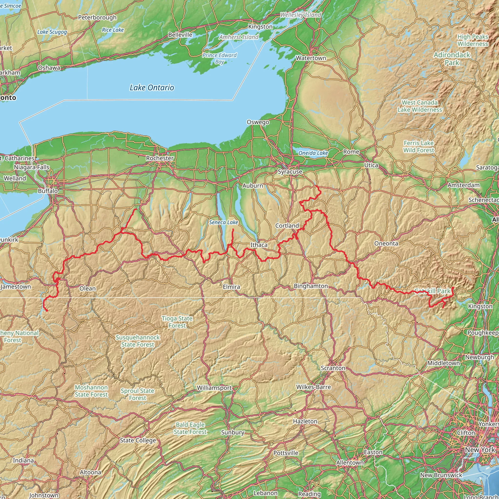
Spanning approximately 940 kilometers (about 585 miles) with an elevation gain of around 18,900 meters (approximately 62,000 feet), the Finger Lakes Trail offers an immersive journey through the diverse landscapes of New York State. Starting near the Pennsylvania-New York border, close to McKean County, the trailhead can be found in the vicinity of Allegany State Park. To reach the starting point, hikers can drive to the park or use public transportation to nearby towns and arrange for a taxi or shuttle service to the trailhead.
The Finger Lakes Trail is a point-to-point trek that weaves through the rugged terrain of the Appalachian Mountains, offering a medium difficulty rating that caters to both seasoned hikers and those with a moderate level of experience. The trail is well-marked and maintained, but hikers should always carry a reliable navigation tool like HiiKER to stay on track and be aware of their progress.
Landmarks and Scenery
As you embark on the trail, you'll traverse through a variety of landscapes, including dense forests, serene lakes, and rolling hills. The trail is part of the larger Finger Lakes Trail System, which connects the Catskills and the Allegheny Plateau. Along the way, you'll encounter landmarks such as the Watkins Glen State Park, known for its stunning 19 waterfalls, and the Letchworth State Park, often referred to as the "Grand Canyon of the East" due to its impressive gorges and waterfalls.
The trail also passes through several wildlife management areas, providing opportunities to spot local fauna such as white-tailed deer, beavers, and a variety of bird species. The changing seasons bring a kaleidoscope of colors, from the vibrant greens of spring to the fiery hues of autumn, making any time of year ideal for experiencing the natural beauty of the region.
Historical Significance
The Finger Lakes region is steeped in history, with the trail itself crossing paths with historic sites and remnants of the past. The area was once home to the Iroquois Confederacy, and hikers can learn about the indigenous cultures at various interpretive sites along the route. The trail also intersects with the Genesee Valley Greenway, where old railway lines and canal paths tell the story of the region's development during the 19th and early 20th centuries.
Preparation and Planning
Before setting out, hikers should prepare for varying weather conditions and terrain. The trail offers a mix of flat sections and challenging climbs, so a good level of fitness is recommended. It's essential to pack adequate supplies, including water, food, and layers for temperature changes. There are designated camping areas along the trail for multi-day treks, and hikers should plan their stops accordingly.
For those looking to hike shorter sections, the trail is divided into several segments, each with its own unique features and access points. Detailed maps and segment descriptions are available on the HiiKER app, allowing hikers to tailor their adventure to their preferences and time constraints.
Access and Transportation
The Finger Lakes Trail is accessible by car, with parking available at various points along the route. For those relying on public transportation, bus services to cities like Ithaca and Rochester are available, and from there, local transport can be arranged to the trailheads. Always check the latest schedules and plan your journey to ensure a smooth start to your hiking experience.
What to expect?
Activity types
Comments and Reviews
User comments, reviews and discussions about the Finger Lakes Trail, Pennsylvania.
4.88
average rating out of 5
8 rating(s)

