Download
3D Flyover
Add to list
More
50.6 km
~3 days
2164 m
Multi-Day
“Trek the Wallowa River Loop for an enchanting encounter with Oregon's alpine wonderland and untamed wildlife.”
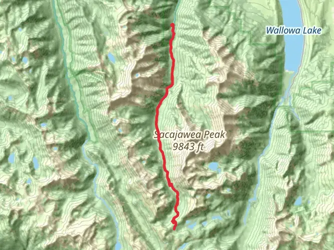
Embarking on the Wallowa River Loop is a journey through the heart of Oregon's majestic Eagle Cap Wilderness, part of the Wallowa-Whitman National Forest. This approximately 51-kilometer (around 32 miles) trek offers an elevation gain of roughly 2100 meters (about 6890 feet), presenting a challenging adventure for even seasoned hikers.
Getting to the Trailhead
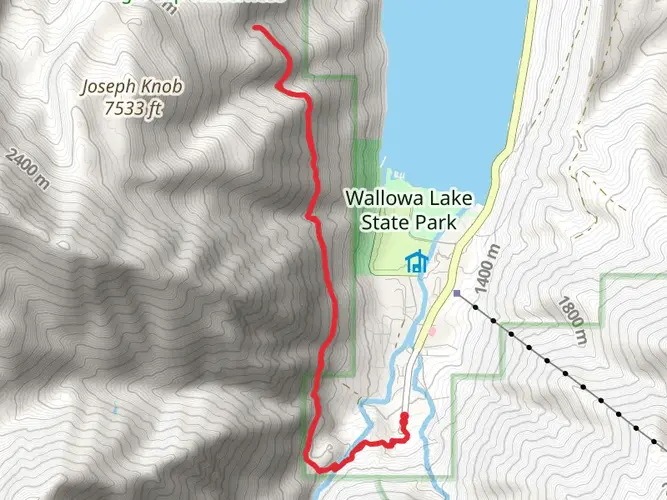
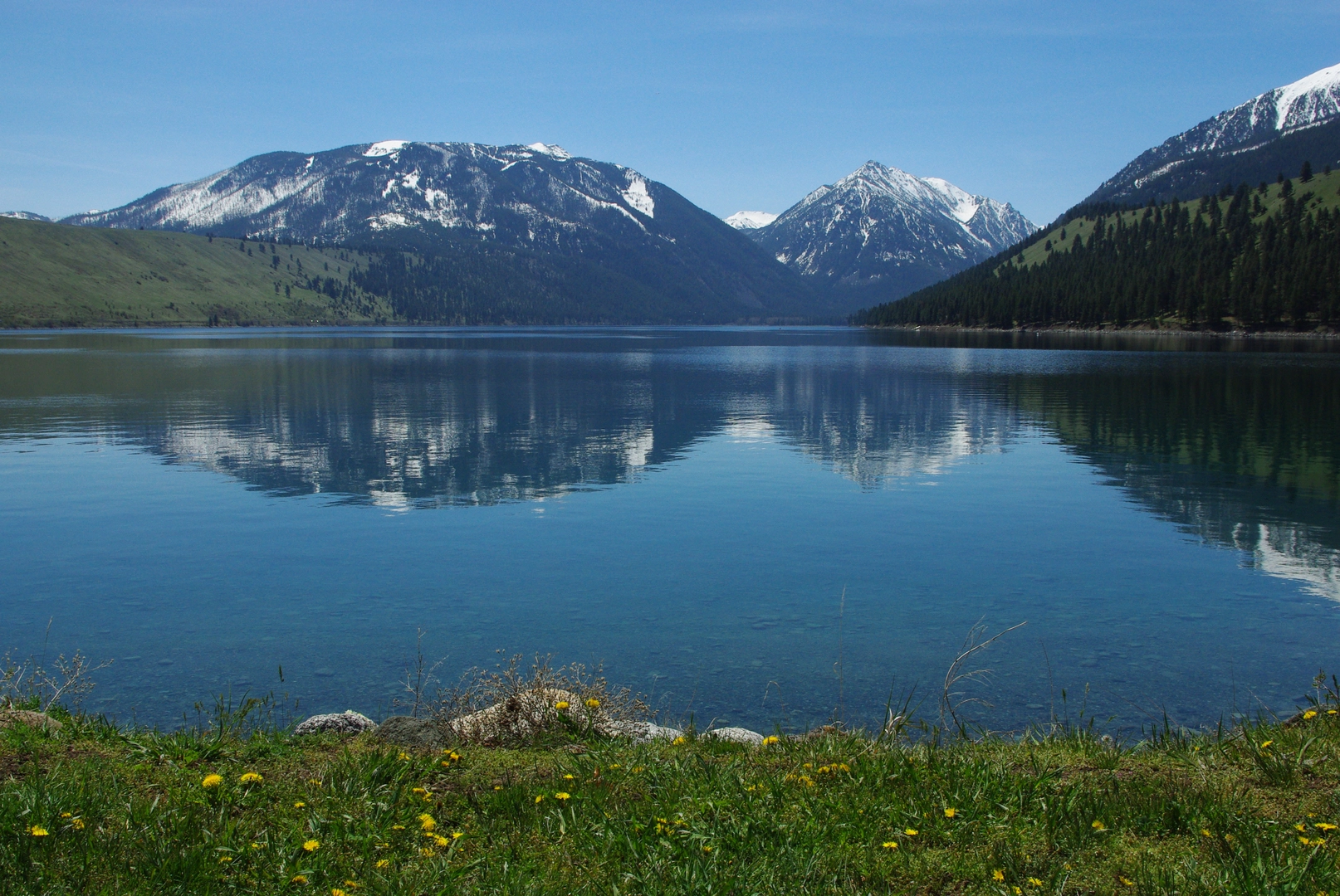
The trailhead is accessible near Wallowa County, Oregon. For those driving, the most common starting point is the Wallowa Lake Trailhead, located at the southern end of Wallowa Lake. From the town of Joseph, take Oregon State Route 351 to Wallowa Lake State Park, where parking is available. Public transport options are limited in this remote area, so driving or arranging a shuttle with local services is recommended.
Navigating the Trail
Hikers can rely on the HiiKER app for detailed maps and navigation assistance throughout the journey. The loop can be tackled in either direction, but many choose to go counter-clockwise, starting on the West Fork Wallowa River Trail.
The Journey Begins
From the trailhead, the path meanders alongside the West Fork Wallowa River, offering serene views of the water and surrounding peaks. The initial section is relatively gentle, allowing hikers to warm up before the more strenuous climbs ahead.
Ascending to the Alpine Zone
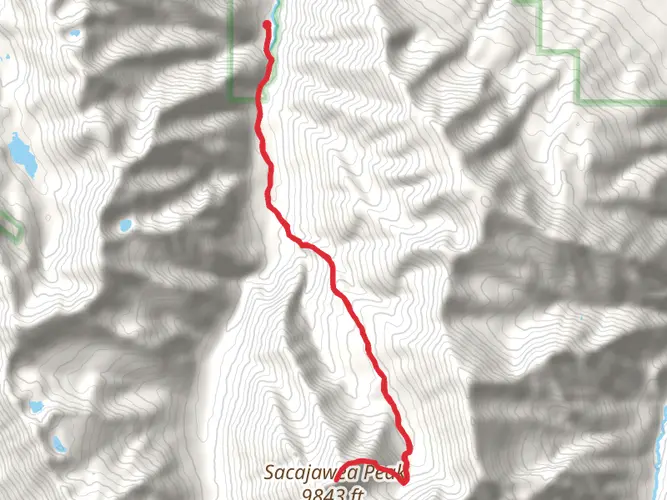
As you progress, the trail begins to ascend more steeply, leading into the alpine zone where the landscape opens up to reveal expansive meadows dotted with wildflowers during the summer months. The climb is steady, and hikers should be prepared for switchbacks and potentially snow-covered paths, even in the early summer.
Lakes and Landmarks
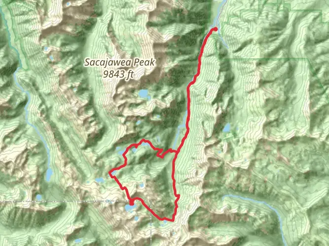
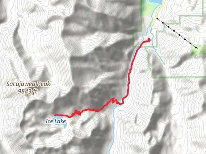
One of the highlights of the Wallowa River Loop is the series of alpine lakes encountered along the way. Approximately 16 kilometers (10 miles) into the hike, you'll reach Ice Lake, a stunning glacial basin perfect for a rest or an overnight camp. The lake is a destination in itself, with its turquoise waters reflecting the surrounding cliffs and peaks.
Continuing on, the trail offers views of other notable landmarks such as the Matterhorn and Sacajawea Peak, the latter being the highest point in the Wallowa Mountains. The area is rich in history, with the Nez Perce tribe having deep ties to the land. The mountains are considered sacred and hold historical significance as part of the tribe's ancestral homeland.
Wildlife Encounters
The Eagle Cap Wilderness is home to diverse wildlife, including mountain goats, bighorn sheep, black bears, and elk. Hikers should be aware of their surroundings and knowledgeable about wildlife safety practices. Always keep a safe distance from animals and store food properly to avoid attracting bears.
Descending Back to the Valley
After reaching the loop's highest elevations, the trail begins its descent back toward the valley. The final stretch follows the East Fork Wallowa River, providing a different perspective of the landscape with its lush riparian zones and the chance to spot beavers or otters in the water.
Trail Etiquette and Conservation
As with any wilderness hike, it's crucial to practice Leave No Trace principles to preserve the beauty and ecological integrity of the area. Pack out all trash, camp on durable surfaces, and respect trail closures and regulations.
Preparation and Safety
Given the trail's difficulty, hikers should be well-prepared with appropriate gear, including sturdy boots, layers for changing weather conditions, and navigation tools like the HiiKER app. It's also wise to check in with the local ranger station for the latest trail conditions and weather forecasts before setting out.
The Wallowa River Loop is a demanding but rewarding experience, offering an immersive journey through some of Oregon's most breathtaking wilderness. With proper preparation and respect for the natural environment, hikers will find this loop to be a memorable adventure.

What to expect?
Activity types
Comments and Reviews
User comments, reviews and discussions about the Wallowa River Loop, Oregon.
4.75
average rating out of 5
8 rating(s)