Download
Preview
Add to list
More
6.5 km
~1 hrs 41 min
228 m
Out and Back
“Immerse in the lush, panoramic beauty of Cape Mountain via Scurvy Ridge and Princess Tasha Trail.”
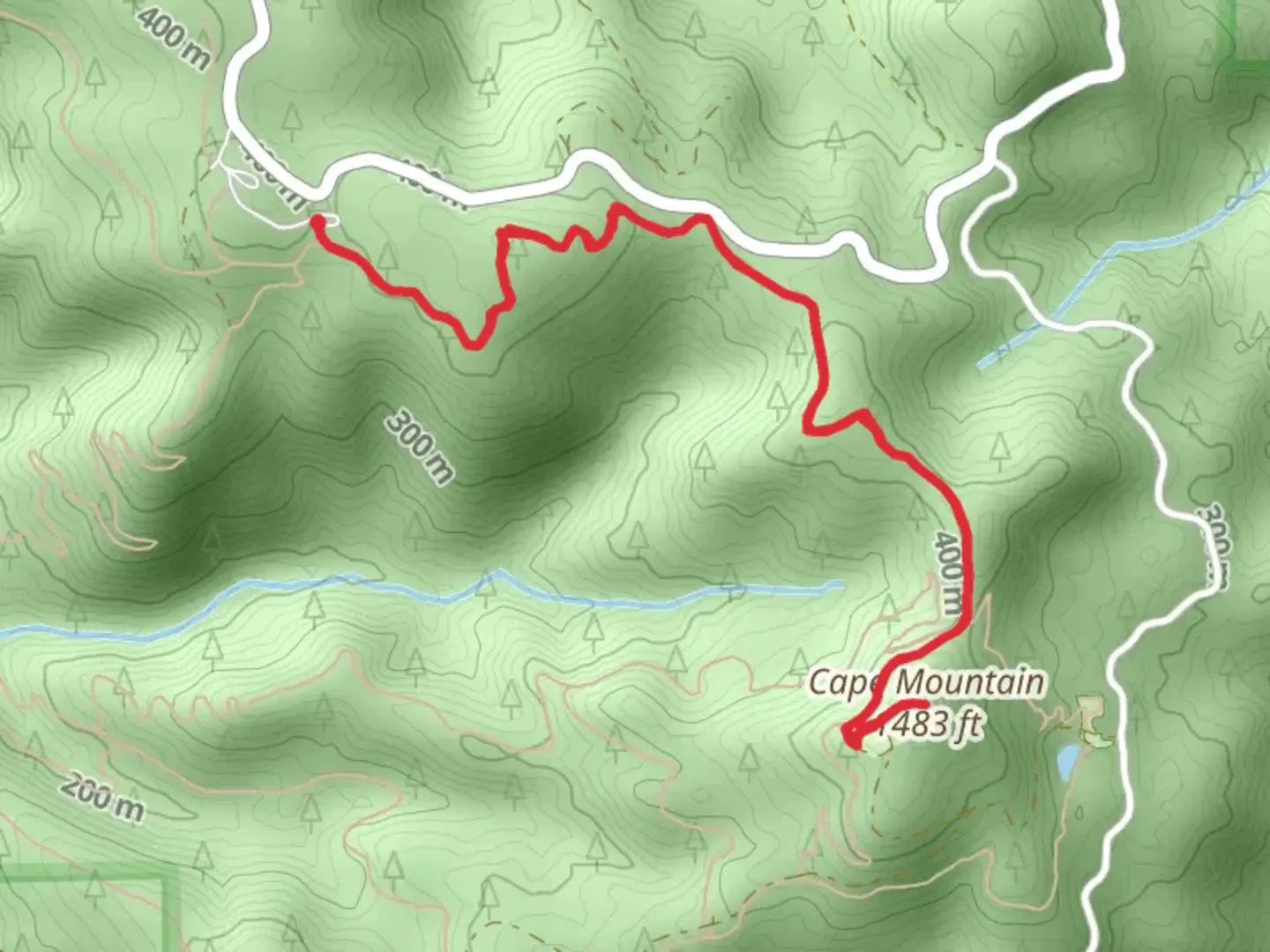
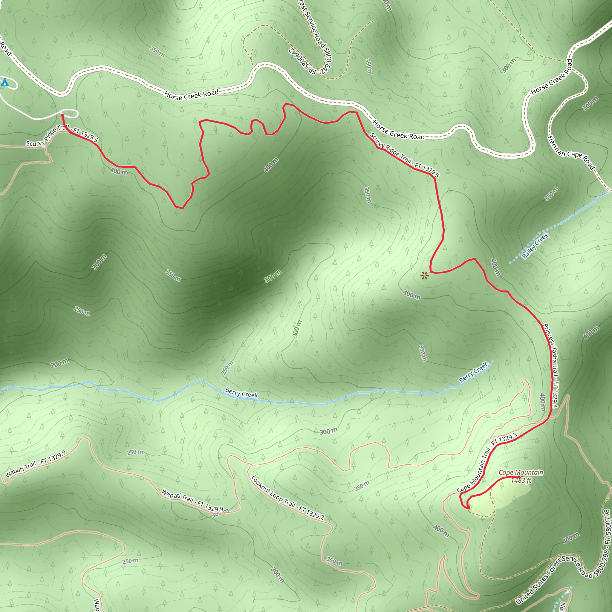
Starting your adventure near Lane County, Oregon, the Cape Mountain via Scurvy Ridge and Princess Tasha Trail offers a moderately challenging hike with a total distance of around 7 km (4.3 miles) and an elevation gain of approximately 200 meters (656 feet). This out-and-back trail is perfect for those looking to immerse themselves in the lush landscapes of the Pacific Northwest.
Getting There To reach the trailhead, you can drive or use public transportation. If driving, head towards the town of Florence, Oregon. From Florence, take Highway 101 north for about 5 miles until you reach the turnoff for Cape Mountain Road. Follow Cape Mountain Road for approximately 3 miles until you reach the trailhead parking area. For those using public transport, you can take a bus to Florence and then arrange for a local taxi or rideshare service to take you the rest of the way to the trailhead.
Trail Overview The trail begins at the Cape Mountain Trailhead, where you will find ample parking and basic amenities like restrooms. The initial section of the trail is relatively flat, making it a good warm-up as you traverse through dense forests of Douglas fir and western hemlock. After about 1 km (0.6 miles), you will start to notice a gradual incline as you approach Scurvy Ridge.
Scurvy Ridge Scurvy Ridge offers some of the most breathtaking views along the trail. As you ascend, the forest opens up to reveal panoramic vistas of the surrounding valleys and the Pacific Ocean in the distance. This section is particularly beautiful in the spring and early summer when wildflowers like lupines and Indian paintbrush are in full bloom. Keep an eye out for local wildlife, including black-tailed deer and various bird species such as the northern flicker and Steller's jay.
Princess Tasha Trail Junction At approximately 3 km (1.9 miles) into your hike, you will reach the junction with the Princess Tasha Trail. This is a great spot to take a short break and enjoy the serene environment. The Princess Tasha Trail is named after a beloved local dog who frequently accompanied hikers in the area. This section of the trail is relatively flat and meanders through a mix of old-growth and second-growth forests.
Cape Mountain Summit Continuing on, the trail becomes steeper as you make your final push towards the summit of Cape Mountain. The last 1 km (0.6 miles) involves a more strenuous climb, but the effort is well worth it. Upon reaching the summit, you are rewarded with sweeping views of the coastline and the Siuslaw National Forest. On clear days, you can see as far as the Heceta Head Lighthouse to the south.
Historical Significance Cape Mountain and the surrounding area have a rich history. The region was originally inhabited by the Siuslaw people, who utilized the abundant natural resources for fishing, hunting, and gathering. In the early 20th century, the area saw a surge in logging activity, which has since been curtailed to preserve the natural beauty of the landscape.
Navigation and Safety For navigation, it is highly recommended to use the HiiKER app, which provides detailed maps and real-time updates. The trail is well-marked, but having a reliable navigation tool can enhance your hiking experience and ensure you stay on track.
Return Journey After soaking in the views and perhaps enjoying a packed lunch at the summit, retrace your steps back to the trailhead. The descent offers a different perspective of the landscape, and you may notice details you missed on the way up.
This trail offers a perfect blend of natural beauty, moderate physical challenge, and historical intrigue, making it a must-visit for any hiking enthusiast exploring the Pacific Northwest.
What to expect?
Activity types
Comments and Reviews
User comments, reviews and discussions about the Cape Mountain via Scurvy Ridge and Princess Tasha Trail, Oregon.
4.56
average rating out of 5
18 rating(s)
