Download
Preview
Add to list
More
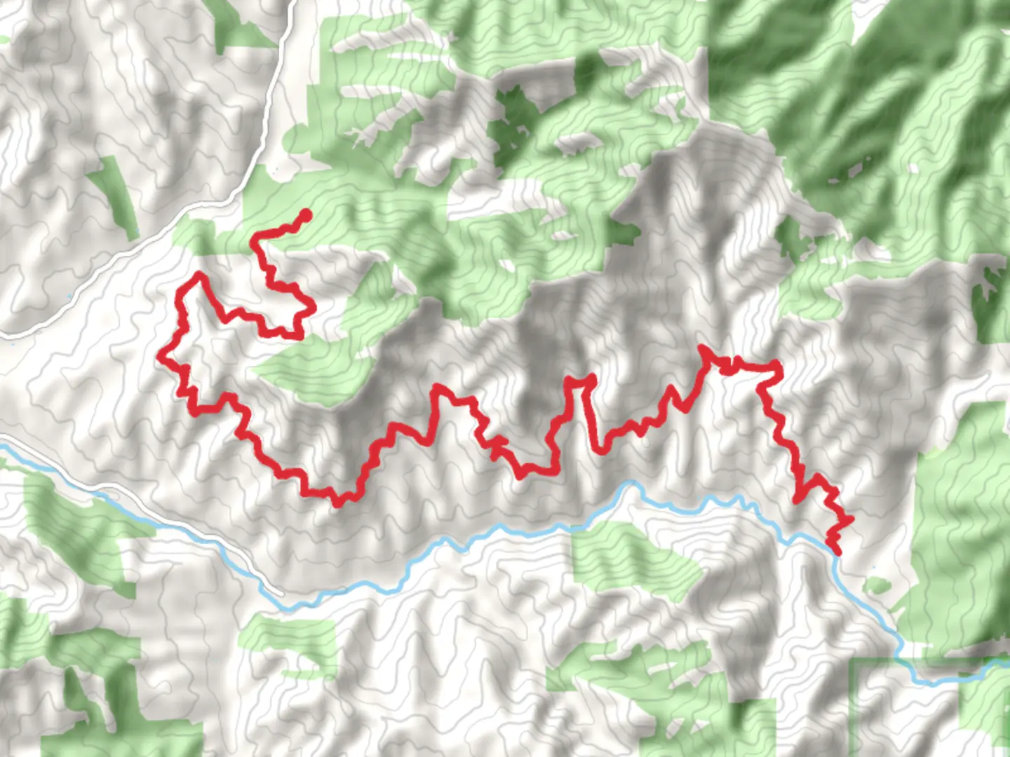
54.7 km
~2 day
870 m
Out and Back
“Explore the Sterling Mine Trail's historic echoes and vibrant landscapes in a captivating Oregon adventure.”
Nestled in the heart of Jackson County, Oregon, the Sterling Mine Trail offers a captivating journey through the region's rich history and diverse natural beauty. This out-and-back trail stretches approximately 55 kilometers (about 34 miles) with an elevation gain of around 800 meters (approximately 2,625 feet), making it a moderately challenging adventure for hikers.
Getting There
The trailhead is conveniently located near Jacksonville, Oregon, a charming town known for its well-preserved 19th-century buildings. If you're driving, take Interstate 5 to Medford, then follow Highway 238 west to Jacksonville. From there, head south on Sterling Creek Road for about 15 miles until you reach the trailhead. For those relying on public transport, the nearest major hub is Medford, which is accessible by Greyhound or Amtrak Thruway buses. From Medford, you may need to arrange a taxi or rideshare to reach the trailhead, as public transport options are limited in this rural area.
Trail Highlights
#### Historical Significance
The Sterling Mine Trail is steeped in history, tracing the path of the old Sterling Mine Ditch, a relic of the gold rush era. This ditch was constructed in the late 1800s to supply water to the Sterling Mine, one of the largest hydraulic gold mines in Oregon. As you hike, you'll encounter remnants of this bygone era, including sections of the ditch and old mining equipment, offering a glimpse into the industrious past of the region.
#### Natural Beauty and Wildlife
The trail meanders through a diverse landscape, featuring lush forests, open meadows, and panoramic ridges. In spring, the meadows burst into a vibrant display of wildflowers, including lupines and Indian paintbrush, creating a colorful tapestry against the backdrop of the Siskiyou Mountains. Keep an eye out for local wildlife such as black-tailed deer, wild turkeys, and a variety of bird species that inhabit the area.
#### Notable Landmarks
Around 10 kilometers (6 miles) into the hike, you'll reach the Tunnel Ridge viewpoint, offering sweeping vistas of the Applegate Valley and beyond. This is an ideal spot for a rest and to soak in the expansive views. Continuing along the trail, you'll pass through the Little Applegate River area, where the gentle sounds of flowing water provide a serene ambiance.
Trail Navigation and Preparation
Given the trail's moderate difficulty, it's essential to come prepared. The path is well-marked, but carrying a reliable navigation tool like HiiKER is recommended to ensure you stay on track. The trail can be completed in sections or as a multi-day hike, depending on your pace and preference. Be sure to pack sufficient water, snacks, and layers, as weather conditions can vary, especially at higher elevations.
Whether you're drawn by the allure of history or the call of the wild, the Sterling Mine Trail promises an enriching experience for those who venture along its path.

What to expect?
Activity types
Comments and Reviews
User comments, reviews and discussions about the Sterling Mine Trail, Oregon.
average rating out of 5
0 rating(s)