Download
Preview
Add to list
More
665.6 km
~36 days
12931 m
Multi-Day
“The Oregon Skyline Trail is an epic, diverse trek through Oregon's stunning landscapes and rich history.”
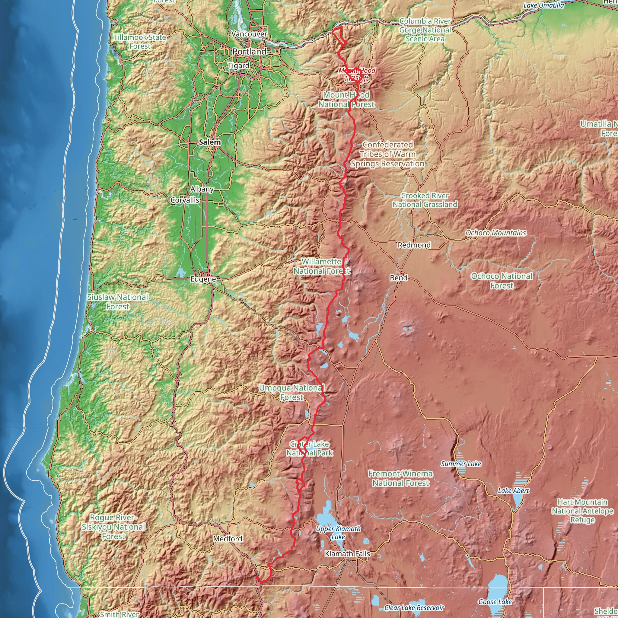
Spanning approximately 414 miles (666 km) with an elevation gain of around 42,300 feet (12,900 meters), the Oregon Skyline Trail is a remarkable journey through the diverse landscapes of Oregon. Starting near Jackson County, the trailhead can be accessed by driving to the southern end of Crater Lake National Park, which is the closest significant landmark to the beginning of the trail. For those using public transportation, options may be limited, but regional bus services can get you close to the park, from where you may need to arrange a shuttle or taxi service to reach the trailhead.
Navigating the Trail
As you embark on this point-to-point trail, it's essential to have a reliable navigation tool. HiiKER is an excellent resource for trail maps and can help you stay on track throughout your journey. The trail is well-marked in most sections, but having a digital map can be invaluable, especially in areas where the trail may be less defined.
Landmarks and Natural Features
The Oregon Skyline Trail takes you through a variety of terrains, from dense forests to alpine meadows, and past numerous lakes and volcanic peaks. One of the first major landmarks you'll encounter is Crater Lake, a caldera lake known for its deep blue color and clarity. As you continue, you'll traverse parts of the Cascade Range, offering views of Mount Thielsen and Mount McLoughlin.
The trail intersects with the famous Pacific Crest Trail (PCT) at several points, allowing hikers to experience sections of another iconic long-distance trail. Approximately halfway through your journey, you'll reach the Three Sisters Wilderness, where you'll be greeted by the stunning sight of the Three Sisters and Broken Top mountains.
Wildlife and Flora
The Oregon Skyline Trail is home to a rich array of wildlife, including black bears, elk, deer, and a variety of bird species. Hikers should be prepared for encounters with wildlife and know how to safely observe and pass animals on the trail. The flora along the trail is equally diverse, with wildflowers blooming in the spring and summer, and the changing colors of the foliage providing a spectacular display in the fall.
Historical Significance
The region through which the Oregon Skyline Trail passes is steeped in history. The trail itself follows routes once used by Native American tribes and later by pioneers and settlers. The volcanic landscape is a testament to the geological forces that have shaped the area over millennia, and many of the peaks and lakes have cultural significance to the indigenous peoples of the region.
Preparation and Planning
Given the trail's length and varying elevations, hikers should be well-prepared with appropriate gear for overnight camping and changing weather conditions. Water sources are generally plentiful, but it's wise to carry a water filter or purification tablets. Resupply points are available in the towns you'll pass near, so plan your itinerary to restock on food and other essentials.
Accessing the Trail
To reach the start of the trail by car, head to Crater Lake National Park, which is the nearest significant landmark to the trailhead. The park is accessible via Highway 62, and from there, follow the signs to the designated starting point of the Oregon Skyline Trail.
For those relying on public transportation, regional bus services can take you to the vicinity of Crater Lake National Park. From the nearest bus stop, you may need to arrange a shuttle or taxi to the trailhead. It's important to check schedules and plan accordingly, as services may be infrequent.
Embarking on the Oregon Skyline Trail is an adventure that offers a deep connection with nature, a glimpse into the past, and a true test of hiking endurance. With careful planning and respect for the natural environment, hikers will find this trail to be a rewarding and unforgettable experience.
Comments and Reviews
User comments, reviews and discussions about the Oregon Skyline Trail, Oregon.
4.57
average rating out of 5
7 rating(s)

