Download
3D Preview
Add to list
More
783.3 km
~33 days
22719 m
Multi-Day
“Embark on a breathtaking, challenging trek through Washington's diverse wilderness on the Pacific Crest Trail.”
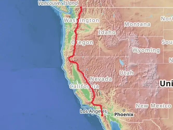
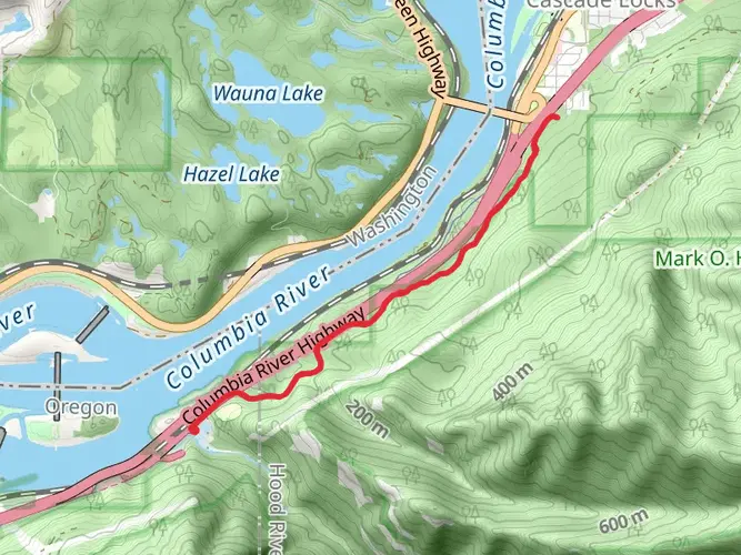
Spanning approximately 486 miles (783 km) and with an elevation gain of around 74,500 feet (22,700 meters), the Washington section of the Pacific Crest Trail (PCT) is a challenging and rewarding journey through some of the most breathtaking landscapes in the Pacific Northwest. This point-to-point trail begins near Hood River County, Oregon, and traverses the Cascade Range, ending at the Canadian border.
Getting to the Trailhead
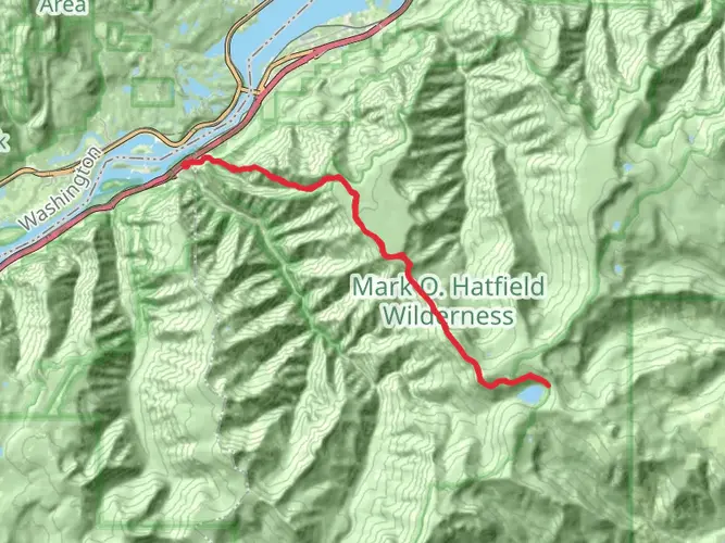
To reach the southern terminus of the Washington section of the PCT, you can drive to the Bridge of the Gods in Cascade Locks, which is the closest landmark to the starting point. For those relying on public transportation, there are bus services available to Cascade Locks, from where you can walk or hitch a ride to the trailhead.
Navigating the Trail
Hikers can utilize the HiiKER app for detailed maps and navigation assistance throughout their journey. The app provides up-to-date trail information, which is essential for planning resupply points and locating campsites.
Landmarks and Scenery
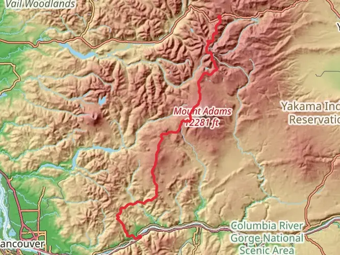
As you embark on the trail, you'll be greeted by the dense forests of the Gifford Pinchot National Forest, home to the iconic Mount Adams. The trail offers stunning views of this dormant volcano, which stands at 12,280 feet (3,743 meters). Approximately 150 miles (241 km) into the Washington section, you'll encounter the Goat Rocks Wilderness, a highlight for many hikers. Here, the Knife's Edge—a narrow ridge with dramatic drops on either side—provides a thrilling experience with panoramic views.
Further north, the trail meanders through the William O. Douglas Wilderness and Norse Peak Wilderness before reaching the Alpine Lakes Wilderness, approximately 240 miles (386 km) from the start. This area is renowned for its crystal-clear lakes and rugged peaks.
Wildlife and Flora
The Washington section of the PCT is rich in biodiversity. Hikers may spot black bears, elk, mountain goats, and a variety of bird species. The trail also passes through old-growth forests and subalpine meadows, showcasing a diverse array of plant life, including wildflowers in the spring and summer months.
Historical Significance
The PCT traverses land with deep historical roots, including areas that were once inhabited by Indigenous peoples. The trail also crosses the historic Cascade Crest, which has been a significant trade and travel route for centuries.
Climate and Best Time to Hike
The best time to hike the Washington section of the PCT is from late July to early October, when the snow has mostly melted, and the weather is more stable. Hikers should be prepared for rapidly changing conditions and pack accordingly for cold nights and the possibility of snowfall, even in summer.
Preparation and Safety
Given the trail's difficulty, hikers should be well-prepared with the appropriate gear, including a reliable tent, sleeping bag, and bear canister for food storage. It's also crucial to have a solid plan for resupplying food and other essentials. Water sources are generally plentiful, but carrying a water filter is necessary due to the risk of waterborne pathogens.
Leave No Trace
As with any wilderness experience, it's important to adhere to Leave No Trace principles to preserve the natural beauty and ecological integrity of the trail. Pack out all trash, camp on durable surfaces, and minimize campfire impacts by using a portable stove.
The Pacific Crest Trail in Washington offers a unique and unforgettable adventure through some of the most spectacular landscapes in the United States. With proper preparation and respect for the natural environment, hikers can enjoy a journey that will leave a lasting impression.

What to expect?
Activity types
Comments and Reviews
User comments, reviews and discussions about the Pacific Crest Trail - Washington, Oregon.
4.71
average rating out of 5
7 rating(s)