Download
3D Preview
Add to list
More
226.9 km
~10 days
6667 m
Multi-Day
“Embark on a breathtaking 141-mile trek through the Cascades, from Mount Adams to Rainier, amidst diverse landscapes and history.”
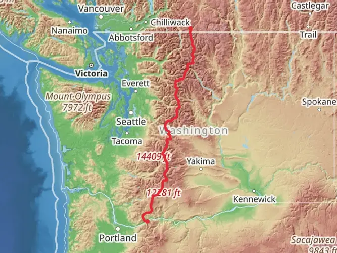
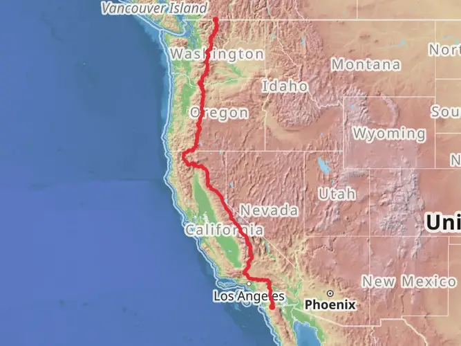
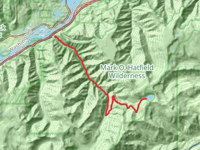
Spanning approximately 141 miles (227 kilometers) with an elevation gain of around 21,654 feet (6600 meters), the Pacific Crest Trail section from Mount Adams to Mount Rainier offers a remarkable journey through the Cascade Range of Washington State. This point-to-point trail is a medium-difficulty hike that takes you through diverse landscapes, including alpine meadows, old-growth forests, and volcanic remnants.
Getting to the Trailhead The trailhead is located near Hood River County, Oregon. If you're driving, you can reach the starting point by taking Highway 35 to the town of Hood River and then following signs to the trailhead. For those relying on public transportation, options may be limited, but regional buses and shuttles can get you close to Hood River, where you might arrange a taxi or a ride-share to the trailhead.
Navigating the Trail As you embark on your journey, ensure you have a reliable navigation tool like HiiKER downloaded with the Pacific Crest Trail maps for offline use. This section of the PCT is well-marked, but having a digital map can be invaluable in case of detours or when the trail becomes less distinct.
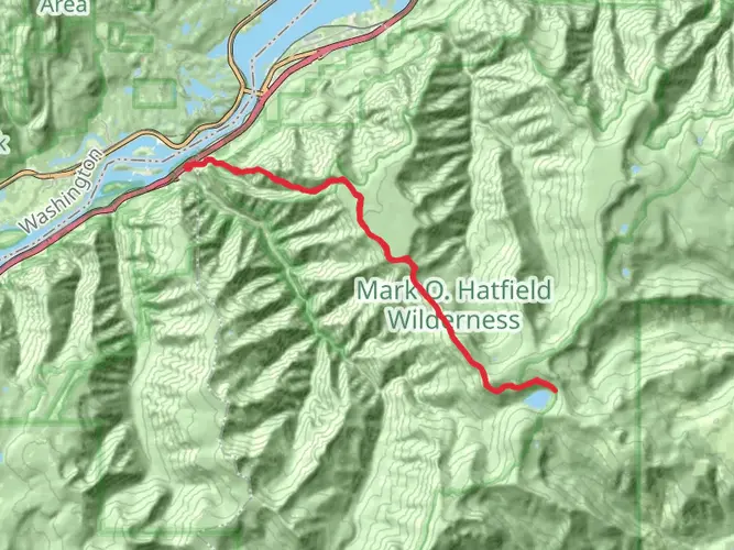
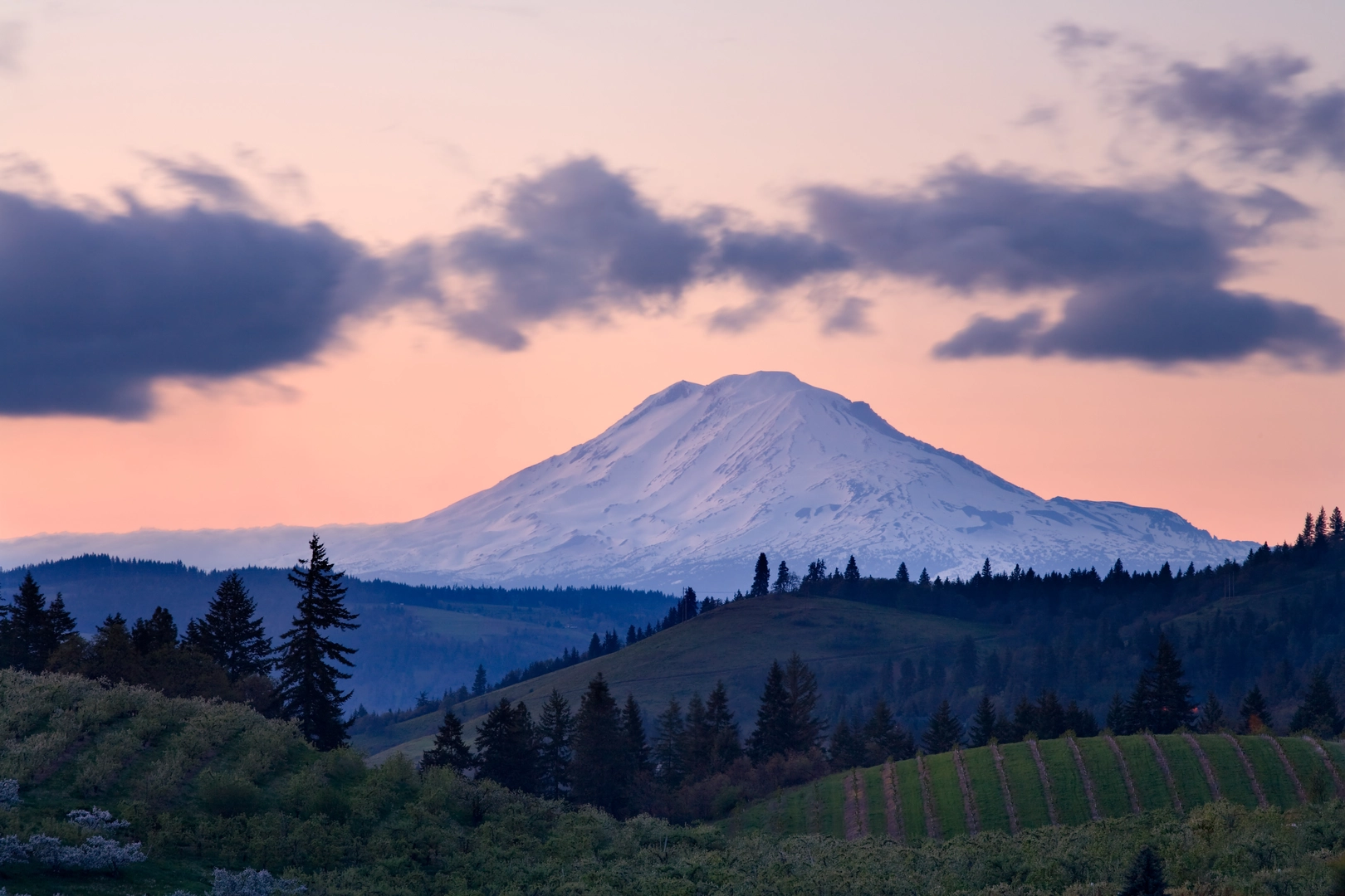
Landmarks and Scenery The trail offers a variety of natural landmarks and stunning vistas. Early in the hike, you'll encounter the base of Mount Adams, an imposing stratovolcano that stands as a sentinel over the surrounding wilderness. As you progress, Goat Rocks Wilderness will present a challenging but rewarding traverse with panoramic views of the surrounding peaks.
Further along, you'll pass by the remnants of the historic Mount St. Helens eruption, a stark reminder of the raw power of nature. The landscape here is a mix of recovery and rebirth, with wildflowers and new vegetation emerging among the lava flows and ash.
Wildlife and Nature The region is home to a rich array of wildlife, including black bears, elk, mountain goats, and a diverse bird population. Hikers should be prepared for encounters with wildlife and knowledgeable about how to safely observe and interact with the animals they may come across.
Historical Significance This area is steeped in history, from the indigenous peoples who first inhabited the land to the later European settlers and explorers. The trail itself is a part of the larger Pacific Crest Trail, which has been a significant route for trade, travel, and adventure for many years.
Preparation and Planning Given the length and varied terrain of this section, hikers should be well-prepared with appropriate gear, including sturdy hiking boots, weather-appropriate clothing, and a tent or shelter for overnight trips. It's also essential to pack enough food and water, as resupply points may be few and far between.
Weather Considerations The weather in the Cascades can be unpredictable, with the potential for sudden storms, especially at higher elevations. Always check the forecast before setting out and be prepared for changing conditions.
Permits and Regulations Before you go, check the latest information on permits required for this section of the PCT. Wilderness permits are often needed for overnight stays, and certain areas may have additional regulations to protect the fragile environment.
By preparing adequately and respecting the natural and historical significance of the region, hikers can look forward to an unforgettable experience traversing from Mount Adams to Mount Rainier on the Pacific Crest Trail.

What to expect?
Activity types
Comments and Reviews
User comments, reviews and discussions about the Pacific Crest Trail - Mount Adams To Mount Rainier, Oregon.
4.83
average rating out of 5
12 rating(s)