Download
Preview
Add to list
More
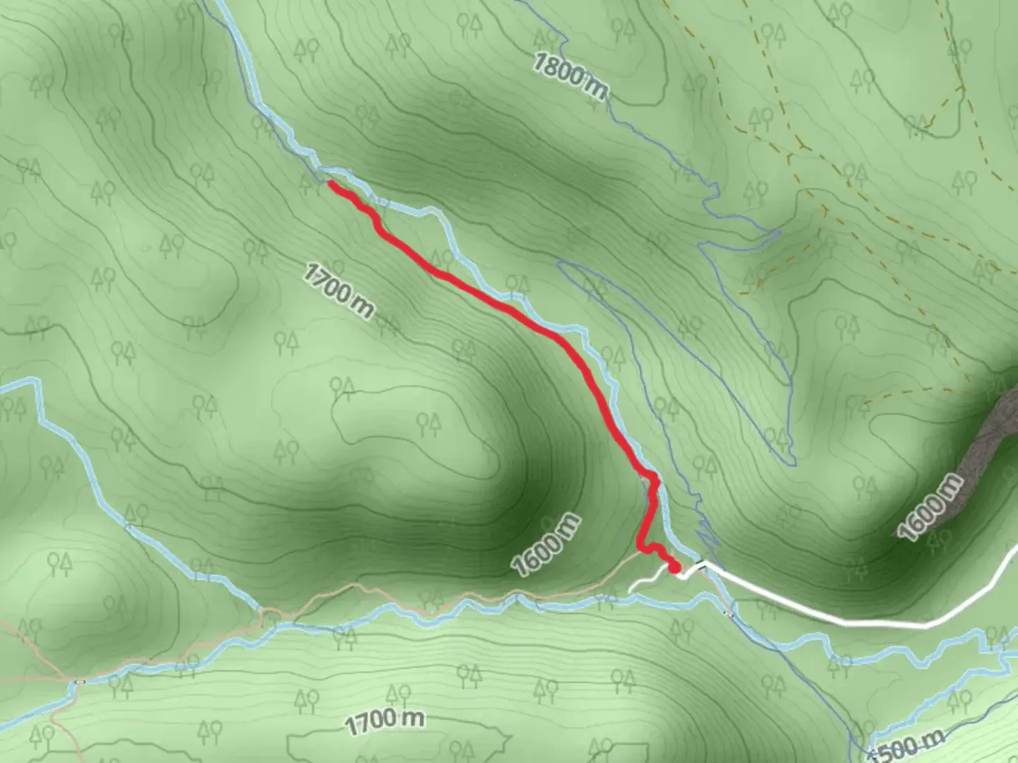
3.2 km
~47 min
96 m
Out and Back
“Embark on the Tumalo Creek - North Fork Trail for a tranquil, forested hike rich with history and wildlife.”
Nestled near Deschutes County in Oregon, the Tumalo Creek - North Fork Trail offers a scenic 3 km (approximately 1.9 miles) out-and-back journey through a lush forested area with an elevation gain that is negligible, making it accessible to hikers of various skill levels. The trail is rated medium in difficulty, likely due to the terrain and navigation rather than the elevation change.
Getting to the Trailhead
To reach the trailhead, if you're coming by car, you'll want to head towards Tumalo Falls, which is a well-known landmark in the area. The trail begins near this popular spot, just a short drive west of Bend, Oregon. For those relying on public transport, options may be limited, and it's advisable to check the latest schedules and routes for any available services heading towards Tumalo Falls or nearby areas.
The Hike Itself
As you embark on the Tumalo Creek - North Fork Trail, you'll be greeted by the soothing sounds of Tumalo Creek. The trail meanders alongside the creek, offering hikers the chance to enjoy the serene ambiance created by the flowing water. The path is well-maintained, but it's important to wear proper footwear as there are sections that can be rocky or root-strewn.
Flora and Fauna
The trail is enveloped by a canopy of conifers, including ponderosa pines and Douglas firs, which provide a habitat for a variety of wildlife. Keep an eye out for local bird species, and if you're lucky, you might spot deer or other wildlife that frequent the area. The underbrush is a mix of ferns and other native plants, adding to the trail's lush greenery.
Historical Significance
The region around Tumalo Creek has a rich history, with the creek itself being a vital resource for Native American tribes who once lived in the area. As you hike, consider the long-standing relationship between the land and its original inhabitants, and the ways in which the creek has sustained life over countless generations.
Navigation and Preparation
For navigation, HiiKER is a reliable tool to use when traversing the Tumalo Creek - North Fork Trail. It's always a good idea to download the trail map on your device before you set out, as cell service can be spotty in natural areas. Additionally, ensure you have enough water and snacks for the hike, and check the weather forecast to dress appropriately.
Remember to leave no trace, pack out what you pack in, and enjoy the natural beauty of the Tumalo Creek - North Fork Trail.

What to expect?
Activity types
Comments and Reviews
User comments, reviews and discussions about the Tumalo Creek - North Fork Trail, Oregon.
4.38
average rating out of 5
13 rating(s)