Download
Preview
Add to list
More
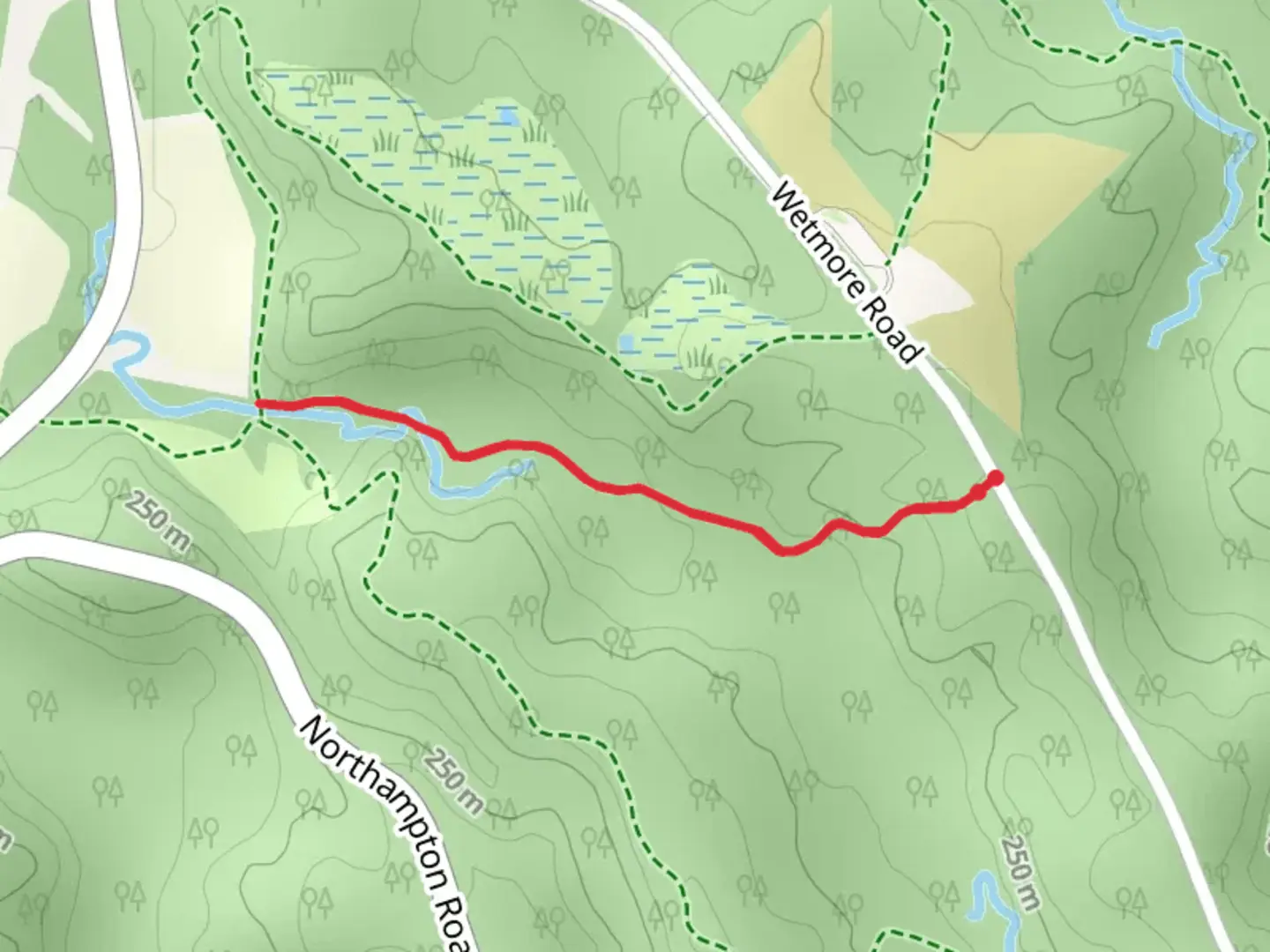
1.9 km
~26 min
47 m
Loop
“"Immerse in Butlers Trail's serene, historic 2 km loop, a well-marked haven for nature lovers and hikers alike."”
Butlers Trail, nestled near Summit County, Ohio, offers a moderate hiking experience that spans approximately 2 km (about 1.24 miles) with minimal elevation gain, making it accessible for hikers seeking a short but engaging outdoor activity. The loop trail is well-marked and begins just a short distance from the nearest parking area, which can be reached by car. For those opting for public transportation, local bus services can be utilized to get close to the trailhead, followed by a brief walk to reach the starting point.
Getting to the Trailhead
To reach the trailhead by car, hikers can navigate to the nearest known address or significant landmark, which is typically provided by the local park's service or can be found on the HiiKER app. Parking is usually available near the trail entrance, but it's advisable to arrive early during peak seasons to secure a spot.
Trail Experience
As you embark on Butlers Trail, you'll be enveloped by a canopy of mixed hardwoods, with the path meandering through a serene forest setting. The trail is well-trodden and marked, making navigation straightforward without the need for constant reference to a map or GPS. However, having the HiiKER app can enhance your experience by providing real-time location tracking and additional trail information.
Flora and Fauna
Throughout the hike, you'll encounter a diverse array of plant life, including seasonal wildflowers that add splashes of color to the landscape. The area is also home to various bird species, so birdwatchers will want to keep their binoculars handy. Wildlife sightings might include deer, squirrels, and the occasional fox, all of which contribute to the trail's natural charm.
Historical Significance
The region surrounding Butlers Trail is steeped in history, with the area having been inhabited by indigenous peoples long before European settlers arrived. As you walk, consider the centuries of history that have shaped the landscape, from ancient trails to the remnants of early settler activity.
Safety and Preparation
Before setting out, ensure you have adequate water, as there are no water sources along the trail. The medium difficulty rating suggests that while the trail isn't particularly strenuous, it's still important to wear appropriate footwear and carry basic hiking essentials. Check the weather forecast in advance and dress accordingly, as conditions can change rapidly.
Conclusion
Remember to practice Leave No Trace principles, keeping the trail clean and undisturbed for future visitors. Enjoy the tranquility of Butlers Trail, a hidden gem that offers a brief escape into nature's embrace.

Comments and Reviews
User comments, reviews and discussions about the Butlers Trail, Ohio.
4.5
average rating out of 5
2 rating(s)